The left side wins overall because the approach into Changi delivers one of the most iconic urban aerial views in Asia — the Singapore skyline, port, and southern islands — and the left side also captures the South China Sea coastline during the long cruise south through Guangdong and over the Gulf of Tonkin. The right side at takeoff is good but the left side payoff on arrival is stronger.
Flown CSX to SIN? Did we get it right?
Flight Path
Changcha to Singapore is 1,952 miles (3,141 km), a flight of about 3 hours 45 minutes.
The flight tracks roughly south-southwest from Changsha, crossing the mountainous interior of Guangdong province with the Nanling mountain ranges visible below, then over the Pearl River Delta and Guangzhou urban region. It then crosses the South China Sea, passing over or near Hainan Island and the Gulf of Tonkin, before tracking south over open ocean and the northern tip of Borneo or the Malay Peninsula depending on routing, finally descending over the South China Sea toward Singapore.
Great circle distance and headings ›

Phase by phase
Takeoff from CSX
RIGHTChangsha Huanghua airport sits east of central Changsha, and departures heading south or southeast put the urban core of Changsha and Dongting Lake to the right (west/northwest). The right side gives you a clear look back at the city sprawl and the broad Xiang River cutting through it.
Landing at SIN
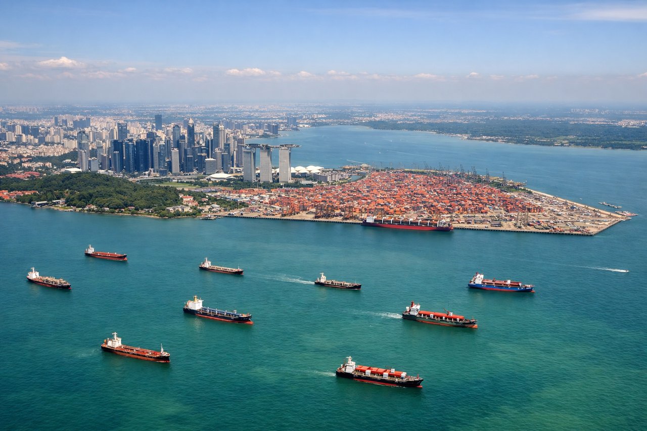
LEFTChangi Airport sits on the far eastern tip of Singapore island, and aircraft typically approach from the east or northeast over the South China Sea, landing westward. The left (south) side gives views of the southern Singapore coastline, Sentosa Island, the container port at Tanjong Pagar, and the city skyline as you cross the island.
Will your flight be in sunlight?
Pick a date and time in the Sun Map to watch the sun move across your whole flight.
About This Route
Which side of the plane should I sit on flying from Huanghua (CSX) to Singapore Changi (SIN)?
Sit on the Left side of the plane for the best views on flights from Changcha to Singapore. The left side wins overall because the approach into Changi delivers one of the most iconic urban aerial views in Asia — the Singapore skyline, port, and southern islands — and the left side also captures the South China Sea coastline during the long cruise south through Guangdong and over the Gulf of Tonkin. The right side at takeoff is good but the left side payoff on arrival is stronger.
What can I see during takeoff from Huanghua in Changcha?
During takeoff from Huanghua (CSX), sit on the Right side for the best views. Changsha Huanghua airport sits east of central Changsha, and departures heading south or southeast put the urban core of Changsha and Dongting Lake to the right (west/northwest). The right side gives you a clear look back at the city sprawl and the broad Xiang River cutting through it. Notable sights include: Xiang River valley, Changsha urban core, Yuelu Mountain ridge to the west, Dongting Lake visible in the distance to the north.
What can I see when landing at Singapore Changi in Singapore?
When landing at Singapore Changi (SIN), sit on the Left side for the best views. Changi Airport sits on the far eastern tip of Singapore island, and aircraft typically approach from the east or northeast over the South China Sea, landing westward. The left (south) side gives views of the southern Singapore coastline, Sentosa Island, the container port at Tanjong Pagar, and the city skyline as you cross the island. Notable sights include: Marina Bay skyline and CBD towers, Sentosa Island and the Southern Islands, PSA container terminal at Tanjong Pagar, Johor Strait and southern Malaysia to the north.
How long is the flight from Changcha to Singapore?
The flight from Huanghua (CSX) to Singapore Changi (SIN) takes about 3 hours 45 minutes. The shortest flight path between them is 1,952 miles (3,141 km); winds and air traffic control usually add a few percent.
What does the Changcha to Singapore flight path pass over?
The flight tracks roughly south-southwest from Changsha, crossing the mountainous interior of Guangdong province with the Nanling mountain ranges visible below, then over the Pearl River Delta and Guangzhou urban region. It then crosses the South China Sea, passing over or near Hainan Island and the Gulf of Tonkin, before tracking south over open ocean and the northern tip of Borneo or the Malay Peninsula depending on routing, finally descending over the South China Sea toward Singapore.