While takeoff favors the right for mountain views, the landing approach on the left side provides more dramatic and sustained geographic features—the Jundu Mountains and Ming Tombs are more visually distinctive than the departure terrain. The left side captures the most memorable segment of this route.
Flown CSX to PEK? Did we get it right?
Flight Path
Changcha to Beijing is 844 miles (1,358 km), a flight of about 2 hours 15 minutes.
The flight path crosses the Yangtze River system and its major tributaries in Hunan Province, then transitions into Hubei Province's rolling terrain. The Dabie Mountains appear as a distant ridge line in the midpoint (around 1 hour into flight). The route then crosses into Henan Province's flatter central plains before approaching the Jundu Mountains north of Beijing. The North China Plain dominates the final 45 minutes of flight, with visibility of major cities including Zhengzhou and Kaifeng possible on clear days before the final descent into the Beijing approach corridor.
Great circle distance and headings ›

Phase by phase
Takeoff from CSX
RIGHTHuanghua typically departs northbound (Runway 01/19). Right-side seats face west toward the Taihang Mountains and the Yangtze River valley terrain, offering dramatic elevation changes and river systems. Left side shows flat industrial plains with less visual interest.
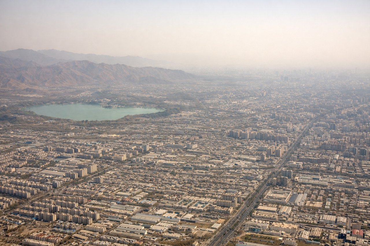
Landing at PEK
LEFTBeijing typically lands northbound on Runway 01L/01R. Left-side seats during descent offer views of the Ming Tombs, Yanqing District terrain, and the approach path over the Jundu Mountains. Right side shows industrial suburbs with less geographic distinction.
Will your flight be in sunlight?
Pick a date and time in the Sun Map to watch the sun move across your whole flight.
About This Route
Which side of the plane should I sit on flying from Huanghua (CSX) to Capital (PEK)?
Sit on the Left side of the plane for the best views on flights from Changcha to Beijing. While takeoff favors the right for mountain views, the landing approach on the left side provides more dramatic and sustained geographic features—the Jundu Mountains and Ming Tombs are more visually distinctive than the departure terrain. The left side captures the most memorable segment of this route.
What can I see during takeoff from Huanghua in Changcha?
During takeoff from Huanghua (CSX), sit on the Right side for the best views. Huanghua typically departs northbound (Runway 01/19). Right-side seats face west toward the Taihang Mountains and the Yangtze River valley terrain, offering dramatic elevation changes and river systems. Left side shows flat industrial plains with less visual interest. Notable sights include: Taihang Mountains (western horizon), Yangtze River tributaries (visible as silver threads in valleys), Changsha urban sprawl (receding southward), industrial zones of Huanghua region (immediate foreground).
What can I see when landing at Capital in Beijing?
When landing at Capital (PEK), sit on the Left side for the best views. Beijing typically lands northbound on Runway 01L/01R. Left-side seats during descent offer views of the Ming Tombs, Yanqing District terrain, and the approach path over the Jundu Mountains. Right side shows industrial suburbs with less geographic distinction. Notable sights include: Jundu Mountains (northern approach corridor), Ming Tombs valley (visible as cleared ceremonial landscape), Yanqing District reservoirs (bright blue water bodies), Beijing urban grid expanding southward.
How long is the flight from Changcha to Beijing?
The flight from Huanghua (CSX) to Capital (PEK) takes about 2 hours 15 minutes. The shortest flight path between them is 844 miles (1,358 km); winds and air traffic control usually add a few percent.
What does the Changcha to Beijing flight path pass over?
The flight path crosses the Yangtze River system and its major tributaries in Hunan Province, then transitions into Hubei Province's rolling terrain. The Dabie Mountains appear as a distant ridge line in the midpoint (around 1 hour into flight). The route then crosses into Henan Province's flatter central plains before approaching the Jundu Mountains north of Beijing. The North China Plain dominates the final 45 minutes of flight, with visibility of major cities including Zhengzhou and Kaifeng possible on clear days before the final descent into the Beijing approach corridor.