Dhaka to Istanbul is 3,706 miles (5,964 km), a flight of about 8 hours 25 minutes.
The right side tracks the mountainous spine of the route — Himalayan foothills near India, the Hindu Kush and Karakoram over Pakistan and Afghanistan, and eventually the Bosphorus on arrival — giving far more terrain variety than the left side's desert plains and plateau.
Flight Path
Hindu Kush mountain range, Iranian plateau, and the arid basins of eastern Iran along the flight path
Great circle distance and headings ›.jpg?width=600)

_in_Istanbul.jpg?width=600)
Phase by phase
Takeoff from DAC
RIGHTClimbing out of Dhaka toward the northwest, the right side offers views over the braided channels of the Brahmaputra and Padma rivers before the terrain rises toward the Himalayan foothills in the distance. The left side mostly shows flat delta farmland fading into haze.
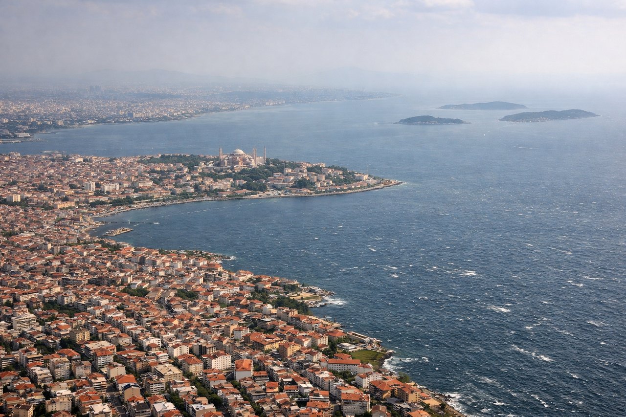
Landing at IST
RIGHTOn final approach into Istanbul Airport, arrivals crossing the Sea of Marmara or cutting near the Bosphorus give the right side a view of the strait, the historic peninsula, and the city's dense skyline. The left side typically faces open Thracian farmland with less visual interest.
Landmarks on this routeAll landmarks →
Will your flight be in sunlight?
Pick a date and time in the Sun Map to watch the sun move across your whole flight.
About This Route
Which side of the plane should I sit on flying from Hazrat Shahjalal International Airport (DAC) to İstanbul Airport (IST)?
Sit on the Right side of the plane for the best views on flights from Dhaka to Istanbul. The right side tracks the mountainous spine of the route — Himalayan foothills near India, the Hindu Kush and Karakoram over Pakistan and Afghanistan, and eventually the Bosphorus on arrival — giving far more terrain variety than the left side's desert plains and plateau.
What can I see during takeoff from Hazrat Shahjalal International Airport in Dhaka?
During takeoff from Hazrat Shahjalal International Airport (DAC), sit on the Right side for the best views. Climbing out of Dhaka toward the northwest, the right side offers views over the braided channels of the Brahmaputra and Padma rivers before the terrain rises toward the Himalayan foothills in the distance. The left side mostly shows flat delta farmland fading into haze. Notable sights include: Brahmaputra River delta, Padma River confluence, Dhaka's northern suburbs, distant Himalayan foothills.
What can I see when landing at İstanbul Airport in Istanbul?
When landing at İstanbul Airport (IST), sit on the Right side for the best views. On final approach into Istanbul Airport, arrivals crossing the Sea of Marmara or cutting near the Bosphorus give the right side a view of the strait, the historic peninsula, and the city's dense skyline. The left side typically faces open Thracian farmland with less visual interest. Notable sights include: Bosphorus Strait, Sea of Marmara coastline, Istanbul city skyline, Princes' Islands.
How long is the flight from Dhaka to Istanbul?
The flight from Hazrat Shahjalal International Airport (DAC) to İstanbul Airport (IST) takes about 8 hours 25 minutes. The shortest flight path between them is 3,706 miles (5,964 km); winds and air traffic control usually add a few percent.
What does the Dhaka to Istanbul flight path pass over?
Hindu Kush mountain range, Iranian plateau, and the arid basins of eastern Iran along the flight path