While cruise scenery over the Appalachian ridges is modest and shared by both sides, the left side wins decisively because of the iconic monument-lined River Visual approach into DCA.
Flight Path
Low ridge-and-valley Appalachian terrain of eastern Ohio, West Virginia panhandle, and western Maryland
Great circle distance and headings ›Phase by phase
Takeoff from DAY
LEFTDeparting DAY on runway 06L/24R climbs over flat Ohio farmland with no distinguishing terrain on either side, so this leg is essentially a wash — a slight edge to the left only because it sets up the later Appalachian ridge views.
Landing at DCA
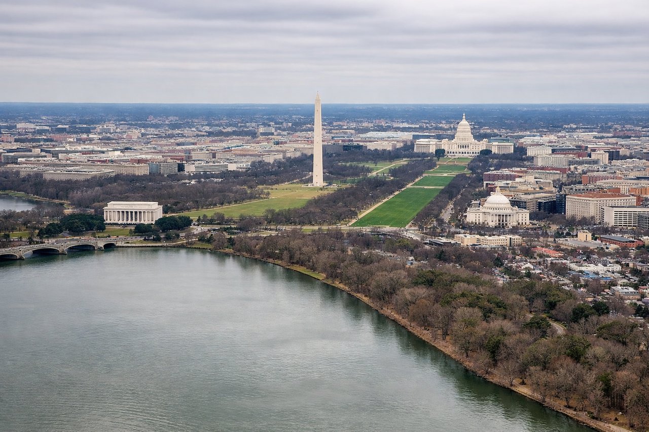
LEFTThe River Visual approach to Runway 19 tracks south along the Potomac, and since DC's monuments sit on the east bank, they line up on the left side of the aircraft as it descends past the Capitol, Washington Monument, and the National Mall before touchdown.
Landmarks on this routeAll landmarks →
Will your flight be in sunlight?
See exactly which side of the plane gets sun and shade at your departure time.
About This Route
Which side of the plane should I sit on flying from James M Cox Dayton International (DAY) to Ronald Reagan Washington National (DCA)?
Sit on the Left side of the plane for the best views on flights from Dayton to Washington. While cruise scenery over the Appalachian ridges is modest and shared by both sides, the left side wins decisively because of the iconic monument-lined River Visual approach into DCA.
What can I see during takeoff from James M Cox Dayton International in Dayton?
During takeoff from James M Cox Dayton International (DAY), sit on the Left side for the best views. Departing DAY on runway 06L/24R climbs over flat Ohio farmland with no distinguishing terrain on either side, so this leg is essentially a wash — a slight edge to the left only because it sets up the later Appalachian ridge views. Notable sights include: Great Miami River, Dayton suburbs, patchwork farmland.
What can I see when landing at Ronald Reagan Washington National in Washington?
When landing at Ronald Reagan Washington National (DCA), sit on the Left side for the best views. The River Visual approach to Runway 19 tracks south along the Potomac, and since DC's monuments sit on the east bank, they line up on the left side of the aircraft as it descends past the Capitol, Washington Monument, and the National Mall before touchdown. Notable sights include: Potomac River, Washington Monument, U.S. Capitol dome, National Mall.
How long is the flight from Dayton to Washington?
The flight from James M Cox Dayton International (DAY) to Ronald Reagan Washington National (DCA) takes 1h16m.
What does the Dayton to Washington flight path pass over?
Low ridge-and-valley Appalachian terrain of eastern Ohio, West Virginia panhandle, and western Maryland