Left side delivers the best views at both ends of this short flight — Dayton's river valley and Wright-Patterson on departure, and the Chicago skyline approach over Lake Michigan on arrival. The flight is too brief for dramatic en-route scenery, so the terminal views matter most.
Flight Path
The route crosses flat agricultural Indiana — primarily the Hoosier farmland grid of corn and soybean fields between Richmond and Gary. The Kankakee River valley is faintly visible from altitude as a slight wooded corridor. No significant terrain changes; Indiana is uniformly flat at roughly 700-900 feet elevation throughout.
Great circle distance and headings ›Phase by phase
Takeoff from DAY
LEFTDayton's primary departures heading northwest toward Chicago will put the city of Dayton and the Great Miami River valley on the left side. You'll see the urban grid of downtown Dayton and Wright-Patterson Air Force Base clearly as you climb out.
Landing at ORD
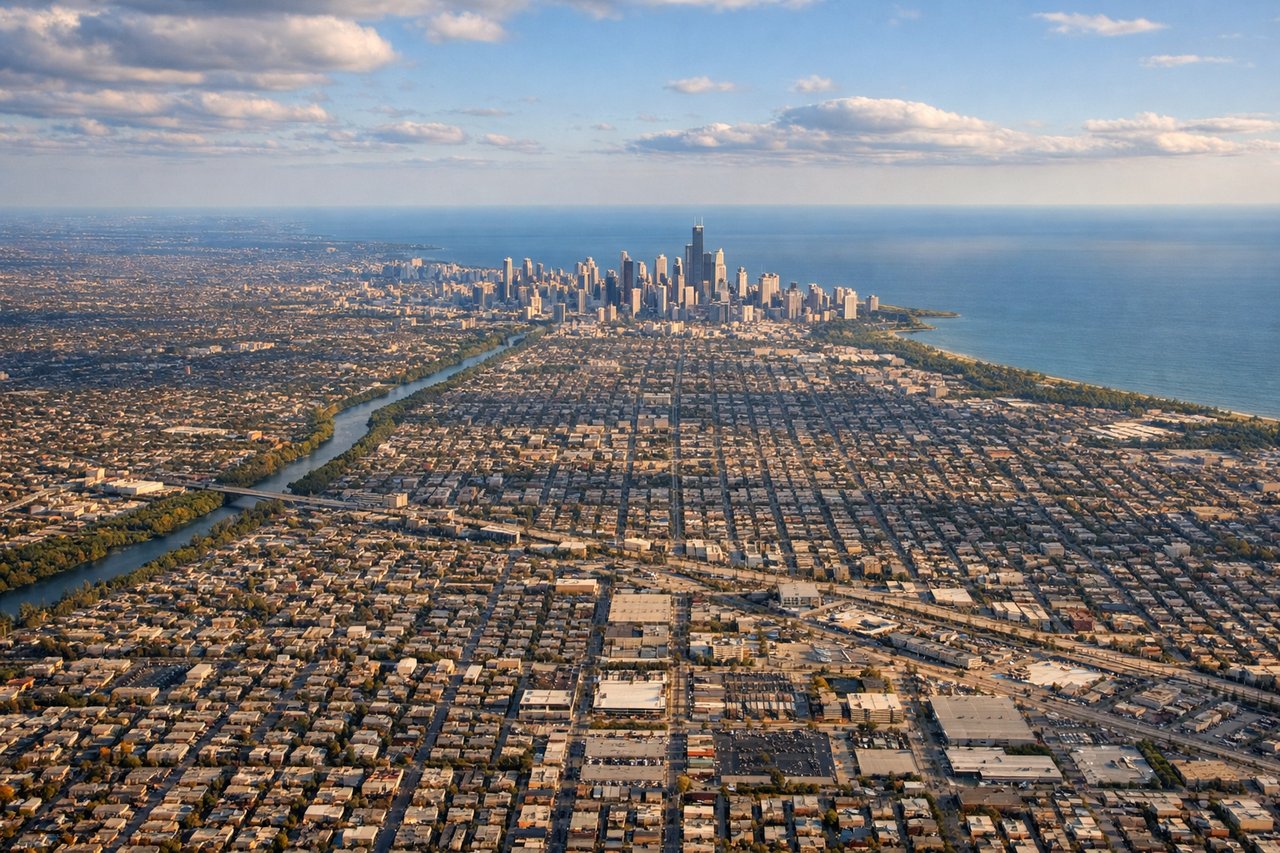
LEFTArrivals into O'Hare typically come from the east or southeast on runways oriented roughly east-west. A left window seat will face south toward the Chicago skyline as you descend, giving you a clear view of the city's lakefront and downtown towers against Lake Michigan.
Landmarks on this routeAll landmarks →
Will your flight be in sunlight?
See exactly which side of the plane gets sun and shade at your departure time.
About This Route
Which side of the plane should I sit on flying from James M Cox Dayton International (DAY) to Chicago Ohare International (ORD)?
Sit on the Left side of the plane for the best views on flights from Dayton to Chicago. Left side delivers the best views at both ends of this short flight — Dayton's river valley and Wright-Patterson on departure, and the Chicago skyline approach over Lake Michigan on arrival. The flight is too brief for dramatic en-route scenery, so the terminal views matter most.
What can I see during takeoff from James M Cox Dayton International in Dayton?
During takeoff from James M Cox Dayton International (DAY), sit on the Left side for the best views. Dayton's primary departures heading northwest toward Chicago will put the city of Dayton and the Great Miami River valley on the left side. You'll see the urban grid of downtown Dayton and Wright-Patterson Air Force Base clearly as you climb out. Notable sights include: Downtown Dayton skyline, Great Miami River, Wright-Patterson AFB runways, Mad River confluence.
What can I see when landing at Chicago Ohare International in Chicago?
When landing at Chicago Ohare International (ORD), sit on the Left side for the best views. Arrivals into O'Hare typically come from the east or southeast on runways oriented roughly east-west. A left window seat will face south toward the Chicago skyline as you descend, giving you a clear view of the city's lakefront and downtown towers against Lake Michigan. Notable sights include: Chicago downtown skyline (Willis Tower, John Hancock), Lake Michigan shoreline, Chicago River, suburban Cook County grid.
How long is the flight from Dayton to Chicago?
The flight from James M Cox Dayton International (DAY) to Chicago Ohare International (ORD) takes Approximately 45-55 minutes.
What does the Dayton to Chicago flight path pass over?
The route crosses flat agricultural Indiana — primarily the Hoosier farmland grid of corn and soybean fields between Richmond and Gary. The Kankakee River valley is faintly visible from altitude as a slight wooded corridor. No significant terrain changes; Indiana is uniformly flat at roughly 700-900 feet elevation throughout.