Denver to Winnipeg is 783 miles (1,260 km), a flight of about 2 hours 40 minutes.
Left side wins both ends of the flight. The Rocky Mountain Front Range at departure is the most dramatic view of the entire route, and the Red River valley and Winnipeg approach on the left at landing rounds out the experience. The mid-flight portion over the northern Great Plains is largely flat on both sides, so the departure and arrival views are what matter most.
Flight Path
The flight tracks northeast across the Nebraska Sandhills — a vast grass-stabilized dune field visible as gently rolling tan terrain — then crosses into South Dakota over the Missouri River, a wide braided ribbon cutting through the plains. Northern South Dakota and southern North Dakota are flat agricultural land with occasional glacial lakes and prairie potholes. The Canadian border crossing near Pembina, North Dakota brings the Red River valley into view as the aircraft begins descent into Winnipeg.
Great circle distance and headings ›Phase by phase
Takeoff from DEN
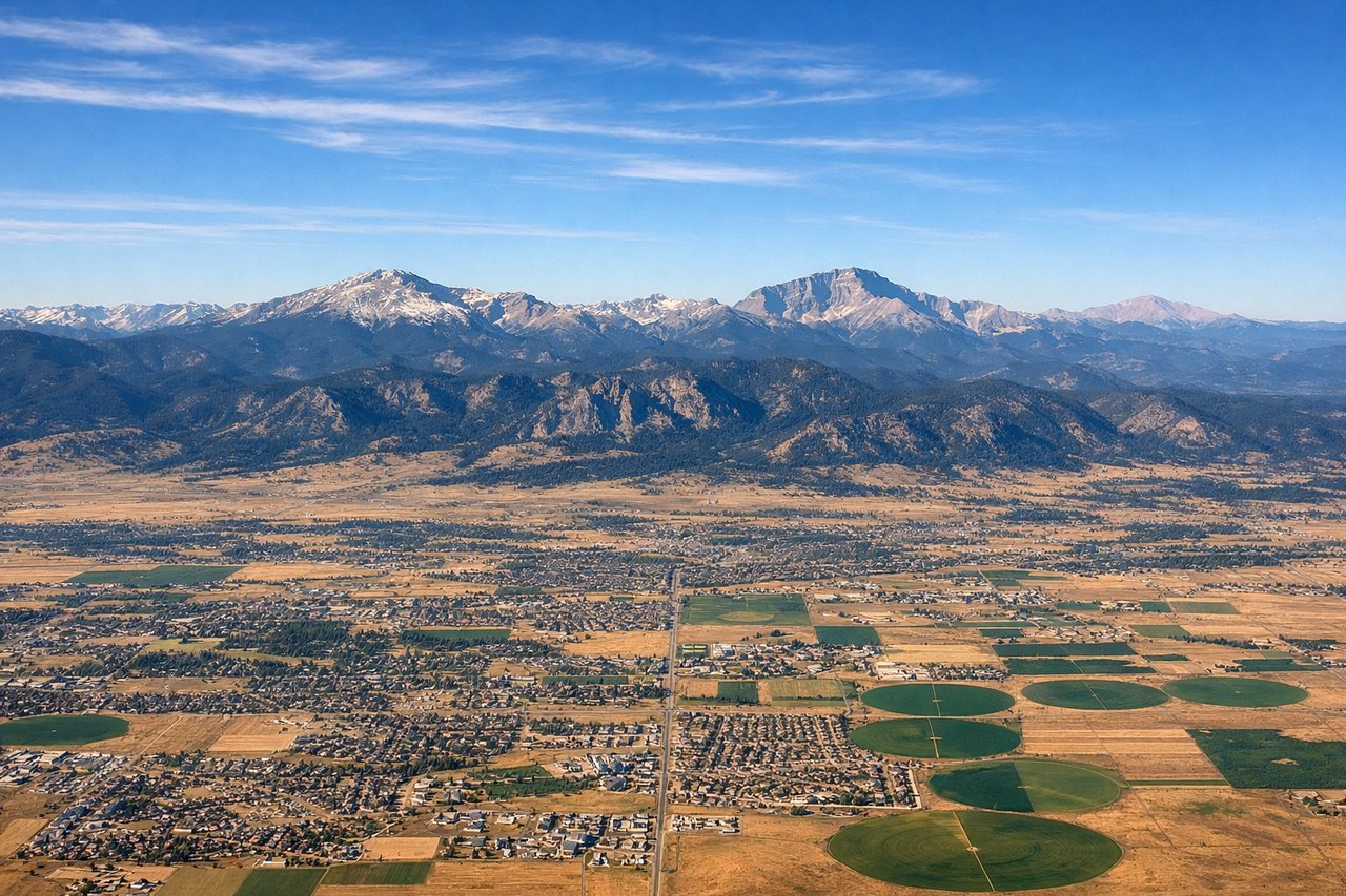
LEFTDEN typically departs east or northeast on runways 16/34 or 8/26. A northeast departure on runway 34L/R puts the Rocky Mountains on the left (west) side as the aircraft climbs and turns north. You get a sweeping view of the entire Front Range from Pikes Peak in the south to Longs Peak in the north, with Denver's grid spread out below.
Landing at YWG
LEFTWinnipeg's Richardson International typically lands from the south or southeast on runways 13/31 or 18/36. Approaching from the south on a northward track, the left (west) side gives a clear view of the Red River winding through the city and the flat Manitoba prairie patchwork. The right side is largely featureless agricultural land.
Landmarks on this routeAll landmarks →
Will your flight be in sunlight?
Pick a date and time in the Sun Map to watch the sun move across your whole flight.
About This Route
Which side of the plane should I sit on flying from Denver International (DEN) to Winnipeg International (YWG)?
Sit on the Left side of the plane for the best views on flights from Denver to Winnipeg. Left side wins both ends of the flight. The Rocky Mountain Front Range at departure is the most dramatic view of the entire route, and the Red River valley and Winnipeg approach on the left at landing rounds out the experience. The mid-flight portion over the northern Great Plains is largely flat on both sides, so the departure and arrival views are what matter most.
What can I see during takeoff from Denver International in Denver?
During takeoff from Denver International (DEN), sit on the Left side for the best views. DEN typically departs east or northeast on runways 16/34 or 8/26. A northeast departure on runway 34L/R puts the Rocky Mountains on the left (west) side as the aircraft climbs and turns north. You get a sweeping view of the entire Front Range from Pikes Peak in the south to Longs Peak in the north, with Denver's grid spread out below. Notable sights include: Front Range of the Rockies (Longs Peak, Pikes Peak visible as bookends), Denver metro grid and downtown skyline, Cherry Creek Reservoir southeast of the city, the high plains stretching east.
What can I see when landing at Winnipeg International in Winnipeg?
When landing at Winnipeg International (YWG), sit on the Left side for the best views. Winnipeg's Richardson International typically lands from the south or southeast on runways 13/31 or 18/36. Approaching from the south on a northward track, the left (west) side gives a clear view of the Red River winding through the city and the flat Manitoba prairie patchwork. The right side is largely featureless agricultural land. Notable sights include: Red River and Assiniboine River confluence in central Winnipeg, downtown Winnipeg skyline, the vast flat Manitoba agricultural grid, Lake Winnipeg visible as a pale smudge on the far northern horizon on clear days.
How long is the flight from Denver to Winnipeg?
The flight from Denver International (DEN) to Winnipeg International (YWG) takes about 2 hours 40 minutes. The shortest flight path between them is 783 miles (1,260 km); winds and air traffic control usually add a few percent.
What does the Denver to Winnipeg flight path pass over?
The flight tracks northeast across the Nebraska Sandhills — a vast grass-stabilized dune field visible as gently rolling tan terrain — then crosses into South Dakota over the Missouri River, a wide braided ribbon cutting through the plains. Northern South Dakota and southern North Dakota are flat agricultural land with occasional glacial lakes and prairie potholes. The Canadian border crossing near Pembina, North Dakota brings the Red River valley into view as the aircraft begins descent into Winnipeg.