Dallas-Fort Worth to Cedar City is 963 miles (1,550 km), a flight of about 2 hours 15 minutes.
While the left seat offers a decent DFW departure view, the right seat delivers the more dramatic scenery across the full flight. As the route tracks northwest, the right side captures the Llano Estacado edge, the Sacramento Mountains of New Mexico, the transition onto the Colorado Plateau, and then the spectacular red rock terrain and volcanic fields of southern Utah on descent into Cedar City.
Flight Path
The flight crosses the flat Llano Estacado of west Texas, then the Sacramento Mountains and Guadalupe Mountains of southeastern New Mexico, transitions over the Rio Grande valley near Albuquerque, crosses the Colorado Plateau with its mesa and canyon terrain, passes near the Zion Canyon region of southwestern Utah, and descends over the Iron County high desert into Cedar City at roughly 5,600 feet elevation.
Great circle distance and headings ›.jpg?width=600)
.jpg?width=600)
.jpeg?width=600)

Phase by phase
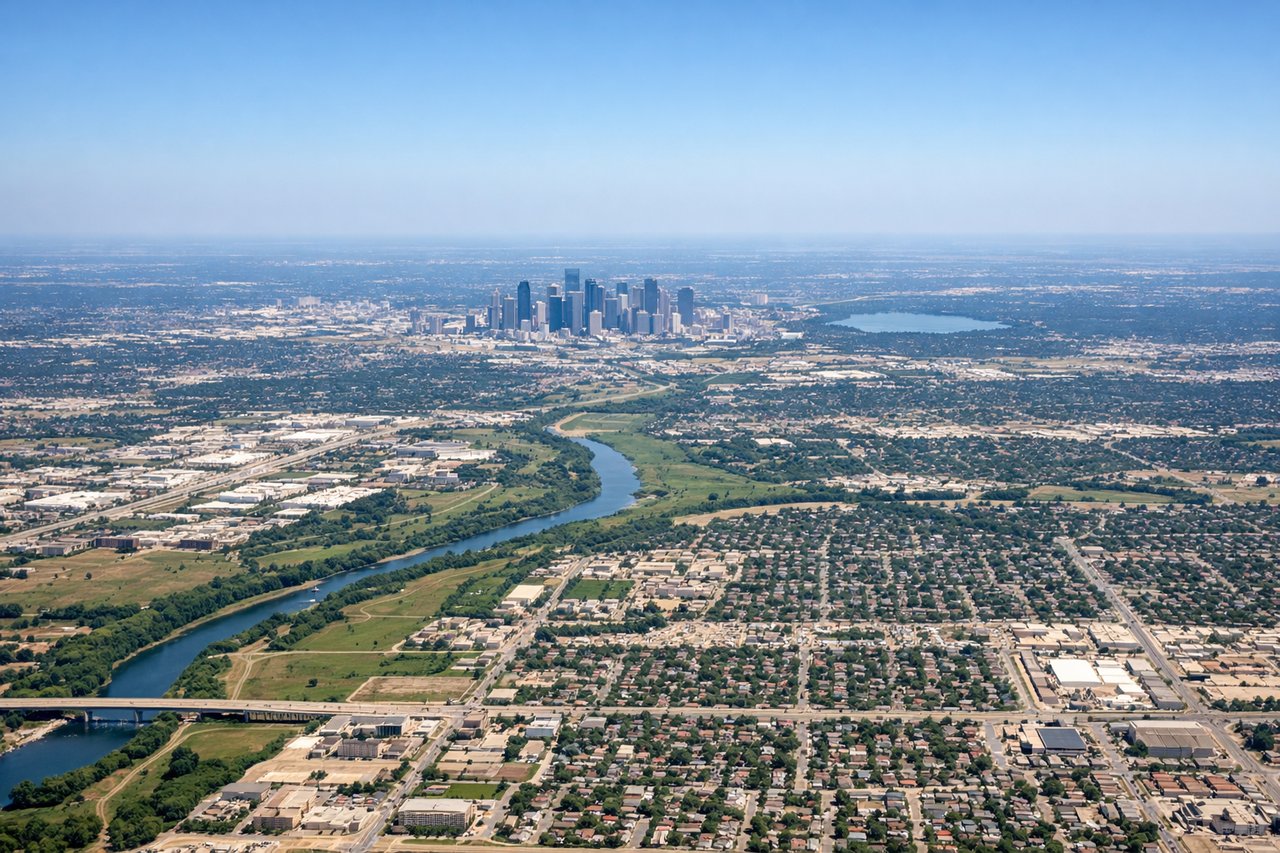
Takeoff from DFW
LEFTDFW typically departs westbound on runways 17L/17R or 18L/18R heading south then turning northwest. A left seat gives you a clear view of the Dallas-Fort Worth metroplex sprawl, including downtown Dallas skyline to the northeast and Fort Worth to the west as you climb out and bank northwest toward New Mexico.
Landing at CDC
RIGHTCedar City Regional sits at the edge of the Colorado Plateau with the Markagunt Plateau and Cedar Breaks National Monument immediately to the east. Aircraft typically approach from the east or southeast on runway 20, meaning a right seat faces east toward the dramatic red rock escarpments and the Iron Mountains, with Brian Head Peak visible as a prominent snow-capped summit.
Landmarks on this routeAll landmarks →
Will your flight be in sunlight?
Pick a date and time in the Sun Map to watch the sun move across your whole flight.
About This Route
Which side of the plane should I sit on flying from Dallas Fort Worth International (DFW) to Cedar City Rgnl (CDC)?
Sit on the Right side of the plane for the best views on flights from Dallas-Fort Worth to Cedar City. While the left seat offers a decent DFW departure view, the right seat delivers the more dramatic scenery across the full flight. As the route tracks northwest, the right side captures the Llano Estacado edge, the Sacramento Mountains of New Mexico, the transition onto the Colorado Plateau, and then the spectacular red rock terrain and volcanic fields of southern Utah on descent into Cedar City.
What can I see during takeoff from Dallas Fort Worth International in Dallas-Fort Worth?
During takeoff from Dallas Fort Worth International (DFW), sit on the Left side for the best views. DFW typically departs westbound on runways 17L/17R or 18L/18R heading south then turning northwest. A left seat gives you a clear view of the Dallas-Fort Worth metroplex sprawl, including downtown Dallas skyline to the northeast and Fort Worth to the west as you climb out and bank northwest toward New Mexico. Notable sights include: Downtown Dallas skyline, Fort Worth urban core, Lake Grapevine, Eagle Mountain Lake.
What can I see when landing at Cedar City Rgnl in Cedar City?
When landing at Cedar City Rgnl (CDC), sit on the Right side for the best views. Cedar City Regional sits at the edge of the Colorado Plateau with the Markagunt Plateau and Cedar Breaks National Monument immediately to the east. Aircraft typically approach from the east or southeast on runway 20, meaning a right seat faces east toward the dramatic red rock escarpments and the Iron Mountains, with Brian Head Peak visible as a prominent snow-capped summit. Notable sights include: Cedar Breaks National Monument amphitheater, Brian Head Peak, Iron Mountains, Markagunt Plateau escarpment.
How long is the flight from Dallas-Fort Worth to Cedar City?
The flight from Dallas Fort Worth International (DFW) to Cedar City Rgnl (CDC) takes about 2 hours 15 minutes. The shortest flight path between them is 963 miles (1,550 km); winds and air traffic control usually add a few percent.
What does the Dallas-Fort Worth to Cedar City flight path pass over?
The flight crosses the flat Llano Estacado of west Texas, then the Sacramento Mountains and Guadalupe Mountains of southeastern New Mexico, transitions over the Rio Grande valley near Albuquerque, crosses the Colorado Plateau with its mesa and canyon terrain, passes near the Zion Canyon region of southwestern Utah, and descends over the Iron County high desert into Cedar City at roughly 5,600 feet elevation.