The takeoff from Bali offers more dramatic and distinctive volcanic scenery with Mount Agung and the island's interior highlands. While the landing approach into Ontario provides good views of the San Gabriel Mountains, the volcanic peaks of Bali are more visually striking and geographically unique.
Flight Path
The flight crosses the Pacific Ocean for approximately 8,000 nautical miles. Notable geographic features along the route include: the Philippine Sea and western Pacific basin (no major landmarks visible at cruise altitude over open ocean); the International Date Line crossing; the Hawaiian Islands chain (if routed south, Maui and Hawaii Big Island may be visible on southern routes); the North American west coast approaching California with the Sierra Nevada range visible inland from the California coast; and the Mojave Desert region east of Los Angeles before descent into Ontario.
Great circle distance and headings ›
.jpg?width=600)
Phase by phase
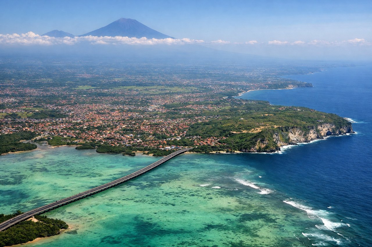
Takeoff from DPS
RIGHTRight-side seats offer views of Bali's volcanic peaks and the island's interior highlands during the initial climb-out. The aircraft departs eastward or northeastward, positioning right-side passengers to see Mount Agung and the central ridge of the island.
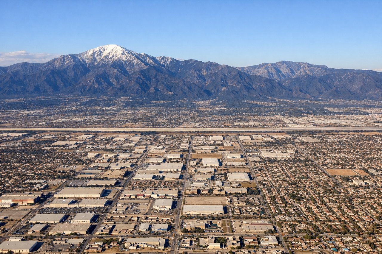
Landing at ONT
LEFTLeft-side seats provide excellent views during the descent into Ontario. The aircraft approaches from the west over the San Gabriel Mountains and the Los Angeles basin, with left-side passengers seeing the mountain range, inland valleys, and the sprawl of Southern California cities.
Landmarks on this routeAll landmarks →
Will your flight be in sunlight?
See exactly which side of the plane gets sun and shade at your departure time.
About This Route
Which side of the plane should I sit on flying from Denpasar I Gusti Ngurah Rai International Airport (DPS) to Ontario International (ONT)?
Sit on the Right side of the plane for the best views on flights from Denpasar to Ontario. The takeoff from Bali offers more dramatic and distinctive volcanic scenery with Mount Agung and the island's interior highlands. While the landing approach into Ontario provides good views of the San Gabriel Mountains, the volcanic peaks of Bali are more visually striking and geographically unique.
What can I see during takeoff from Denpasar I Gusti Ngurah Rai International Airport in Denpasar?
During takeoff from Denpasar I Gusti Ngurah Rai International Airport (DPS), sit on the Right side for the best views. Right-side seats offer views of Bali's volcanic peaks and the island's interior highlands during the initial climb-out. The aircraft departs eastward or northeastward, positioning right-side passengers to see Mount Agung and the central ridge of the island. Notable sights include: Mount Agung (3,142 m active volcano), Mount Batur (1,717 m), Bali's interior highlands, Lombok Strait to the east.
What can I see when landing at Ontario International in Ontario?
When landing at Ontario International (ONT), sit on the Left side for the best views. Left-side seats provide excellent views during the descent into Ontario. The aircraft approaches from the west over the San Gabriel Mountains and the Los Angeles basin, with left-side passengers seeing the mountain range, inland valleys, and the sprawl of Southern California cities. Notable sights include: San Gabriel Mountains, San Bernardino Valley, Los Angeles metropolitan area sprawl, Cajon Pass.
How long is the flight from Denpasar to Ontario?
The flight from Denpasar I Gusti Ngurah Rai International Airport (DPS) to Ontario International (ONT) takes 13h 45m.
What does the Denpasar to Ontario flight path pass over?
The flight crosses the Pacific Ocean for approximately 8,000 nautical miles. Notable geographic features along the route include: the Philippine Sea and western Pacific basin (no major landmarks visible at cruise altitude over open ocean); the International Date Line crossing; the Hawaiian Islands chain (if routed south, Maui and Hawaii Big Island may be visible on southern routes); the North American west coast approaching California with the Sierra Nevada range visible inland from the California coast; and the Mojave Desert region east of Los Angeles before descent into Ontario.