Left seats capture the most dramatic geography on both legs: the San Gabriel Mountains during departure and Mount Agung plus the Bali Strait during arrival. The westbound routing maximizes volcanic and water-body visibility.
Flight Path
Pacific Ocean (primary crossing), Hawaiian Islands (if routed via Honolulu—Big Island's Mauna Kea visible at 13,796 ft if passing nearby), Micronesian island chains (Marshall Islands region if on northern routing), Equatorial waters with scattered cumulus cloud formations, International Date Line crossing, transition from North Pacific to tropical waters as aircraft approaches Indonesia
Great circle distance and headings ›.jpg?width=600)

Phase by phase
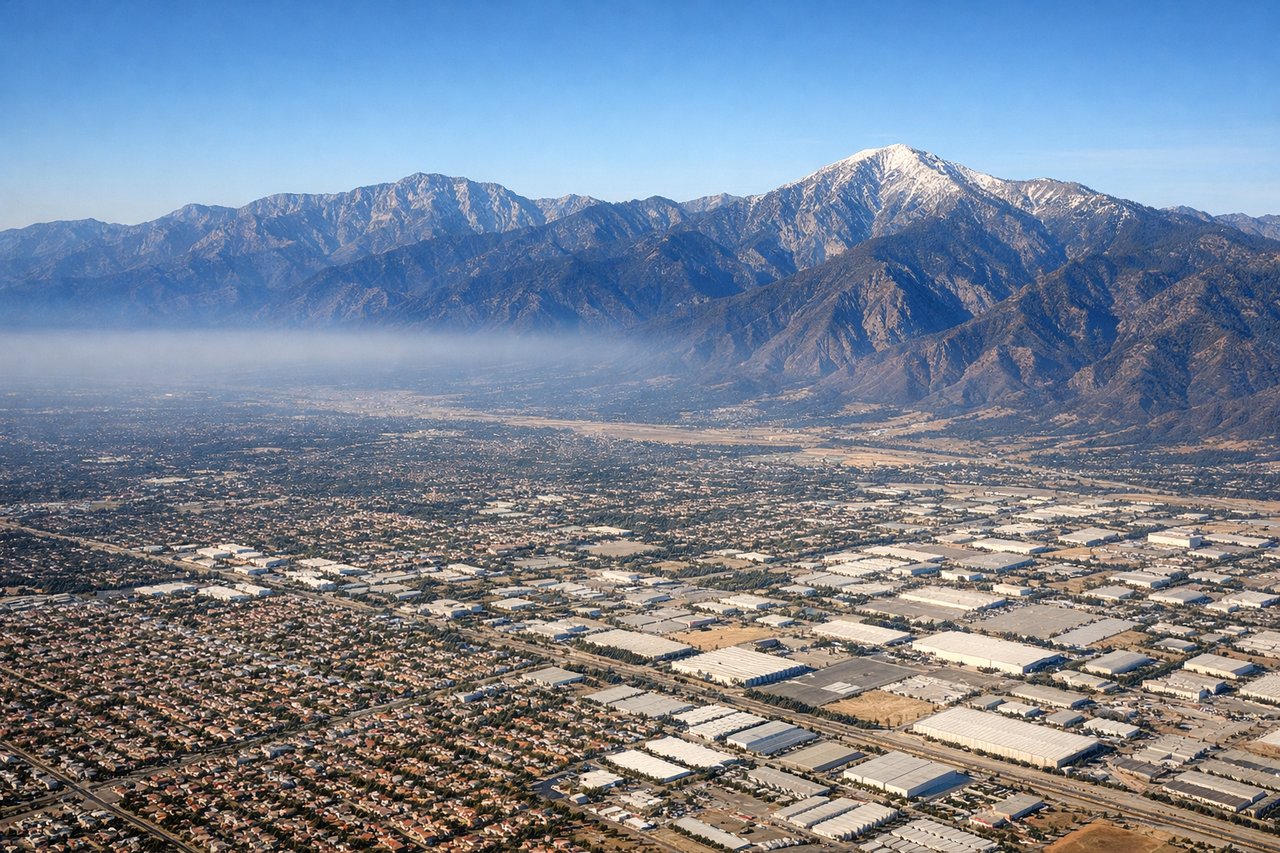
Takeoff from ONT
RIGHTOntario typically departs eastbound (runways 08L/08R). Right-side seats face north toward the San Gabriel Mountains and the sprawling Los Angeles basin, offering clear views of the urban landscape and mountain backdrop during climb-out.
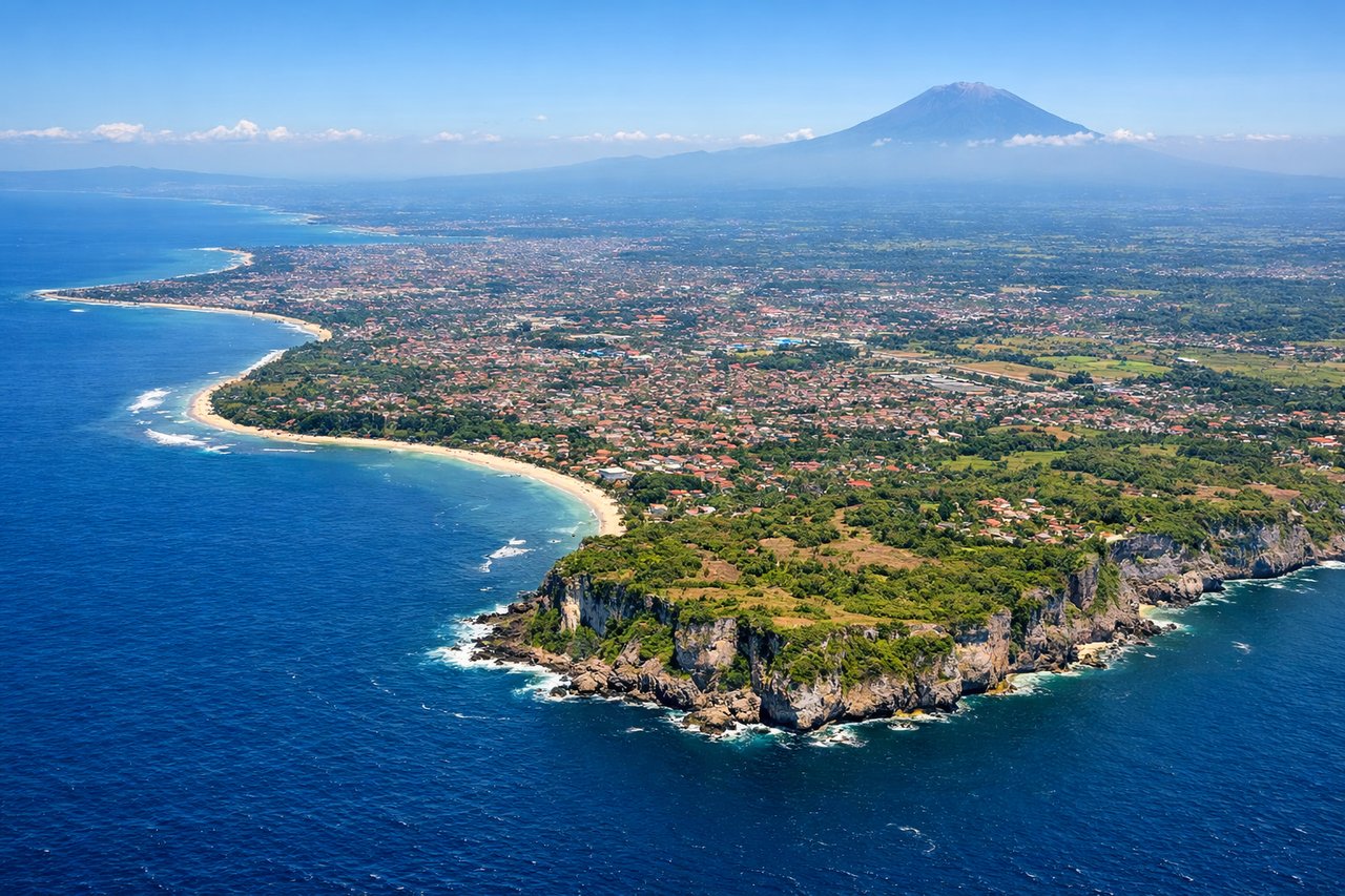
Landing at DPS
LEFTBali's primary runway (09/27) typically handles international arrivals from the west. Left-side seats during westbound approach offer views of the Bali Strait, Mount Agung (Bali's dominant volcano), and the island's central highlands before descent into Denpasar.
Landmarks on this routeAll landmarks →
Will your flight be in sunlight?
See exactly which side of the plane gets sun and shade at your departure time.
About This Route
Which side of the plane should I sit on flying from Ontario International (ONT) to Denpasar I Gusti Ngurah Rai International Airport (DPS)?
Sit on the Left side of the plane for the best views on flights from Ontario to Denpasar. Left seats capture the most dramatic geography on both legs: the San Gabriel Mountains during departure and Mount Agung plus the Bali Strait during arrival. The westbound routing maximizes volcanic and water-body visibility.
What can I see during takeoff from Ontario International in Ontario?
During takeoff from Ontario International (ONT), sit on the Right side for the best views. Ontario typically departs eastbound (runways 08L/08R). Right-side seats face north toward the San Gabriel Mountains and the sprawling Los Angeles basin, offering clear views of the urban landscape and mountain backdrop during climb-out. Notable sights include: San Gabriel Mountains (north), Los Angeles urban grid (northwest), San Bernardino Valley (east), Inland Empire sprawl (southeast).
What can I see when landing at Denpasar I Gusti Ngurah Rai International Airport in Denpasar?
When landing at Denpasar I Gusti Ngurah Rai International Airport (DPS), sit on the Left side for the best views. Bali's primary runway (09/27) typically handles international arrivals from the west. Left-side seats during westbound approach offer views of the Bali Strait, Mount Agung (Bali's dominant volcano), and the island's central highlands before descent into Denpasar. Notable sights include: Mount Agung (3,142 m, visible as a prominent peak on Bali's eastern side), Bali Strait (separating Bali from Lombok), central Bali highlands and rice terraces, Denpasar urban area (southern coast).
How long is the flight from Ontario to Denpasar?
The flight from Ontario International (ONT) to Denpasar I Gusti Ngurah Rai International Airport (DPS) takes Approximately 14-15 hours (including typical routing across the Pacific via Hawaii or direct trans-Pacific corridor).
What does the Ontario to Denpasar flight path pass over?
Pacific Ocean (primary crossing), Hawaiian Islands (if routed via Honolulu—Big Island's Mauna Kea visible at 13,796 ft if passing nearby), Micronesian island chains (Marshall Islands region if on northern routing), Equatorial waters with scattered cumulus cloud formations, International Date Line crossing, transition from North Pacific to tropical waters as aircraft approaches Indonesia