The right side wins overall because the Las Vegas landing approach delivers one of the most dramatic urban desert arrivals in aviation, with the Strip and Spring Mountains simultaneously in view. The takeoff left-side advantage at Edinburgh is real but shorter-lived; the right side also catches the Firth of Forth and its bridges during the initial climb before the route turns west, making it competitive at departure too.
Flown EDI to LAS? Did we get it right?
Flight Path
Edinburgh to Las Vegas is 4,929 miles (7,932 km), a flight of about 10 hours.
The route crosses the North Atlantic tracking south of Greenland, then enters Canadian airspace over Labrador and Quebec. It crosses the Great Lakes region, then tracks southwest over the US Great Plains. The Rocky Mountains are crossed somewhere over Colorado or Utah depending on routing, with the Wasatch Range and Colorado Plateau visible before descending into the Mojave Desert basin toward Las Vegas.
Great circle distance and headings ›


Phase by phase
Takeoff from EDI
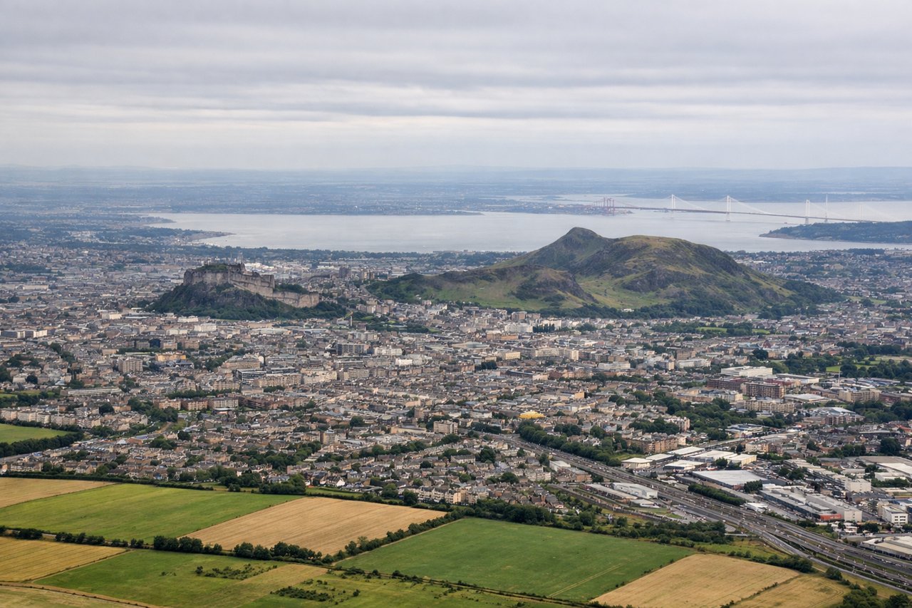
LEFTEdinburgh typically departs westbound on runway 24, so the left (south) side gives you Arthur's Seat and the Old Town skyline as you climb, then the Pentland Hills rolling away to the southwest. The Firth of Forth and its bridges are visible to the right briefly, but the left side holds the more dramatic urban and hill scenery longer.
Landing at LAS
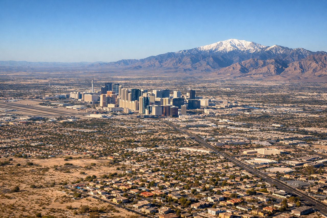
RIGHTLas Vegas McCarran typically lands from the north on runway 19R/19L, meaning the right (west) side gives you the Las Vegas Strip laid out below as you descend over the valley. The Spring Mountains and Red Rock Canyon escarpment are visible to the right on approach, with the Strip's hotels clearly identifiable in the valley floor.
Will your flight be in sunlight?
Pick a date and time in the Sun Map to watch the sun move across your whole flight.
About This Route
Which side of the plane should I sit on flying from Edinburgh (EDI) to Mc Carran International (LAS)?
Sit on the Right side of the plane for the best views on flights from Edinburgh to Las Vegas. The right side wins overall because the Las Vegas landing approach delivers one of the most dramatic urban desert arrivals in aviation, with the Strip and Spring Mountains simultaneously in view. The takeoff left-side advantage at Edinburgh is real but shorter-lived; the right side also catches the Firth of Forth and its bridges during the initial climb before the route turns west, making it competitive at departure too.
What can I see during takeoff from Edinburgh in Edinburgh?
During takeoff from Edinburgh (EDI), sit on the Left side for the best views. Edinburgh typically departs westbound on runway 24, so the left (south) side gives you Arthur's Seat and the Old Town skyline as you climb, then the Pentland Hills rolling away to the southwest. The Firth of Forth and its bridges are visible to the right briefly, but the left side holds the more dramatic urban and hill scenery longer. Notable sights include: Arthur's Seat volcanic plug, Edinburgh Old Town and castle, Pentland Hills, Firth of Forth estuary.
What can I see when landing at Mc Carran International in Las Vegas?
When landing at Mc Carran International (LAS), sit on the Right side for the best views. Las Vegas McCarran typically lands from the north on runway 19R/19L, meaning the right (west) side gives you the Las Vegas Strip laid out below as you descend over the valley. The Spring Mountains and Red Rock Canyon escarpment are visible to the right on approach, with the Strip's hotels clearly identifiable in the valley floor. Notable sights include: Las Vegas Strip hotel corridor, Spring Mountains (Charleston Peak), Red Rock Canyon escarpment, Lake Mead on the distant eastern horizon.
How long is the flight from Edinburgh to Las Vegas?
The flight from Edinburgh (EDI) to Mc Carran International (LAS) takes about 10 hours. The shortest flight path between them is 4,929 miles (7,932 km); winds and air traffic control usually add a few percent.
What does the Edinburgh to Las Vegas flight path pass over?
The route crosses the North Atlantic tracking south of Greenland, then enters Canadian airspace over Labrador and Quebec. It crosses the Great Lakes region, then tracks southwest over the US Great Plains. The Rocky Mountains are crossed somewhere over Colorado or Utah depending on routing, with the Wasatch Range and Colorado Plateau visible before descending into the Mojave Desert basin toward Las Vegas.