The right side strings together the most memorable moments of the flight: the Manhattan skyline at departure, glimpses of the southern Rockies and high desert mesas during cruise, and the Phoenix mountain backdrop on arrival. The left side spends most of the flight over featureless Midwestern farmland and flat desert suburbs.
Flown EWR to PHX? Did we get it right?
Flight Path
Newark to Phoenix is 2,128 miles (3,425 km), a flight of about 4 hours 50 minutes.
The route crosses the Appalachian ridges of western Pennsylvania, the flat farmland of the Ohio and Missouri River valleys, then the high plains of Kansas before climbing scenery resumes near the southern Rocky Mountains and the Sangre de Cristo range along the Colorado-New Mexico border, followed by the high desert plateau of northern Arizona.
Great circle distance and headings ›


Phase by phase

Takeoff from EWR
RIGHTDeparting EWR toward the southwest, the aircraft's climb-out puts Manhattan and the Hudson River on the right side of the plane, giving a brief but striking skyline view before the turn onto the westbound route. The left side only shows New Jersey suburbs and refinery flatlands.
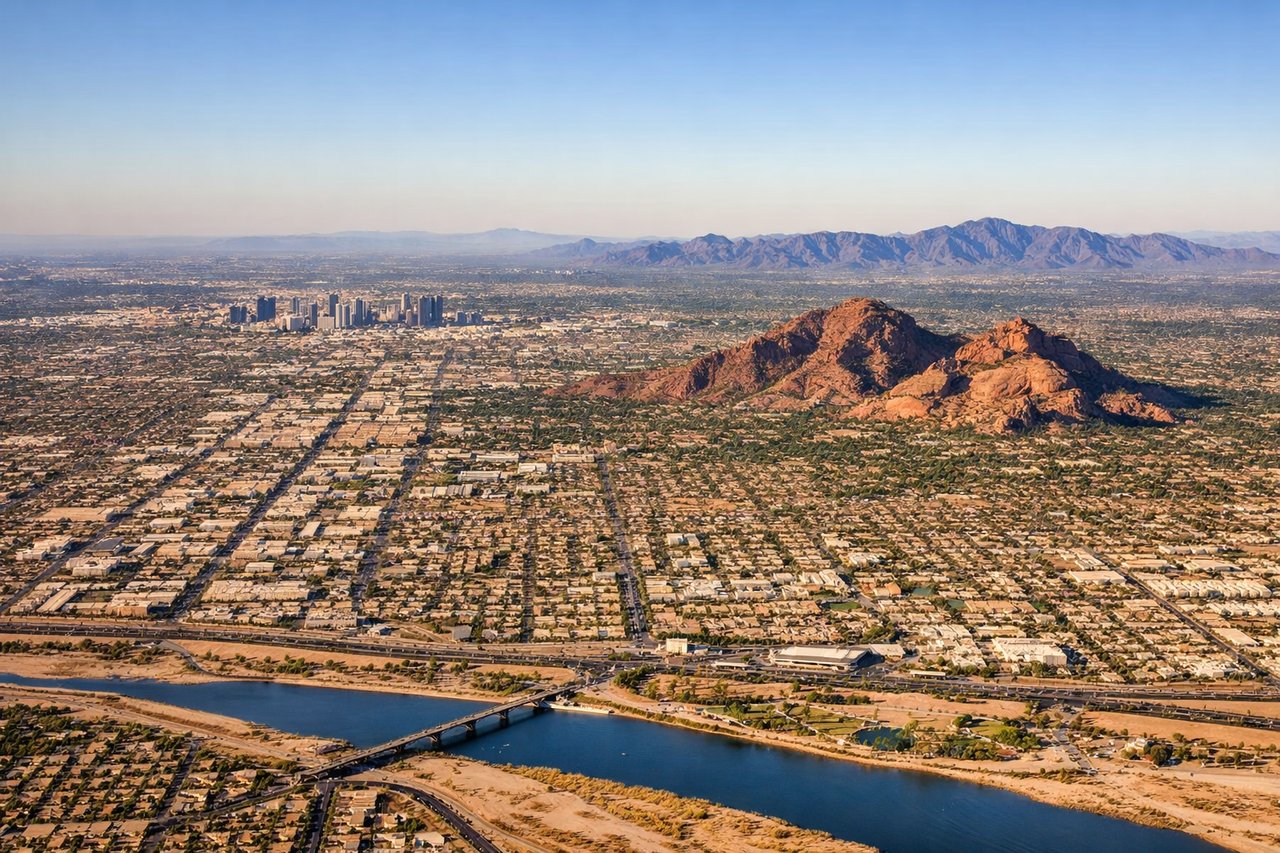
Landing at PHX
RIGHTOn a typical west-flow arrival into PHX, the descent path crosses the East Valley heading west, putting the McDowell Mountains and Camelback Mountain on the right side as the plane lines up for landing. The left side mostly shows flat desert suburbs and South Mountain in a less dramatic silhouette.
Will your flight be in sunlight?
Pick a date and time in the Sun Map to watch the sun move across your whole flight.
About This Route
Which side of the plane should I sit on flying from Newark Liberty International (EWR) to Phoenix Sky Harbor International (PHX)?
Sit on the Right side of the plane for the best views on flights from Newark to Phoenix. The right side strings together the most memorable moments of the flight: the Manhattan skyline at departure, glimpses of the southern Rockies and high desert mesas during cruise, and the Phoenix mountain backdrop on arrival. The left side spends most of the flight over featureless Midwestern farmland and flat desert suburbs.
What can I see during takeoff from Newark Liberty International in Newark?
During takeoff from Newark Liberty International (EWR), sit on the Right side for the best views. Departing EWR toward the southwest, the aircraft's climb-out puts Manhattan and the Hudson River on the right side of the plane, giving a brief but striking skyline view before the turn onto the westbound route. The left side only shows New Jersey suburbs and refinery flatlands. Notable sights include: Manhattan skyline, Hudson River, One World Trade Center, George Washington Bridge.
What can I see when landing at Phoenix Sky Harbor International in Phoenix?
When landing at Phoenix Sky Harbor International (PHX), sit on the Right side for the best views. On a typical west-flow arrival into PHX, the descent path crosses the East Valley heading west, putting the McDowell Mountains and Camelback Mountain on the right side as the plane lines up for landing. The left side mostly shows flat desert suburbs and South Mountain in a less dramatic silhouette. Notable sights include: Camelback Mountain, McDowell Mountains, Piestewa Peak, Superstition Mountains in the distance.
How long is the flight from Newark to Phoenix?
The flight from Newark Liberty International (EWR) to Phoenix Sky Harbor International (PHX) takes about 4 hours 50 minutes. The shortest flight path between them is 2,128 miles (3,425 km); winds and air traffic control usually add a few percent.
What does the Newark to Phoenix flight path pass over?
The route crosses the Appalachian ridges of western Pennsylvania, the flat farmland of the Ohio and Missouri River valleys, then the high plains of Kansas before climbing scenery resumes near the southern Rocky Mountains and the Sangre de Cristo range along the Colorado-New Mexico border, followed by the high desert plateau of northern Arizona.