Left side wins both ends of the flight. Over the New York metro area at departure it captures the most iconic urban geography in North America, and on approach into Santo Domingo it faces the city and coastline rather than inland scrubland. During cruise the flight tracks southeast over the Atlantic and then the Caribbean, so both sides see open ocean for most of the journey.
Flown EWR to SDQ? Did we get it right?
Flight Path
Newark to Santo Domingo is 1,561 miles (2,512 km), a flight of about 4 hours 30 minutes.
After departing the New Jersey coast the route crosses the Atlantic Ocean southeast of Cape Hatteras and the Outer Banks of North Carolina. The Bahamas archipelago — including Great Abaco, Eleuthera, and the Exuma chain — passes beneath or to the right side roughly two-thirds through the flight, visible as thin ribbons of pale sand and turquoise shallow-water banks against the deep blue Atlantic. The Turks and Caicos Islands and the southeastern Bahamas appear near the end of cruise before descending toward Hispaniola.
Great circle distance and headings ›Phase by phase

Takeoff from EWR
LEFTEWR's primary departure runway 22L sends aircraft southwest over New Jersey, then curving southeast. The left side captures Manhattan's skyline directly across Newark Bay, plus the Statue of Liberty and Upper New York Bay. Right side gets industrial New Jersey marshlands.
Landing at SDQ
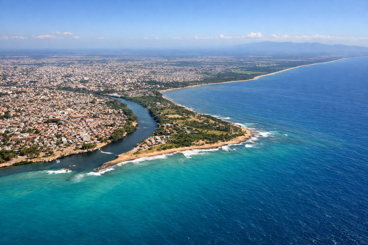
LEFTLas Americas airport sits east of Santo Domingo on the Caribbean coast. Aircraft typically approach from the east or northeast over the Caribbean, landing westward on runway 17/35 or the main east-west orientation. The left side gives views of Santo Domingo's urban coastline, the Colonial City district, and the mouth of the Ozama River. Right side faces inland toward scrubby lowlands.
Will your flight be in sunlight?
Pick a date and time in the Sun Map to watch the sun move across your whole flight.
About This Route
Which side of the plane should I sit on flying from Newark Liberty International (EWR) to Las Americas International (SDQ)?
Sit on the Left side of the plane for the best views on flights from Newark to Santo Domingo. Left side wins both ends of the flight. Over the New York metro area at departure it captures the most iconic urban geography in North America, and on approach into Santo Domingo it faces the city and coastline rather than inland scrubland. During cruise the flight tracks southeast over the Atlantic and then the Caribbean, so both sides see open ocean for most of the journey.
What can I see during takeoff from Newark Liberty International in Newark?
During takeoff from Newark Liberty International (EWR), sit on the Left side for the best views. EWR's primary departure runway 22L sends aircraft southwest over New Jersey, then curving southeast. The left side captures Manhattan's skyline directly across Newark Bay, plus the Statue of Liberty and Upper New York Bay. Right side gets industrial New Jersey marshlands. Notable sights include: Manhattan skyline, Statue of Liberty in Upper New York Bay, Verrazano-Narrows Bridge, Brooklyn waterfront.
What can I see when landing at Las Americas International in Santo Domingo?
When landing at Las Americas International (SDQ), sit on the Left side for the best views. Las Americas airport sits east of Santo Domingo on the Caribbean coast. Aircraft typically approach from the east or northeast over the Caribbean, landing westward on runway 17/35 or the main east-west orientation. The left side gives views of Santo Domingo's urban coastline, the Colonial City district, and the mouth of the Ozama River. Right side faces inland toward scrubby lowlands. Notable sights include: Santo Domingo Colonial City waterfront, Ozama River mouth, Caribbean Sea coastline, Distrito Nacional urban grid.
How long is the flight from Newark to Santo Domingo?
The flight from Newark Liberty International (EWR) to Las Americas International (SDQ) takes about 4 hours 30 minutes. The shortest flight path between them is 1,561 miles (2,512 km); winds and air traffic control usually add a few percent.
What does the Newark to Santo Domingo flight path pass over?
After departing the New Jersey coast the route crosses the Atlantic Ocean southeast of Cape Hatteras and the Outer Banks of North Carolina. The Bahamas archipelago — including Great Abaco, Eleuthera, and the Exuma chain — passes beneath or to the right side roughly two-thirds through the flight, visible as thin ribbons of pale sand and turquoise shallow-water banks against the deep blue Atlantic. The Turks and Caicos Islands and the southeastern Bahamas appear near the end of cruise before descending toward Hispaniola.