Newark to Tegucigalpa is 2,001 miles (3,220 km), a flight of about 5 hours.
The left side delivers the unmistakable Manhattan and New York Harbor departure view, which is genuinely world-class. Over the Caribbean and Central America the views are more symmetric, but the Yucatan Peninsula coastline and Gulf of Honduras are slightly better framed from the left on the typical southwesterly track. The departure alone makes left the clear winner.
Flight Path
The flight tracks south over the Delmarva Peninsula and the Outer Banks of North Carolina, then crosses the Bahamas archipelago with its shallow turquoise banks clearly visible from altitude, followed by Cuba's elongated landmass, then the deep blue Caribbean Sea, the Yucatan Channel between Cuba and Mexico, and finally the Gulf of Honduras and mountainous interior of Honduras on descent into Tegucigalpa
Great circle distance and headings ›.jpeg?width=600)
.jpg?width=600)

Phase by phase
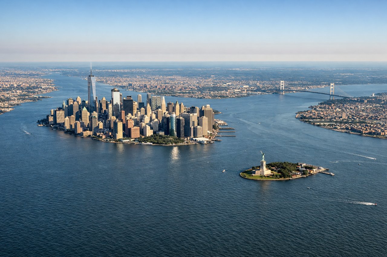
Takeoff from EWR
LEFTEWR typically departs runway 22L/22R heading southwest, then turns south. The left side gives you Manhattan's skyline across Newark Bay, the Statue of Liberty, and the full sweep of New York Harbor before the aircraft tracks south over New Jersey. This is one of the most iconic urban departure views in aviation.
Landing at TGU
RIGHTToncontin's runway 02 approach comes in from the south over mountainous terrain, meaning the right side faces west toward the Valle de Tegucigalpa and the city bowl surrounded by the Cordillera del Merendón foothills. The left side faces east into steep ridge terrain. Runway 20 departures reverse this but arrivals on 02 are most common.
Landmarks on this routeAll landmarks →
Will your flight be in sunlight?
Pick a date and time in the Sun Map to watch the sun move across your whole flight.
About This Route
Which side of the plane should I sit on flying from Newark Liberty International (EWR) to Toncontin International (TGU)?
Sit on the Left side of the plane for the best views on flights from Newark to Tegucigalpa. The left side delivers the unmistakable Manhattan and New York Harbor departure view, which is genuinely world-class. Over the Caribbean and Central America the views are more symmetric, but the Yucatan Peninsula coastline and Gulf of Honduras are slightly better framed from the left on the typical southwesterly track. The departure alone makes left the clear winner.
What can I see during takeoff from Newark Liberty International in Newark?
During takeoff from Newark Liberty International (EWR), sit on the Left side for the best views. EWR typically departs runway 22L/22R heading southwest, then turns south. The left side gives you Manhattan's skyline across Newark Bay, the Statue of Liberty, and the full sweep of New York Harbor before the aircraft tracks south over New Jersey. This is one of the most iconic urban departure views in aviation. Notable sights include: Manhattan skyline across Newark Bay, Statue of Liberty in New York Harbor, Verrazano-Narrows Bridge, the Hudson River corridor.
What can I see when landing at Toncontin International in Tegucigalpa?
When landing at Toncontin International (TGU), sit on the Right side for the best views. Toncontin's runway 02 approach comes in from the south over mountainous terrain, meaning the right side faces west toward the Valle de Tegucigalpa and the city bowl surrounded by the Cordillera del Merendón foothills. The left side faces east into steep ridge terrain. Runway 20 departures reverse this but arrivals on 02 are most common. Notable sights include: Valle de Tegucigalpa city bowl, Cordillera Central ridgelines surrounding the capital, El Picacho peak north of the city, Rio Choluteca valley.
How long is the flight from Newark to Tegucigalpa?
The flight from Newark Liberty International (EWR) to Toncontin International (TGU) takes about 5 hours. The shortest flight path between them is 2,001 miles (3,220 km); winds and air traffic control usually add a few percent.
What does the Newark to Tegucigalpa flight path pass over?
The flight tracks south over the Delmarva Peninsula and the Outer Banks of North Carolina, then crosses the Bahamas archipelago with its shallow turquoise banks clearly visible from altitude, followed by Cuba's elongated landmass, then the deep blue Caribbean Sea, the Yucatan Channel between Cuba and Mexico, and finally the Gulf of Honduras and mountainous interior of Honduras on descent into Tegucigalpa