Spokane to Minneapolis is 1,172 miles (1,886 km), a flight of about 2 hours 15 minutes.
The left side delivers a more varied and scenic experience end to end: Spokane's forested foothills at takeoff, a partial view of Montana's Rocky Mountain Front and Big Belt ranges during cruise, and the Minneapolis skyline with the Mississippi River on approach, compared to the flatter plains and farmland dominating the right side.
Flight Path
The route crosses the Idaho Panhandle near Coeur d'Alene Lake, then passes over the Rocky Mountain Front and Big Belt Mountains in central Montana near Great Falls and Helena, before flattening out over the wheat and ranch country of eastern Montana and North Dakota, crossing the Missouri River near Bismarck.
Great circle distance and headings ›.jpg?width=600)

Phase by phase
Takeoff from GEG
LEFTDeparting GEG on runway 21, the aircraft banks left through its turn toward the eastbound cruise track, bringing Mount Spokane and the forested foothills of the Selkirk Mountains into view on the north side. The right side shows the flatter Palouse farmland to the south, which is scenic but far less dramatic.
Landing at MSP
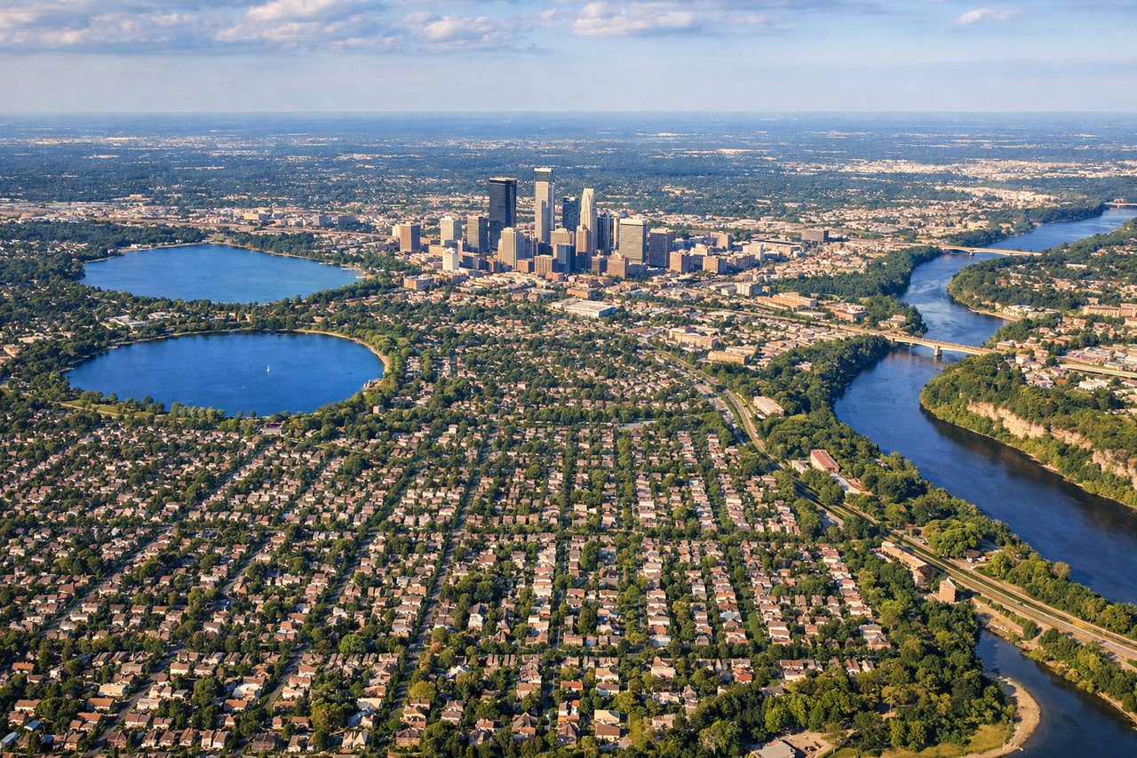
LEFTArriving from the northwest, MSP typically lands toward the southeast on 12L/12R, putting the Minneapolis skyline and the winding bends of the Mississippi River on the north side of the aircraft during the final descent. The right side mostly overlooks flatter suburban terrain and the Minnesota River valley, which is pleasant but less distinctive.
Landmarks on this routeAll landmarks →
Will your flight be in sunlight?
Pick a date and time in the Sun Map to watch the sun move across your whole flight.
About This Route
Which side of the plane should I sit on flying from Spokane International (GEG) to Minneapolis St Paul International (MSP)?
Sit on the Left side of the plane for the best views on flights from Spokane to Minneapolis. The left side delivers a more varied and scenic experience end to end: Spokane's forested foothills at takeoff, a partial view of Montana's Rocky Mountain Front and Big Belt ranges during cruise, and the Minneapolis skyline with the Mississippi River on approach, compared to the flatter plains and farmland dominating the right side.
What can I see during takeoff from Spokane International in Spokane?
During takeoff from Spokane International (GEG), sit on the Left side for the best views. Departing GEG on runway 21, the aircraft banks left through its turn toward the eastbound cruise track, bringing Mount Spokane and the forested foothills of the Selkirk Mountains into view on the north side. The right side shows the flatter Palouse farmland to the south, which is scenic but far less dramatic. Notable sights include: Mount Spokane, Selkirk Mountain foothills, Spokane River valley, city of Spokane.
What can I see when landing at Minneapolis St Paul International in Minneapolis?
When landing at Minneapolis St Paul International (MSP), sit on the Left side for the best views. Arriving from the northwest, MSP typically lands toward the southeast on 12L/12R, putting the Minneapolis skyline and the winding bends of the Mississippi River on the north side of the aircraft during the final descent. The right side mostly overlooks flatter suburban terrain and the Minnesota River valley, which is pleasant but less distinctive. Notable sights include: Downtown Minneapolis skyline, Mississippi River bends, University of Minnesota campus, Lake Nokomis.
How long is the flight from Spokane to Minneapolis?
The flight from Spokane International (GEG) to Minneapolis St Paul International (MSP) takes about 2 hours 15 minutes. The shortest flight path between them is 1,172 miles (1,886 km); winds and air traffic control usually add a few percent.
What does the Spokane to Minneapolis flight path pass over?
The route crosses the Idaho Panhandle near Coeur d'Alene Lake, then passes over the Rocky Mountain Front and Big Belt Mountains in central Montana near Great Falls and Helena, before flattening out over the wheat and ranch country of eastern Montana and North Dakota, crossing the Missouri River near Bismarck.