Point Salines to Miami is 1,536 miles (2,472 km), a flight of about 3 hours 45 minutes.
Right side wins at both ends of the flight. During the cruise over the Caribbean, the right side also faces east toward the island chain including Martinique, Dominica, and Guadeloupe visible in the distance during the early climb, and later the Bahamas archipelago comes into view on the right as you approach Florida.
Flight Path
The flight tracks northwest over the Eastern Caribbean, passing east of Martinique and Dominica, then over the open Caribbean Sea north of Hispaniola and Cuba. The Bahamas archipelago, particularly the Turks and Caicos and the southern Bahamian islands, becomes visible on the right side roughly an hour before landing. The Florida Straits and the shallow turquoise waters of the Bahama Banks are distinctly visible before crossing the Florida coast near Homestead.
Great circle distance and headings ›Phase by phase
Takeoff from GND
RIGHTPoint Salines runway runs roughly east-west. Departures typically head west then turn north, putting the right side facing the island interior and the dramatic volcanic spine of Grenada. You get a clear view of Grand Etang Lake in the crater and the forested central ridge before the island falls away behind you.
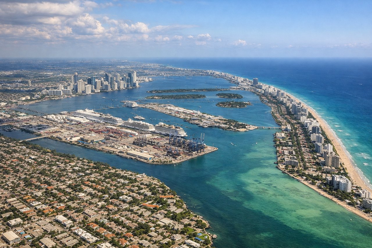
Landing at MIA
RIGHTMiami International typically uses runways 08R/26L or 09/27 for arrivals from the south. Approaching from the southeast on a northwesterly heading, the right side faces north and northeast, giving you the best view of downtown Miami's skyline, Biscayne Bay, and the barrier islands including Miami Beach. The left side faces southwest toward the Everglades, which is flat and featureless by comparison.
Landmarks on this routeAll landmarks →
Will your flight be in sunlight?
Pick a date and time in the Sun Map to watch the sun move across your whole flight.
About This Route
Which side of the plane should I sit on flying from Point Salines International (GND) to Miami International (MIA)?
Sit on the Right side of the plane for the best views on flights from Point Salines to Miami. Right side wins at both ends of the flight. During the cruise over the Caribbean, the right side also faces east toward the island chain including Martinique, Dominica, and Guadeloupe visible in the distance during the early climb, and later the Bahamas archipelago comes into view on the right as you approach Florida.
What can I see during takeoff from Point Salines International in Point Salines?
During takeoff from Point Salines International (GND), sit on the Right side for the best views. Point Salines runway runs roughly east-west. Departures typically head west then turn north, putting the right side facing the island interior and the dramatic volcanic spine of Grenada. You get a clear view of Grand Etang Lake in the crater and the forested central ridge before the island falls away behind you. Notable sights include: Grand Etang crater lake, Grenada's central volcanic ridge, St. George's harbor and capital town, the southwestern peninsula and Calivigny Island.
What can I see when landing at Miami International in Miami?
When landing at Miami International (MIA), sit on the Right side for the best views. Miami International typically uses runways 08R/26L or 09/27 for arrivals from the south. Approaching from the southeast on a northwesterly heading, the right side faces north and northeast, giving you the best view of downtown Miami's skyline, Biscayne Bay, and the barrier islands including Miami Beach. The left side faces southwest toward the Everglades, which is flat and featureless by comparison. Notable sights include: Downtown Miami skyline, Biscayne Bay, Miami Beach barrier island, Port of Miami with cruise ships.
How long is the flight from Point Salines to Miami?
The flight from Point Salines International (GND) to Miami International (MIA) takes about 3 hours 45 minutes. The shortest flight path between them is 1,536 miles (2,472 km); winds and air traffic control usually add a few percent.
What does the Point Salines to Miami flight path pass over?
The flight tracks northwest over the Eastern Caribbean, passing east of Martinique and Dominica, then over the open Caribbean Sea north of Hispaniola and Cuba. The Bahamas archipelago, particularly the Turks and Caicos and the southern Bahamian islands, becomes visible on the right side roughly an hour before landing. The Florida Straits and the shallow turquoise waters of the Bahama Banks are distinctly visible before crossing the Florida coast near Homestead.