Point Salines to Philadelphia is 2,093 miles (3,369 km), a flight of about 4 hours 15 minutes.
The takeoff scenery from Grenada's volcanic landscape and island chain is more visually distinctive and dramatic than the landing approach into Philadelphia. Right-side seats capture the Caribbean geography that makes this route memorable.
Flight Path
The flight path crosses the Atlantic Ocean northwestward. Notable reference points include the Bahamas archipelago (visible around 2.5 hours into flight), with the shallow turquoise banks and island formations of the central Bahamas appearing as the aircraft passes east of the islands. The continental shelf transition from deep ocean to shallower coastal waters becomes visible approaching the US East Coast. The Outer Banks of North Carolina may be visible in clear conditions as a thin barrier island formation along the horizon approximately 1 hour before landing.
Great circle distance and headings ›Phase by phase
Takeoff from GND
RIGHTRight-side seats capture the dramatic volcanic topography of Grenada and the southern Grenadines archipelago during the initial climb. The island's interior ridges and the chain of small islands extending northward are best framed from the right wing.
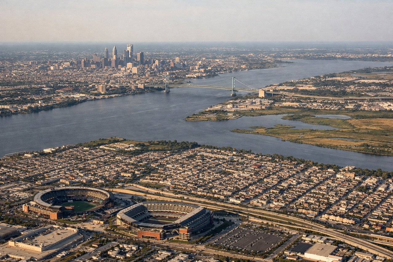
Landing at PHL
LEFTLeft-side seats offer the best views during final approach into Philadelphia. The Delaware River, the city skyline, and the industrial corridor along the river are all positioned to the left as the aircraft descends on a westerly approach vector into PHL.
Will your flight be in sunlight?
Pick a date and time in the Sun Map to watch the sun move across your whole flight.
About This Route
Which side of the plane should I sit on flying from Point Salines International (GND) to Philadelphia International (PHL)?
Sit on the Right side of the plane for the best views on flights from Point Salines to Philadelphia. The takeoff scenery from Grenada's volcanic landscape and island chain is more visually distinctive and dramatic than the landing approach into Philadelphia. Right-side seats capture the Caribbean geography that makes this route memorable.
What can I see during takeoff from Point Salines International in Point Salines?
During takeoff from Point Salines International (GND), sit on the Right side for the best views. Right-side seats capture the dramatic volcanic topography of Grenada and the southern Grenadines archipelago during the initial climb. The island's interior ridges and the chain of small islands extending northward are best framed from the right wing. Notable sights include: Grenada's central volcanic ridge, Carriacou Island to the north, the Grenadines chain, Caribbean Sea.
What can I see when landing at Philadelphia International in Philadelphia?
When landing at Philadelphia International (PHL), sit on the Left side for the best views. Left-side seats offer the best views during final approach into Philadelphia. The Delaware River, the city skyline, and the industrial corridor along the river are all positioned to the left as the aircraft descends on a westerly approach vector into PHL. Notable sights include: Delaware River, Philadelphia skyline and downtown district, industrial waterfront, New Jersey Pine Barrens to the west.
How long is the flight from Point Salines to Philadelphia?
The flight from Point Salines International (GND) to Philadelphia International (PHL) takes about 4 hours 15 minutes. The shortest flight path between them is 2,093 miles (3,369 km); winds and air traffic control usually add a few percent.
What does the Point Salines to Philadelphia flight path pass over?
The flight path crosses the Atlantic Ocean northwestward. Notable reference points include the Bahamas archipelago (visible around 2.5 hours into flight), with the shallow turquoise banks and island formations of the central Bahamas appearing as the aircraft passes east of the islands. The continental shelf transition from deep ocean to shallower coastal waters becomes visible approaching the US East Coast. The Outer Banks of North Carolina may be visible in clear conditions as a thin barrier island formation along the horizon approximately 1 hour before landing.