Hobart to Sydney is 645 miles (1,039 km), a flight of about 1 hour 50 minutes.
While the Hobart departure favors the left side briefly, the right side delivers a stronger and more sustained payoff: clear coastal scenery on the Sydney approach including Botany Bay, Cronulla, and glimpses toward the Harbour, outweighing the largely featureless Tasman Sea crossing shared by both sides.
Flight Path
Bass Strait, Flinders Island region, open Tasman Sea, approaching the NSW South Coast near Jervis Bay before turning toward Sydney
Great circle distance and headings ›Phase by phase
Takeoff from HBA
LEFTDeparting Hobart, the climb-out typically swings the aircraft past the Derwent River estuary with Mount Wellington's dramatic dolerite cliffs rising directly behind the city on the left side. This gives a brief but striking view of Hobart's compact CBD wedged between mountain and river before the plane turns north over open water.
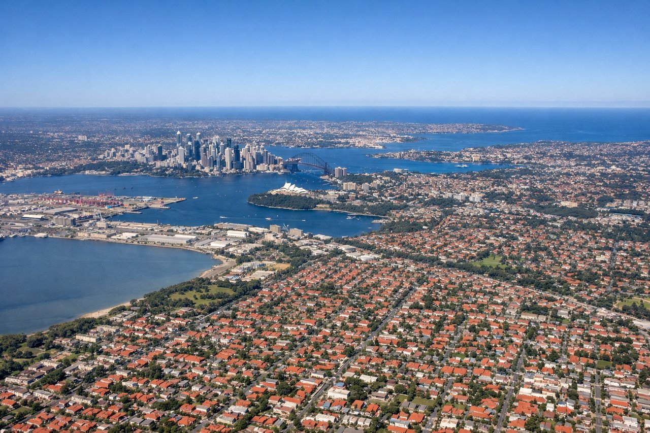
Landing at SYD
RIGHTArriving from the south, flights typically track up the NSW coastline before turning onto final approach for Sydney's north-south runways. Right-side passengers get sweeping views of the Royal National Park's sandstone cliffs, Cronulla's beaches, and Botany Bay's entrance, with the distant Sydney Harbour heads sometimes visible as the plane lines up to land.
Landmarks on this routeAll landmarks →
Will your flight be in sunlight?
Pick a date and time in the Sun Map to watch the sun move across your whole flight.
About This Route
Which side of the plane should I sit on flying from Hobart (HBA) to Kingsford Smith International Airport (SYD)?
Sit on the Right side of the plane for the best views on flights from Hobart to Sydney. While the Hobart departure favors the left side briefly, the right side delivers a stronger and more sustained payoff: clear coastal scenery on the Sydney approach including Botany Bay, Cronulla, and glimpses toward the Harbour, outweighing the largely featureless Tasman Sea crossing shared by both sides.
What can I see during takeoff from Hobart in Hobart?
During takeoff from Hobart (HBA), sit on the Left side for the best views. Departing Hobart, the climb-out typically swings the aircraft past the Derwent River estuary with Mount Wellington's dramatic dolerite cliffs rising directly behind the city on the left side. This gives a brief but striking view of Hobart's compact CBD wedged between mountain and river before the plane turns north over open water. Notable sights include: Mount Wellington, Hobart CBD, Derwent River estuary, Storm Bay.
What can I see when landing at Kingsford Smith International Airport in Sydney?
When landing at Kingsford Smith International Airport (SYD), sit on the Right side for the best views. Arriving from the south, flights typically track up the NSW coastline before turning onto final approach for Sydney's north-south runways. Right-side passengers get sweeping views of the Royal National Park's sandstone cliffs, Cronulla's beaches, and Botany Bay's entrance, with the distant Sydney Harbour heads sometimes visible as the plane lines up to land. Notable sights include: Royal National Park cliffs, Cronulla beaches, Botany Bay, distant Sydney Harbour entrance.
How long is the flight from Hobart to Sydney?
The flight from Hobart (HBA) to Kingsford Smith International Airport (SYD) takes about 1 hour 50 minutes. The shortest flight path between them is 645 miles (1,039 km); winds and air traffic control usually add a few percent.
What does the Hobart to Sydney flight path pass over?
Bass Strait, Flinders Island region, open Tasman Sea, approaching the NSW South Coast near Jervis Bay before turning toward Sydney