Hobart to Perth is 1,874 miles (3,016 km), a flight of about 3 hours 15 minutes.
The takeoff view from Hobart is more geographically distinctive and visually rewarding than the landing. While Perth's ocean and island views are pleasant, Hobart's combination of river estuary, mountain, and highland terrain provides more varied and recognizable landmarks during the initial climb phase.
Flight Path
The flight crosses the Bass Strait and southern Victoria. Notable features include the Furneaux Islands (northeast of Tasmania), the Victorian coastline near Lakes Entrance, and the Grampians mountain range in western Victoria. At cruise altitude (around 25,000-30,000 feet), these appear as distant landforms on the horizon. The flight then transitions over South Australia's Nullarbor Plain—a vast, featureless expanse with minimal visible landmarks. The final approach into Perth crosses the Indian Ocean and the Western Australian coastline.
Great circle distance and headings ›Phase by phase
Takeoff from HBA
LEFTHobart typically departs runway 27 (westbound). Left-side seats face north during climb-out, giving direct views of the Derwent River estuary, the city sprawl, and the Tasmanian highlands inland. Right-side seats face the open Tasman Sea with minimal landmarks.
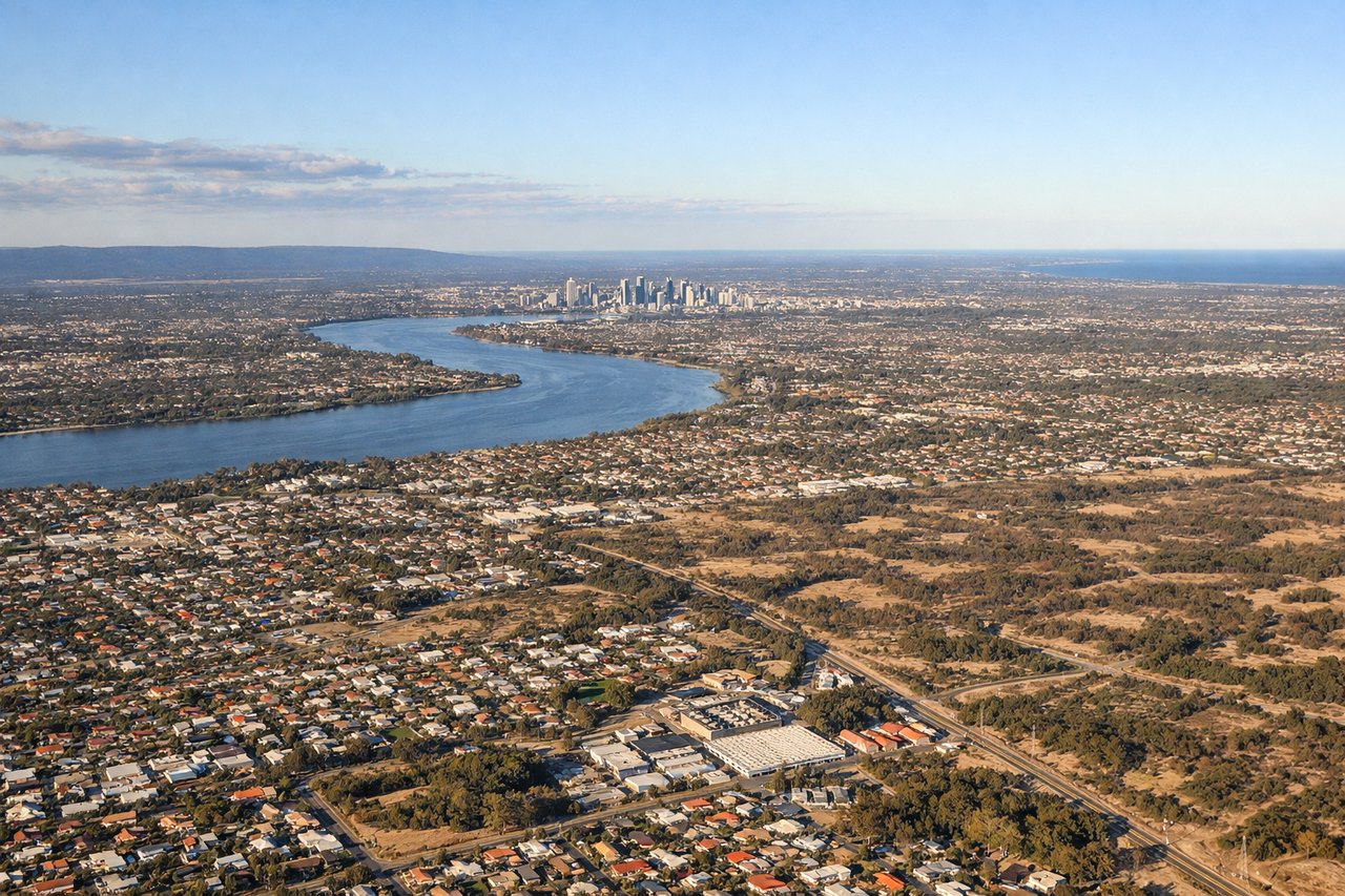
Landing at PER
RIGHTPerth typically lands runway 03 (northbound approach). Right-side seats face west during descent, offering views of the Indian Ocean, Rottnest Island, and the Swan River system. Left-side seats face inland with fewer distinctive water features.
Landmarks on this routeAll landmarks →
Will your flight be in sunlight?
Pick a date and time in the Sun Map to watch the sun move across your whole flight.
About This Route
Which side of the plane should I sit on flying from Hobart (HBA) to Perth International (PER)?
Sit on the Left side of the plane for the best views on flights from Hobart to Perth. The takeoff view from Hobart is more geographically distinctive and visually rewarding than the landing. While Perth's ocean and island views are pleasant, Hobart's combination of river estuary, mountain, and highland terrain provides more varied and recognizable landmarks during the initial climb phase.
What can I see during takeoff from Hobart in Hobart?
During takeoff from Hobart (HBA), sit on the Left side for the best views. Hobart typically departs runway 27 (westbound). Left-side seats face north during climb-out, giving direct views of the Derwent River estuary, the city sprawl, and the Tasmanian highlands inland. Right-side seats face the open Tasman Sea with minimal landmarks. Notable sights include: Derwent River estuary, Hobart city center and suburbs, Mount Wellington (1,271 m), Tasmanian highlands to the northwest.
What can I see when landing at Perth International in Perth?
When landing at Perth International (PER), sit on the Right side for the best views. Perth typically lands runway 03 (northbound approach). Right-side seats face west during descent, offering views of the Indian Ocean, Rottnest Island, and the Swan River system. Left-side seats face inland with fewer distinctive water features. Notable sights include: Indian Ocean, Rottnest Island, Swan River estuary, Perth city skyline.
How long is the flight from Hobart to Perth?
The flight from Hobart (HBA) to Perth International (PER) takes about 3 hours 15 minutes. The shortest flight path between them is 1,874 miles (3,016 km); winds and air traffic control usually add a few percent.
What does the Hobart to Perth flight path pass over?
The flight crosses the Bass Strait and southern Victoria. Notable features include the Furneaux Islands (northeast of Tasmania), the Victorian coastline near Lakes Entrance, and the Grampians mountain range in western Victoria. At cruise altitude (around 25,000-30,000 feet), these appear as distant landforms on the horizon. The flight then transitions over South Australia's Nullarbor Plain—a vast, featureless expanse with minimal visible landmarks. The final approach into Perth crosses the Indian Ocean and the Western Australian coastline.