The left side bookends the flight well, catching the Washington DC monuments during departure and the Ethiopian highlands and Entoto ridge on arrival, while the right side sees comparatively plain suburban Virginia and flatter approach terrain into Addis.
Flown IAD to ADD? Did we get it right?
Flight Path
Washington to Addis Ababa is 7,185 miles (11,563 km), a flight of about 13 hours 35 minutes.
North Atlantic Ocean crossing, Iberian Peninsula coastline near Portugal/Spain, Mediterranean Sea, Sahara Desert across Libya/Egypt/Sudan, Nile River corridor near Khartoum
Great circle distance and headings ›


Phase by phase
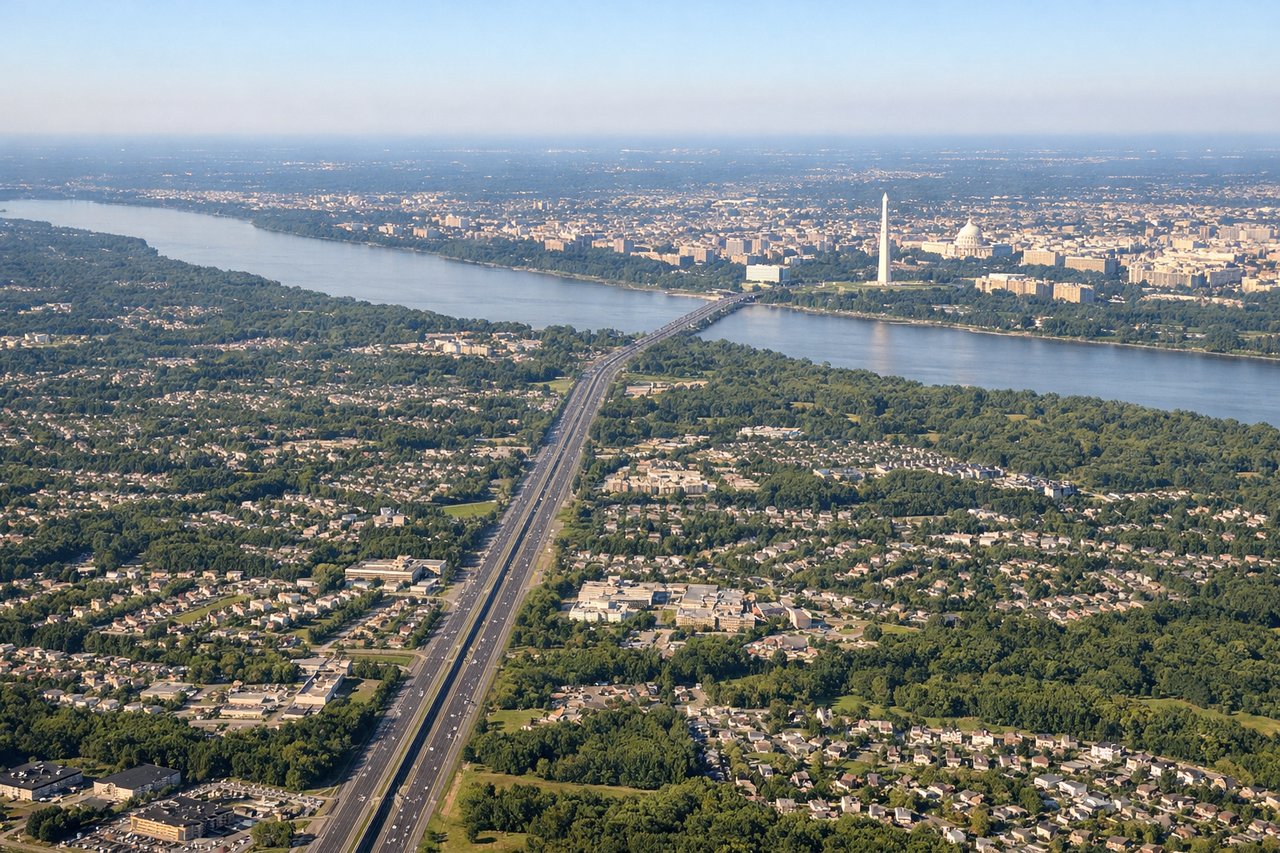
Takeoff from IAD
LEFTDeparting IAD on the long eastbound climb, the flight path curves northeast around Washington's restricted airspace, putting the National Mall and Potomac River on the left side before the terrain opens into the Chesapeake Bay. The right side over Virginia is mostly rolling suburban terrain with no comparable landmark.
Landing at ADD
LEFTOn the descent into Bole, the aircraft approaches from the north over Ethiopia's highland plateau, and the left side faces the Entoto ridge that rises directly over Addis Ababa before the city's rooftops and eucalyptus-covered hills spread out below. The right side mainly shows the flatter southern outskirts with less relief.
Will your flight be in sunlight?
Pick a date and time in the Sun Map to watch the sun move across your whole flight.
About This Route
Which side of the plane should I sit on flying from Washington Dulles International (IAD) to Bole International (ADD)?
Sit on the Left side of the plane for the best views on flights from Washington to Addis Ababa. The left side bookends the flight well, catching the Washington DC monuments during departure and the Ethiopian highlands and Entoto ridge on arrival, while the right side sees comparatively plain suburban Virginia and flatter approach terrain into Addis.
What can I see during takeoff from Washington Dulles International in Washington?
During takeoff from Washington Dulles International (IAD), sit on the Left side for the best views. Departing IAD on the long eastbound climb, the flight path curves northeast around Washington's restricted airspace, putting the National Mall and Potomac River on the left side before the terrain opens into the Chesapeake Bay. The right side over Virginia is mostly rolling suburban terrain with no comparable landmark. Notable sights include: Washington Monument and U.S. Capitol dome, Potomac River, Chesapeake Bay shoreline.
What can I see when landing at Bole International in Addis Ababa?
When landing at Bole International (ADD), sit on the Left side for the best views. On the descent into Bole, the aircraft approaches from the north over Ethiopia's highland plateau, and the left side faces the Entoto ridge that rises directly over Addis Ababa before the city's rooftops and eucalyptus-covered hills spread out below. The right side mainly shows the flatter southern outskirts with less relief. Notable sights include: Entoto Mountains, Ethiopian highland escarpment, Addis Ababa cityscape.
How long is the flight from Washington to Addis Ababa?
The flight from Washington Dulles International (IAD) to Bole International (ADD) takes about 13 hours 35 minutes. The shortest flight path between them is 7,185 miles (11,563 km); winds and air traffic control usually add a few percent.
What does the Washington to Addis Ababa flight path pass over?
North Atlantic Ocean crossing, Iberian Peninsula coastline near Portugal/Spain, Mediterranean Sea, Sahara Desert across Libya/Egypt/Sudan, Nile River corridor near Khartoum