The left side wins overall because the Dulles departure delivers genuinely dramatic views of Washington DC and the Potomac that the Atlanta arrival cannot match. Mid-flight the left side also tracks closer to the Blue Ridge Mountains in Virginia and the Appalachian ridges through Georgia, offering more terrain interest than the flatter right-side view.
Flown IAD to ATL? Did we get it right?
Flight Path
Washington to Atlanta is 534 miles (859 km), a flight of about 1 hour 55 minutes.
The flight path crosses the Blue Ridge Mountains in central Virginia, then the Appalachian ridges and valleys through western North Carolina and northwest Georgia. The New River and French Broad River valleys are visible in the mountain terrain. Piedmont plateau farmland and the Carolinas' red-clay landscape fill the mid-flight view before the terrain flattens approaching metropolitan Atlanta.
Great circle distance and headings ›Phase by phase
Takeoff from IAD
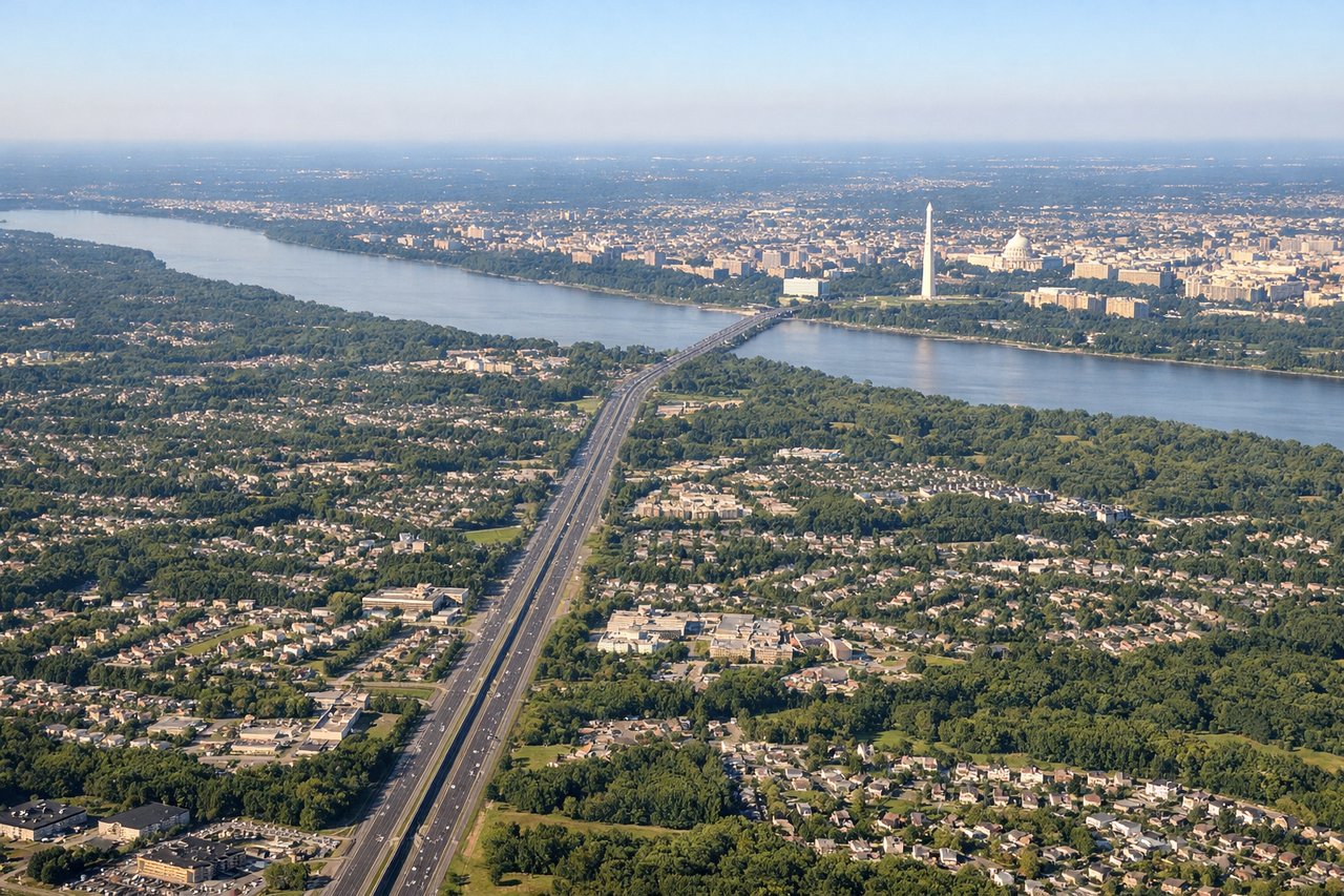
LEFTDulles typically departs east on runways 01R/01L or southeast on 19L/19R. A southeastward departure on the left side gives you a clear view toward Washington DC, with the Potomac River and the Capitol Mall visible as you climb out. The right side faces open Virginia suburbs with little of note.
Landing at ATL
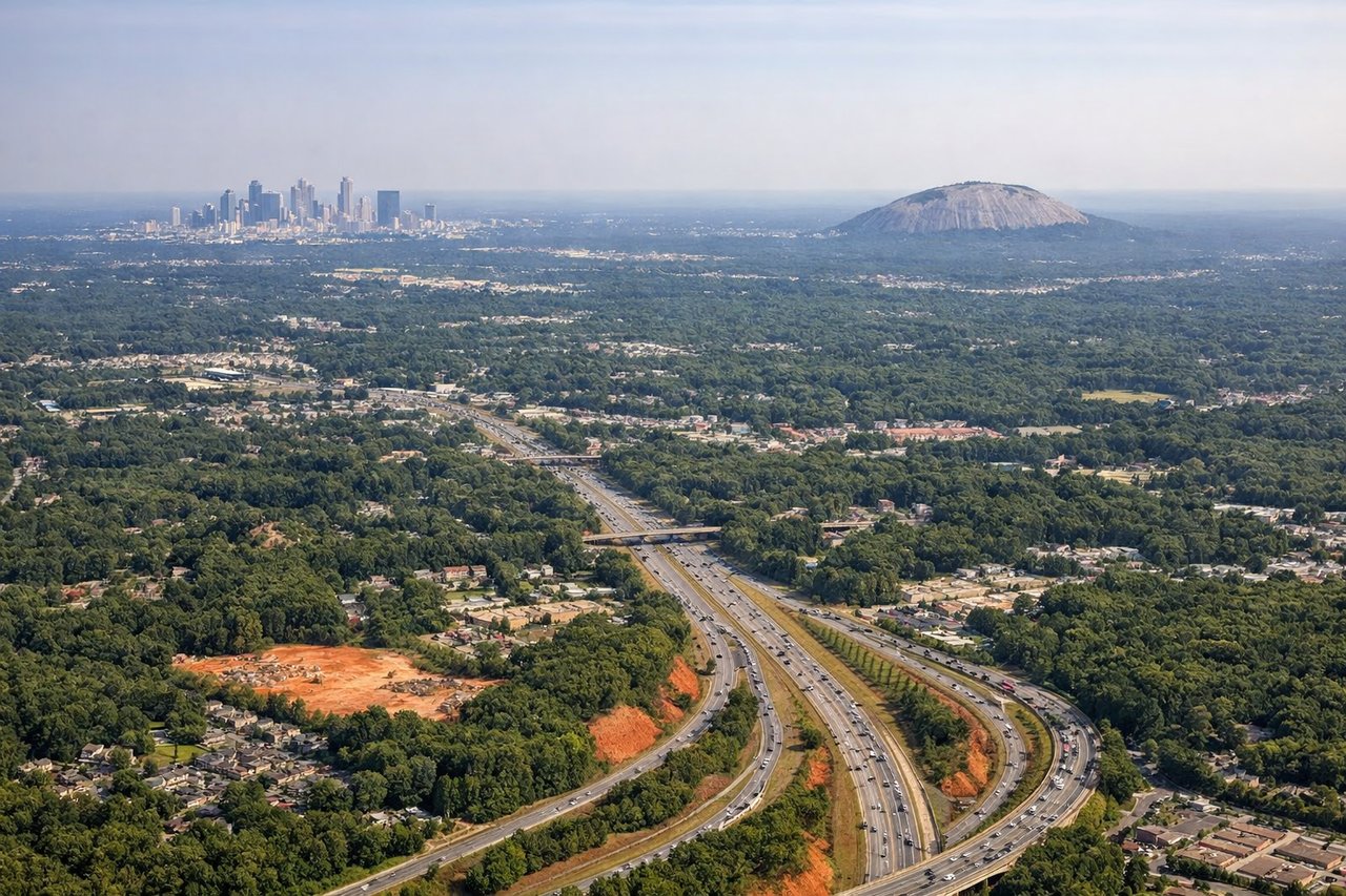
RIGHTAtlanta Hartsfield typically lands from the north on runways 08R/08L or from the northwest on 27L/27R. On a northwesterly approach, the right side faces south toward downtown Atlanta's skyline, which is clearly visible a few miles north of the airport as you descend. The left side looks toward open south Atlanta suburbs and industrial areas.
Will your flight be in sunlight?
Pick a date and time in the Sun Map to watch the sun move across your whole flight.
About This Route
Which side of the plane should I sit on flying from Washington Dulles International (IAD) to The William B Hartsfield Atlanta International (ATL)?
Sit on the Left side of the plane for the best views on flights from Washington to Atlanta. The left side wins overall because the Dulles departure delivers genuinely dramatic views of Washington DC and the Potomac that the Atlanta arrival cannot match. Mid-flight the left side also tracks closer to the Blue Ridge Mountains in Virginia and the Appalachian ridges through Georgia, offering more terrain interest than the flatter right-side view.
What can I see during takeoff from Washington Dulles International in Washington?
During takeoff from Washington Dulles International (IAD), sit on the Left side for the best views. Dulles typically departs east on runways 01R/01L or southeast on 19L/19R. A southeastward departure on the left side gives you a clear view toward Washington DC, with the Potomac River and the Capitol Mall visible as you climb out. The right side faces open Virginia suburbs with little of note. Notable sights include: Potomac River corridor, Washington DC Mall and monuments, Tysons Corner urban cluster, Reston Town Center.
What can I see when landing at The William B Hartsfield Atlanta International in Atlanta?
When landing at The William B Hartsfield Atlanta International (ATL), sit on the Right side for the best views. Atlanta Hartsfield typically lands from the north on runways 08R/08L or from the northwest on 27L/27R. On a northwesterly approach, the right side faces south toward downtown Atlanta's skyline, which is clearly visible a few miles north of the airport as you descend. The left side looks toward open south Atlanta suburbs and industrial areas. Notable sights include: Downtown Atlanta skyline, Stone Mountain (distant to northeast), I-285 perimeter highway loop, Chattahoochee River valley.
How long is the flight from Washington to Atlanta?
The flight from Washington Dulles International (IAD) to The William B Hartsfield Atlanta International (ATL) takes about 1 hour 55 minutes. The shortest flight path between them is 534 miles (859 km); winds and air traffic control usually add a few percent.
What does the Washington to Atlanta flight path pass over?
The flight path crosses the Blue Ridge Mountains in central Virginia, then the Appalachian ridges and valleys through western North Carolina and northwest Georgia. The New River and French Broad River valleys are visible in the mountain terrain. Piedmont plateau farmland and the Carolinas' red-clay landscape fill the mid-flight view before the terrain flattens approaching metropolitan Atlanta.