The left side strings together the flight's best landmarks: the Blue Ridge Mountains at departure, likely views of red-rock canyon country and desert ranges during the transcontinental cruise, and Pearl Harbor with the Koolau Range on arrival into Honolulu. The right side's highlights—Rockies front range and possibly the Great Salt Lake—are real but bracketed by long stretches of flat plains and, on approach, open ocean.
Flown IAD to HNL? Did we get it right?
Flight Path
Washington to Honolulu is 4,809 miles (7,740 km), a flight of about 10 hours 50 minutes.
The great-circle path crosses the Appalachians in West Virginia, the plains of Kansas, the Rocky Mountains near Colorado and Utah, the canyon and desert country of the Colorado Plateau and Great Basin, and the Mojave Desert before nearly six hours over the open Pacific to Hawaii.
Great circle distance and headings ›


Phase by phase
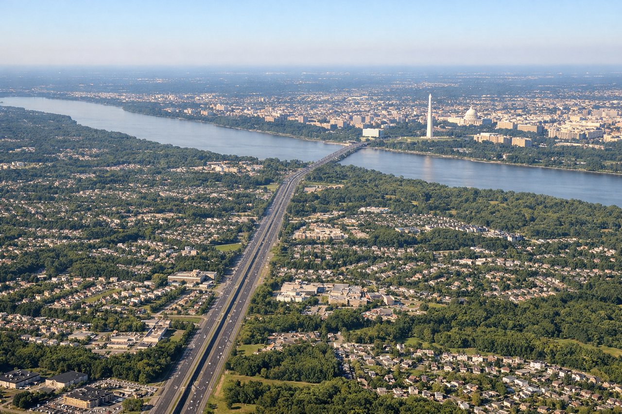
Takeoff from IAD
LEFTAs the aircraft climbs out of Dulles and turns onto its westbound routing, the left side looks out toward the Blue Ridge Mountains and Shenandoah Valley rising above the Piedmont. The right side mostly shows Loudoun County suburbs and flat farmland fading into haze.

Landing at HNL
LEFTWith trade-wind operations favoring landings toward the northeast, the final approach into HNL comes in from the west over Pearl Harbor and central Oahu, so the left side gets clear views of the harbor's channels and the Koolau Range beyond. The right side faces mostly open ocean during this leg of the approach.
Will your flight be in sunlight?
Pick a date and time in the Sun Map to watch the sun move across your whole flight.
About This Route
Which side of the plane should I sit on flying from Washington Dulles International (IAD) to Honolulu International (HNL)?
Sit on the Left side of the plane for the best views on flights from Washington to Honolulu. The left side strings together the flight's best landmarks: the Blue Ridge Mountains at departure, likely views of red-rock canyon country and desert ranges during the transcontinental cruise, and Pearl Harbor with the Koolau Range on arrival into Honolulu. The right side's highlights—Rockies front range and possibly the Great Salt Lake—are real but bracketed by long stretches of flat plains and, on approach, open ocean.
What can I see during takeoff from Washington Dulles International in Washington?
During takeoff from Washington Dulles International (IAD), sit on the Left side for the best views. As the aircraft climbs out of Dulles and turns onto its westbound routing, the left side looks out toward the Blue Ridge Mountains and Shenandoah Valley rising above the Piedmont. The right side mostly shows Loudoun County suburbs and flat farmland fading into haze. Notable sights include: Blue Ridge Mountains, Shenandoah Valley, Bull Run Mountains, Northern Virginia horse country.
What can I see when landing at Honolulu International in Honolulu?
When landing at Honolulu International (HNL), sit on the Left side for the best views. With trade-wind operations favoring landings toward the northeast, the final approach into HNL comes in from the west over Pearl Harbor and central Oahu, so the left side gets clear views of the harbor's channels and the Koolau Range beyond. The right side faces mostly open ocean during this leg of the approach. Notable sights include: Pearl Harbor, USS Arizona Memorial area, Koolau Range, central Oahu plain.
How long is the flight from Washington to Honolulu?
The flight from Washington Dulles International (IAD) to Honolulu International (HNL) takes about 10 hours 50 minutes. The shortest flight path between them is 4,809 miles (7,740 km); winds and air traffic control usually add a few percent.
What does the Washington to Honolulu flight path pass over?
The great-circle path crosses the Appalachians in West Virginia, the plains of Kansas, the Rocky Mountains near Colorado and Utah, the canyon and desert country of the Colorado Plateau and Great Basin, and the Mojave Desert before nearly six hours over the open Pacific to Hawaii.