The right side delivers the more dramatic and concentrated payoff at takeoff with the Washington DC monumental core and Potomac River clearly visible. The landing views on the left are interesting but Houston's flat terrain and industrial landscape are less visually compelling. Right side wins on the strength of the departure.
Flown IAD to IAH? Did we get it right?
Flight Path
Washington to Houston is 1,189 miles (1,913 km), a flight of about 3 hours 15 minutes.
The flight tracks southwest over the Virginia and West Virginia Appalachians briefly before crossing into Tennessee and Kentucky, then over the Mississippi Alluvial Plain in Arkansas and Louisiana. The Mississippi River crossing near Memphis or further south is the most visually distinctive midpoint feature, appearing as a wide brown meandering river cutting through flat agricultural land. East Texas pine forests and the Trinity River basin precede the Houston metro approach.
Great circle distance and headings ›

Phase by phase

Takeoff from IAD
RIGHTDulles typically departs east on runways 01R/01L or southwest on 19L/19R. On the dominant eastward departures, the aircraft banks south toward Washington, putting the right side over the Potomac River corridor, the DC monuments district, and the Capitol area. Left side faces suburban Virginia with little of note.
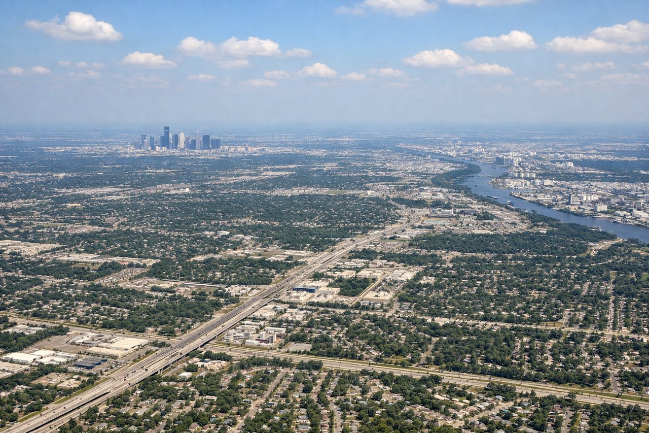
Landing at IAH
LEFTIAH primarily lands from the south on runways 26L/26R or from the east on 15L/15R. On the common westward approach over the Houston metro, the left side tracks over downtown Houston's skyline, the Ship Channel industrial corridor, and Lake Houston to the northeast. Right side faces suburban sprawl with fewer distinguishing features.
Will your flight be in sunlight?
Pick a date and time in the Sun Map to watch the sun move across your whole flight.
About This Route
Which side of the plane should I sit on flying from Washington Dulles International (IAD) to George Bush Intcntl Houston (IAH)?
Sit on the Right side of the plane for the best views on flights from Washington to Houston. The right side delivers the more dramatic and concentrated payoff at takeoff with the Washington DC monumental core and Potomac River clearly visible. The landing views on the left are interesting but Houston's flat terrain and industrial landscape are less visually compelling. Right side wins on the strength of the departure.
What can I see during takeoff from Washington Dulles International in Washington?
During takeoff from Washington Dulles International (IAD), sit on the Right side for the best views. Dulles typically departs east on runways 01R/01L or southwest on 19L/19R. On the dominant eastward departures, the aircraft banks south toward Washington, putting the right side over the Potomac River corridor, the DC monuments district, and the Capitol area. Left side faces suburban Virginia with little of note. Notable sights include: Potomac River winding southeast, Washington Monument and Mall district, Reagan National Airport visible below, Arlington and the Pentagon complex.
What can I see when landing at George Bush Intcntl Houston in Houston?
When landing at George Bush Intcntl Houston (IAH), sit on the Left side for the best views. IAH primarily lands from the south on runways 26L/26R or from the east on 15L/15R. On the common westward approach over the Houston metro, the left side tracks over downtown Houston's skyline, the Ship Channel industrial corridor, and Lake Houston to the northeast. Right side faces suburban sprawl with fewer distinguishing features. Notable sights include: Downtown Houston skyline cluster, Houston Ship Channel and turning basin, Lake Houston to the northeast, Galveston Bay visible on the southern horizon.
How long is the flight from Washington to Houston?
The flight from Washington Dulles International (IAD) to George Bush Intcntl Houston (IAH) takes about 3 hours 15 minutes. The shortest flight path between them is 1,189 miles (1,913 km); winds and air traffic control usually add a few percent.
What does the Washington to Houston flight path pass over?
The flight tracks southwest over the Virginia and West Virginia Appalachians briefly before crossing into Tennessee and Kentucky, then over the Mississippi Alluvial Plain in Arkansas and Louisiana. The Mississippi River crossing near Memphis or further south is the most visually distinctive midpoint feature, appearing as a wide brown meandering river cutting through flat agricultural land. East Texas pine forests and the Trinity River basin precede the Houston metro approach.