The left side benefits from a rare glimpse of Greenland's southern coastal mountains during the North Atlantic crossing and the dramatic volcanic Icelandic landscape on final approach, giving it more terrain variety than the ocean-dominated right side.
Flown IAD to KEF? Did we get it right?
Flight Path
Washington to Keflavik is 2,793 miles (4,495 km), a flight of about 5 hours 45 minutes.
Open North Atlantic Ocean with a possible distant view of Greenland's southern coastal mountains on clear days, followed by the volcanic Icelandic coastline near landing
Great circle distance and headings ›Phase by phase

Takeoff from IAD
RIGHTIAD departures on the northbound runways typically bank east soon after liftoff, putting the Washington DC skyline, the Potomac River, and the National Mall into view on the right side before the aircraft settles onto its northeastern track.
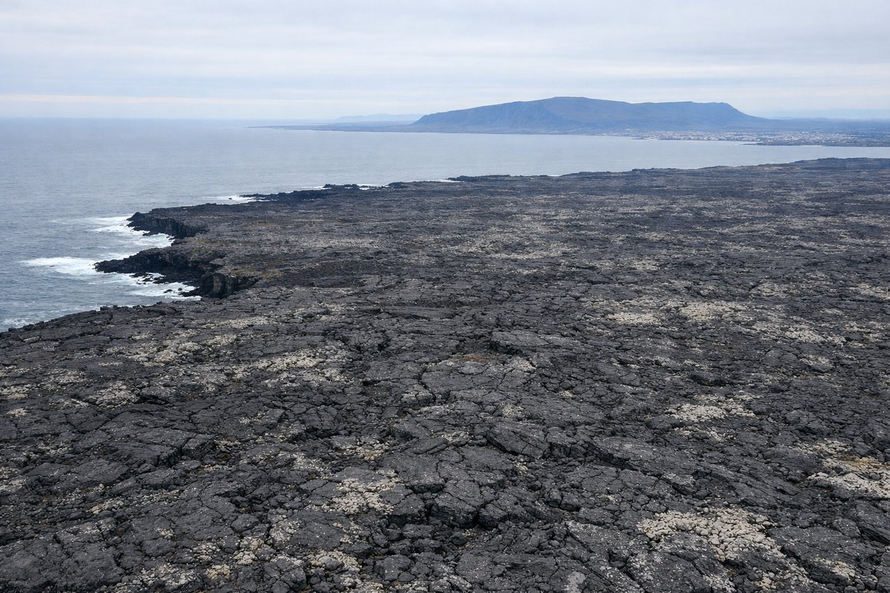
Landing at KEF
LEFTOn approach into Keflavik from the southwest, the descent path crosses the jagged, treeless Reykjanes Peninsula with its volcanic craters and black lava fields, features that sit on the left side of the aircraft as it lines up for the north-south runways.
Will your flight be in sunlight?
Pick a date and time in the Sun Map to watch the sun move across your whole flight.
About This Route
Which side of the plane should I sit on flying from Washington Dulles International (IAD) to Keflavik Nas (KEF)?
Sit on the Left side of the plane for the best views on flights from Washington to Keflavik. The left side benefits from a rare glimpse of Greenland's southern coastal mountains during the North Atlantic crossing and the dramatic volcanic Icelandic landscape on final approach, giving it more terrain variety than the ocean-dominated right side.
What can I see during takeoff from Washington Dulles International in Washington?
During takeoff from Washington Dulles International (IAD), sit on the Right side for the best views. IAD departures on the northbound runways typically bank east soon after liftoff, putting the Washington DC skyline, the Potomac River, and the National Mall into view on the right side before the aircraft settles onto its northeastern track. Notable sights include: Washington DC skyline, Potomac River, Chesapeake Bay approaches.
What can I see when landing at Keflavik Nas in Keflavik?
When landing at Keflavik Nas (KEF), sit on the Left side for the best views. On approach into Keflavik from the southwest, the descent path crosses the jagged, treeless Reykjanes Peninsula with its volcanic craters and black lava fields, features that sit on the left side of the aircraft as it lines up for the north-south runways. Notable sights include: Reykjanes Peninsula lava fields, Atlantic coastline cliffs, volcanic crater rows near Keflavik.
How long is the flight from Washington to Keflavik?
The flight from Washington Dulles International (IAD) to Keflavik Nas (KEF) takes about 5 hours 45 minutes. The shortest flight path between them is 2,793 miles (4,495 km); winds and air traffic control usually add a few percent.
What does the Washington to Keflavik flight path pass over?
Open North Atlantic Ocean with a possible distant view of Greenland's southern coastal mountains on clear days, followed by the volcanic Icelandic coastline near landing