While takeoff scenery is mild on both sides, the left side wins overall thanks to the dramatic Tampa Bay approach with its bridges, coastline, and city skyline, which outweighs the flat, unremarkable Virginia countryside seen at departure.
Flown IAD to TPA? Did we get it right?
Flight Path
Washington to Tampa is 812 miles (1,307 km), a flight of about 2 hours 20 minutes.
Cruise passes over central Virginia and North Carolina's coastal plain, then Georgia's pine forests and the Okefenokee Swamp region before crossing into Florida's flatwoods and lake country near Ocala.
Great circle distance and headings ›Phase by phase

Takeoff from IAD
RIGHTDeparting IAD southbound, the right side offers views over the Virginia Piedmont with glimpses of the Occoquan River and suburban sprawl toward Fredericksburg. It's not dramatic but slightly more visually varied than the left side's featureless farmland.
Landing at TPA
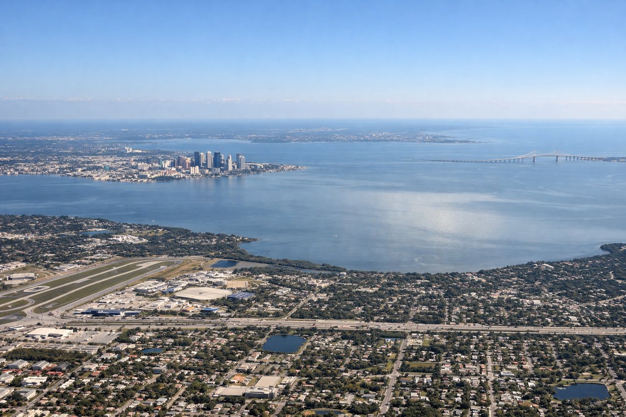
LEFTArriving into TPA from the north, the left side gives passengers a sweeping view of Tampa Bay, the causeways, and downtown Tampa's skyline as the aircraft turns onto final approach. The right side mostly shows flat inland Florida terrain with little visual interest.
Will your flight be in sunlight?
Pick a date and time in the Sun Map to watch the sun move across your whole flight.
About This Route
Which side of the plane should I sit on flying from Washington Dulles International (IAD) to Tampa International (TPA)?
Sit on the Left side of the plane for the best views on flights from Washington to Tampa. While takeoff scenery is mild on both sides, the left side wins overall thanks to the dramatic Tampa Bay approach with its bridges, coastline, and city skyline, which outweighs the flat, unremarkable Virginia countryside seen at departure.
What can I see during takeoff from Washington Dulles International in Washington?
During takeoff from Washington Dulles International (IAD), sit on the Right side for the best views. Departing IAD southbound, the right side offers views over the Virginia Piedmont with glimpses of the Occoquan River and suburban sprawl toward Fredericksburg. It's not dramatic but slightly more visually varied than the left side's featureless farmland. Notable sights include: Occoquan Reservoir, Virginia Piedmont farmland, Fredericksburg outskirts.
What can I see when landing at Tampa International in Tampa?
When landing at Tampa International (TPA), sit on the Left side for the best views. Arriving into TPA from the north, the left side gives passengers a sweeping view of Tampa Bay, the causeways, and downtown Tampa's skyline as the aircraft turns onto final approach. The right side mostly shows flat inland Florida terrain with little visual interest. Notable sights include: Tampa Bay, Downtown Tampa skyline, Gandy Bridge, MacDill Air Force Base peninsula.
How long is the flight from Washington to Tampa?
The flight from Washington Dulles International (IAD) to Tampa International (TPA) takes about 2 hours 20 minutes. The shortest flight path between them is 812 miles (1,307 km); winds and air traffic control usually add a few percent.
What does the Washington to Tampa flight path pass over?
Cruise passes over central Virginia and North Carolina's coastal plain, then Georgia's pine forests and the Okefenokee Swamp region before crossing into Florida's flatwoods and lake country near Ocala.