Wichita to Denver is 419 miles (674 km), a flight of about 1 hour 10 minutes.
The left side misses the Wichita departure views but wins decisively on the approach to Denver, where the Front Range panorama during descent is one of the best mountain views available on any domestic US route. The left side also tracks the gradual rise of the terrain across Kansas and into Colorado during cruise.
Flight Path
The flight crosses the flat High Plains of central Kansas, passing over Dodge City and the Arkansas River valley. Around the Colorado border, the terrain begins its gradual rise toward the Rockies. The Flint Hills of eastern Kansas are visible early in the flight as subtle rolling terrain — one of the few topographic breaks on the route. Near the Colorado border, the landscape transitions from irrigated green circles (center-pivot agriculture) to drier, browner shortgrass prairie. The Front Range becomes visible on the left side roughly 100 miles out from Denver.
Great circle distance and headings ›Phase by phase
Takeoff from ICT
RIGHTICT typically departs runway 19L/R heading south before turning northwest toward Denver. A right-side seat gives you a view back over downtown Wichita and the Arkansas River as you climb out. The city grid and the confluence of the Arkansas and Little Arkansas rivers are clearly visible on the right side during the initial turn.
Landing at DEN
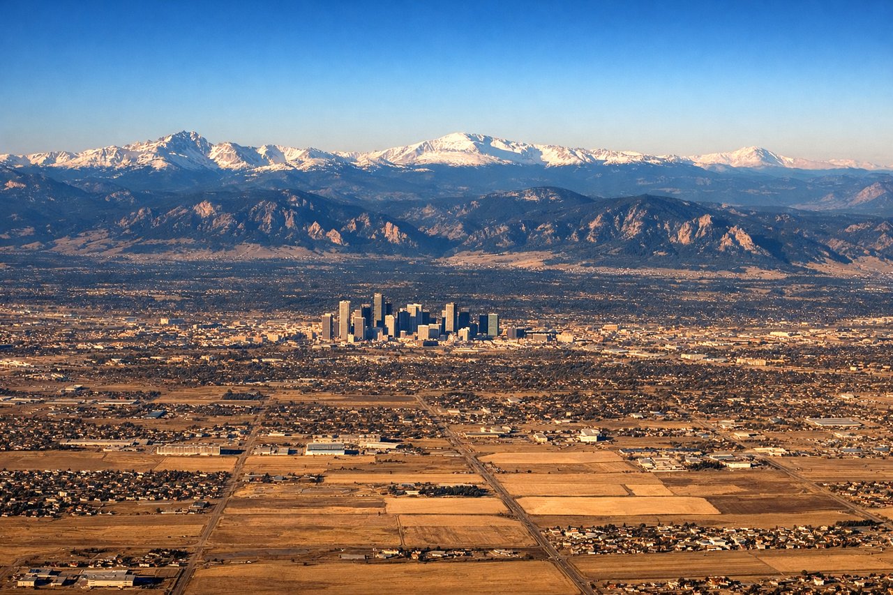
LEFTDEN typically lands on runways oriented north-south, with approaches from the east. On a flight from Wichita, the aircraft approaches Denver from the southeast, and a left-side seat gives a sustained view of the entire Front Range — from Pikes Peak in the south to Longs Peak in the north — as you descend over the plains. The Rocky Mountain wall is one of the most dramatic aerial views in the continental US.
Landmarks on this routeAll landmarks →
Will your flight be in sunlight?
Pick a date and time in the Sun Map to watch the sun move across your whole flight.
About This Route
Which side of the plane should I sit on flying from Wichita Mid Continent (ICT) to Denver International (DEN)?
Sit on the Left side of the plane for the best views on flights from Wichita to Denver. The left side misses the Wichita departure views but wins decisively on the approach to Denver, where the Front Range panorama during descent is one of the best mountain views available on any domestic US route. The left side also tracks the gradual rise of the terrain across Kansas and into Colorado during cruise.
What can I see during takeoff from Wichita Mid Continent in Wichita?
During takeoff from Wichita Mid Continent (ICT), sit on the Right side for the best views. ICT typically departs runway 19L/R heading south before turning northwest toward Denver. A right-side seat gives you a view back over downtown Wichita and the Arkansas River as you climb out. The city grid and the confluence of the Arkansas and Little Arkansas rivers are clearly visible on the right side during the initial turn. Notable sights include: Downtown Wichita skyline, Arkansas River corridor, Cheney Reservoir to the west, flat Kansas agricultural grid.
What can I see when landing at Denver International in Denver?
When landing at Denver International (DEN), sit on the Left side for the best views. DEN typically lands on runways oriented north-south, with approaches from the east. On a flight from Wichita, the aircraft approaches Denver from the southeast, and a left-side seat gives a sustained view of the entire Front Range — from Pikes Peak in the south to Longs Peak in the north — as you descend over the plains. The Rocky Mountain wall is one of the most dramatic aerial views in the continental US. Notable sights include: Front Range of the Rockies (Pikes Peak, Mount Evans, Longs Peak), Denver metro grid, Cherry Creek Reservoir, DIA's white tent roof structure.
How long is the flight from Wichita to Denver?
The flight from Wichita Mid Continent (ICT) to Denver International (DEN) takes about 1 hour 10 minutes. The shortest flight path between them is 419 miles (674 km); winds and air traffic control usually add a few percent.
What does the Wichita to Denver flight path pass over?
The flight crosses the flat High Plains of central Kansas, passing over Dodge City and the Arkansas River valley. Around the Colorado border, the terrain begins its gradual rise toward the Rockies. The Flint Hills of eastern Kansas are visible early in the flight as subtle rolling terrain — one of the few topographic breaks on the route. Near the Colorado border, the landscape transitions from irrigated green circles (center-pivot agriculture) to drier, browner shortgrass prairie. The Front Range becomes visible on the left side roughly 100 miles out from Denver.