Wichita to Seattle is 1,427 miles (2,297 km), a flight of about 3 hours 30 minutes.
The left side misses the best of the Wichita departure but wins decisively on the Seattle approach with Mount Rainier, the Seattle skyline, and Puget Sound all visible simultaneously. During the cruise portion heading northwest, the left side also tracks closer to the Snake River Plain in Idaho and gets better views of the Cascades on descent. The SeaTac approach on the left is one of the most spectacular in the US.
Flight Path
Colorado Rockies visible to the south early in the flight, the high plains of eastern Colorado and Wyoming below, the Snake River Plain across southern Idaho with the Snake River visible as a dark ribbon, the Blue Mountains of northeastern Oregon, then the Columbia River Gorge region before climbing into the Cascades and descending into the Seattle basin
Great circle distance and headings ›.jpg?width=600)

.jpg?width=600)

Phase by phase
Takeoff from ICT
RIGHTICT typically departs northwest on runway 1L/19R or northeast on 14/32. A northwest departure puts the right side facing the Wichita urban grid and the Arkansas River snaking through the city. The flat Kansas plains spread out clearly in all directions but the river and city layout are the most distinctive features from the right.
Landing at SEA
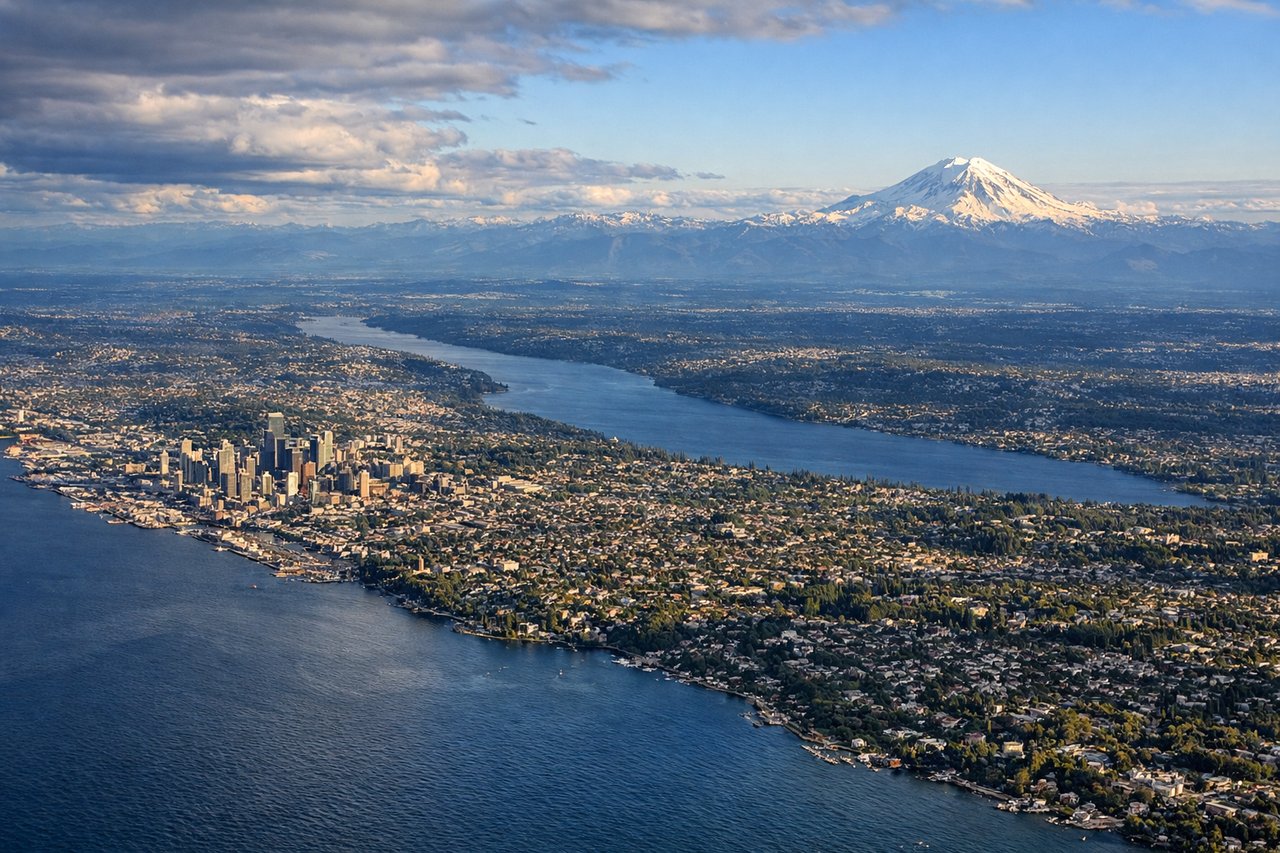
LEFTSeaTac typically lands on runways 16L/16R heading south, meaning the approach comes from the north over Puget Sound. The left side faces east toward the Cascade Range, giving a direct view of Mount Rainier dominating the skyline and the Seattle city skyline along Elliott Bay. This is one of the most dramatic approach views in the continental US.
Landmarks on this routeAll landmarks →
Will your flight be in sunlight?
Pick a date and time in the Sun Map to watch the sun move across your whole flight.
About This Route
Which side of the plane should I sit on flying from Wichita Mid Continent (ICT) to Seattle Tacoma International (SEA)?
Sit on the Left side of the plane for the best views on flights from Wichita to Seattle. The left side misses the best of the Wichita departure but wins decisively on the Seattle approach with Mount Rainier, the Seattle skyline, and Puget Sound all visible simultaneously. During the cruise portion heading northwest, the left side also tracks closer to the Snake River Plain in Idaho and gets better views of the Cascades on descent. The SeaTac approach on the left is one of the most spectacular in the US.
What can I see during takeoff from Wichita Mid Continent in Wichita?
During takeoff from Wichita Mid Continent (ICT), sit on the Right side for the best views. ICT typically departs northwest on runway 1L/19R or northeast on 14/32. A northwest departure puts the right side facing the Wichita urban grid and the Arkansas River snaking through the city. The flat Kansas plains spread out clearly in all directions but the river and city layout are the most distinctive features from the right. Notable sights include: Arkansas River through Wichita, Wichita city grid and downtown, Cheney Reservoir to the west, flat Kansas agricultural patchwork.
What can I see when landing at Seattle Tacoma International in Seattle?
When landing at Seattle Tacoma International (SEA), sit on the Left side for the best views. SeaTac typically lands on runways 16L/16R heading south, meaning the approach comes from the north over Puget Sound. The left side faces east toward the Cascade Range, giving a direct view of Mount Rainier dominating the skyline and the Seattle city skyline along Elliott Bay. This is one of the most dramatic approach views in the continental US. Notable sights include: Mount Rainier (14,411 ft), Seattle skyline and Elliott Bay, Lake Washington, Cascade Range foothills.
How long is the flight from Wichita to Seattle?
The flight from Wichita Mid Continent (ICT) to Seattle Tacoma International (SEA) takes about 3 hours 30 minutes. The shortest flight path between them is 1,427 miles (2,297 km); winds and air traffic control usually add a few percent.
What does the Wichita to Seattle flight path pass over?
Colorado Rockies visible to the south early in the flight, the high plains of eastern Colorado and Wyoming below, the Snake River Plain across southern Idaho with the Snake River visible as a dark ribbon, the Blue Mountains of northeastern Oregon, then the Columbia River Gorge region before climbing into the Cascades and descending into the Seattle basin