New York to Albany is 146 miles (235 km), a flight of about 50 minutes.
Left side delivers the best views at both ends of this short flight — Jamaica Bay and Manhattan on departure, and the Hudson River valley with the Catskills on approach into Albany. The right side offers suburban Long Island on departure and less dramatic eastern terrain on arrival.
Flight Path
The flight tracks roughly north-northeast up the Hudson Valley corridor. At cruise altitude the Hudson River is visible below for much of the route, with the Catskill Mountains to the west and the Taconic Range to the east. The city of Poughkeepsie and the Mid-Hudson Bridge are visible mid-route, and the Shawangunk Ridge runs parallel to the west.
Great circle distance and headings ›.jpg?width=600)
.jpeg?width=600)
Phase by phase
Takeoff from JFK
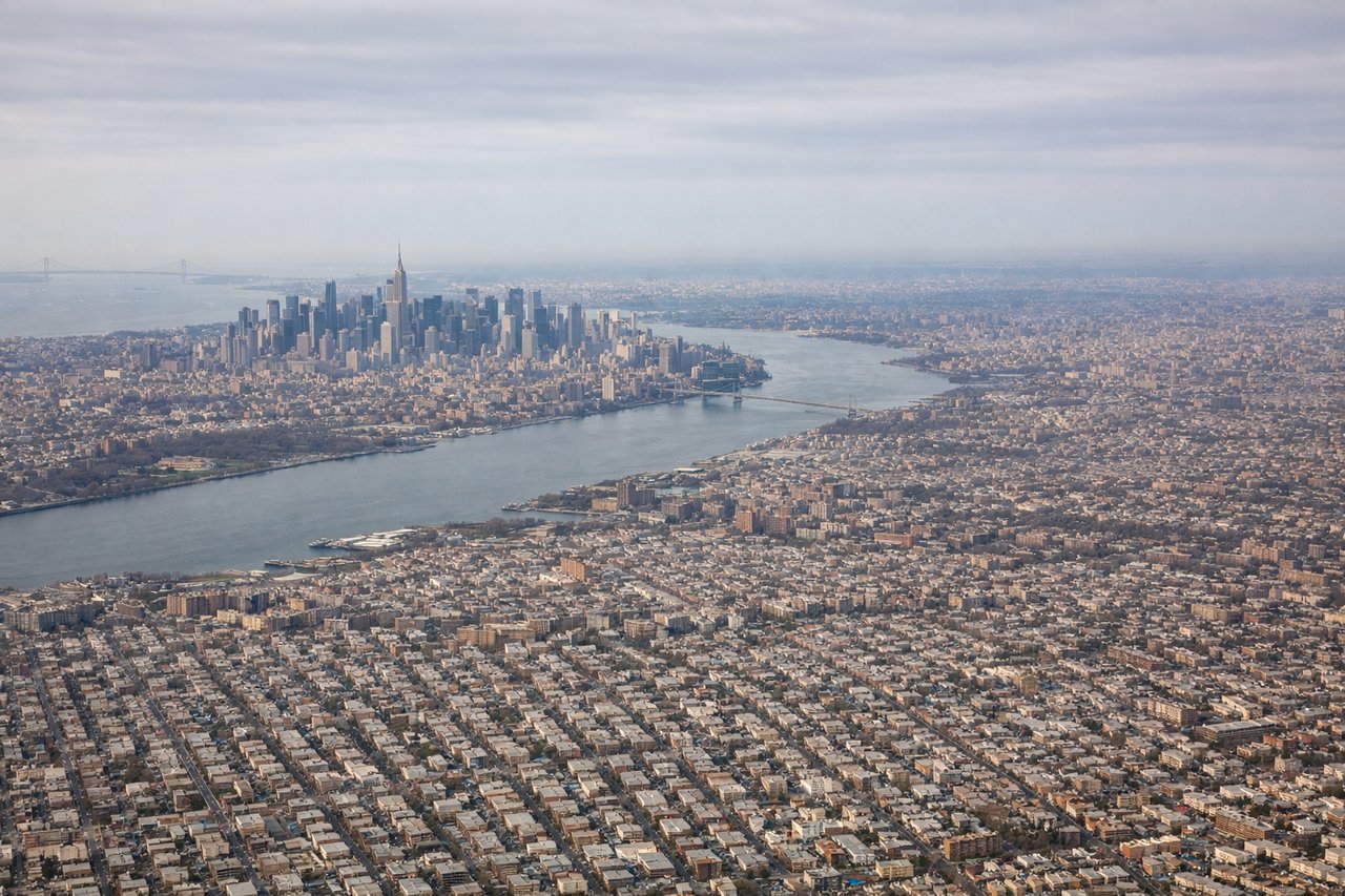
LEFTJFK's primary departure runways (31L/31R) head northwest, putting the left side over Jamaica Bay and then the urban core of Brooklyn and Queens. You get a clear look at the Manhattan skyline receding to the northwest as the aircraft climbs out over Long Island Sound.
Landing at ALB
LEFTAlbany International typically uses runway 01 for northbound arrivals, meaning the aircraft approaches from the south. The left side faces west toward the Hudson River valley and the Catskill Mountains on the horizon, which are the most visually dramatic features on approach.
Landmarks on this routeAll landmarks →
Will your flight be in sunlight?
Pick a date and time in the Sun Map to watch the sun move across your whole flight.
About This Route
Which side of the plane should I sit on flying from John F Kennedy International (JFK) to Albany International (ALB)?
Sit on the Left side of the plane for the best views on flights from New York to Albany. Left side delivers the best views at both ends of this short flight — Jamaica Bay and Manhattan on departure, and the Hudson River valley with the Catskills on approach into Albany. The right side offers suburban Long Island on departure and less dramatic eastern terrain on arrival.
What can I see during takeoff from John F Kennedy International in New York?
During takeoff from John F Kennedy International (JFK), sit on the Left side for the best views. JFK's primary departure runways (31L/31R) head northwest, putting the left side over Jamaica Bay and then the urban core of Brooklyn and Queens. You get a clear look at the Manhattan skyline receding to the northwest as the aircraft climbs out over Long Island Sound. Notable sights include: Jamaica Bay, Manhattan skyline, Brooklyn waterfront, Queens residential grid.
What can I see when landing at Albany International in Albany?
When landing at Albany International (ALB), sit on the Left side for the best views. Albany International typically uses runway 01 for northbound arrivals, meaning the aircraft approaches from the south. The left side faces west toward the Hudson River valley and the Catskill Mountains on the horizon, which are the most visually dramatic features on approach. Notable sights include: Hudson River, Catskill Mountains, Albany city center, Mohawk River confluence.
How long is the flight from New York to Albany?
The flight from John F Kennedy International (JFK) to Albany International (ALB) takes about 50 minutes. The shortest flight path between them is 146 miles (235 km); winds and air traffic control usually add a few percent.
What does the New York to Albany flight path pass over?
The flight tracks roughly north-northeast up the Hudson Valley corridor. At cruise altitude the Hudson River is visible below for much of the route, with the Catskill Mountains to the west and the Taconic Range to the east. The city of Poughkeepsie and the Mid-Hudson Bridge are visible mid-route, and the Shawangunk Ridge runs parallel to the west.