Yogyakarta to Denpasar is 330 miles (532 km), a flight of about 1 hour 15 minutes.
Right side wins overall because the takeoff view of Merapi-Merbabu is more dramatic and immediate than the landing view of Agung. While both flights offer volcanic scenery, the twin peaks dominating the right window during climb-out provide the most striking visual experience early in the flight.
Flight Path
The flight path crosses the Java Sea heading southeast. At midpoint (around 37 minutes), you'll be over open water with no major landmarks visible—just the Java Sea's blue expanse. The transition from Java's volcanic landscape to Bali's volcanic landscape is marked by the Lombok Strait's deeper blue waters. Bali's interior volcanic ridge becomes visible on the right (east) side as you approach, with Mount Agung dominating the landscape 30-40 miles before landing.
Great circle distance and headings ›


Phase by phase
Takeoff from JOG
RIGHTRight side captures the Merapi-Merbabu volcanic complex immediately north of Yogyakarta during climb-out. These twin stratovolcanoes dominate the landscape and are unmissable from the right window as you gain altitude heading northeast or east.
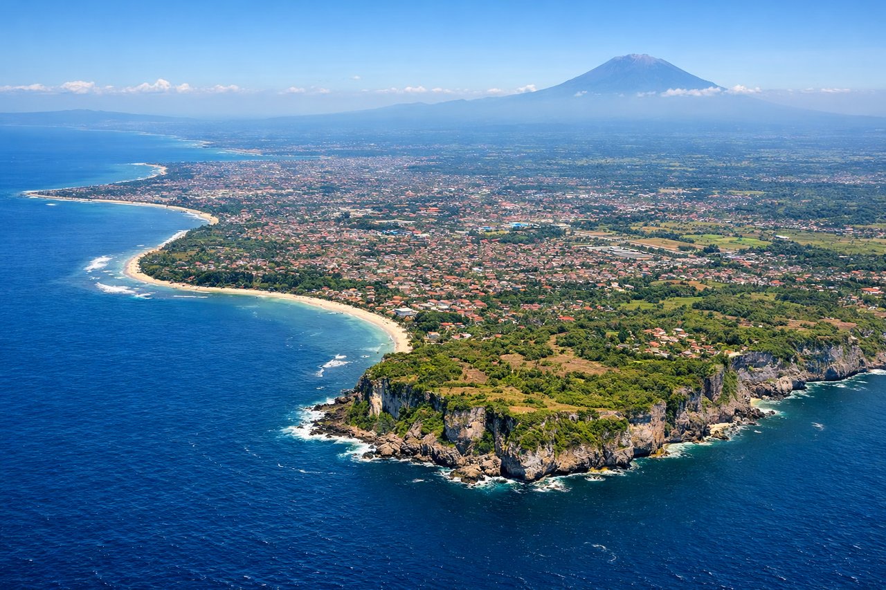
Landing at DPS
LEFTLeft side offers the best view of Bali's northern coastline and Mount Agung during descent into Denpasar. The approach typically comes from the north or northeast, making the left window ideal for seeing the volcanic spine and coastal geography that defines Bali's geography.
Landmarks on this routeAll landmarks →
Will your flight be in sunlight?
Pick a date and time in the Sun Map to watch the sun move across your whole flight.
About This Route
Which side of the plane should I sit on flying from Adisutjipto International Airport (JOG) to Denpasar I Gusti Ngurah Rai International Airport (DPS)?
Sit on the Right side of the plane for the best views on flights from Yogyakarta to Denpasar. Right side wins overall because the takeoff view of Merapi-Merbabu is more dramatic and immediate than the landing view of Agung. While both flights offer volcanic scenery, the twin peaks dominating the right window during climb-out provide the most striking visual experience early in the flight.
What can I see during takeoff from Adisutjipto International Airport in Yogyakarta?
During takeoff from Adisutjipto International Airport (JOG), sit on the Right side for the best views. Right side captures the Merapi-Merbabu volcanic complex immediately north of Yogyakarta during climb-out. These twin stratovolcanoes dominate the landscape and are unmissable from the right window as you gain altitude heading northeast or east. Notable sights include: Mount Merapi (2,968m, active volcano with distinctive cone), Mount Merbabu (3,142m, dormant twin peak), Yogyakarta city grid (visible as urban sprawl directly below during initial climb), Progo River valley (cuts through the plain to the west).
What can I see when landing at Denpasar I Gusti Ngurah Rai International Airport in Denpasar?
When landing at Denpasar I Gusti Ngurah Rai International Airport (DPS), sit on the Left side for the best views. Left side offers the best view of Bali's northern coastline and Mount Agung during descent into Denpasar. The approach typically comes from the north or northeast, making the left window ideal for seeing the volcanic spine and coastal geography that defines Bali's geography. Notable sights include: Mount Agung (3,142m, Bali's dominant volcano, visible from 40+ miles away), Bali's northern coast and reef systems (turquoise shallow waters), Denpasar city sprawl (visible in final approach), Lombok Strait (the deep water channel between Bali and Lombok to the east).
How long is the flight from Yogyakarta to Denpasar?
The flight from Adisutjipto International Airport (JOG) to Denpasar I Gusti Ngurah Rai International Airport (DPS) takes about 1 hour 15 minutes. The shortest flight path between them is 330 miles (532 km); winds and air traffic control usually add a few percent.
What does the Yogyakarta to Denpasar flight path pass over?
The flight path crosses the Java Sea heading southeast. At midpoint (around 37 minutes), you'll be over open water with no major landmarks visible—just the Java Sea's blue expanse. The transition from Java's volcanic landscape to Bali's volcanic landscape is marked by the Lombok Strait's deeper blue waters. Bali's interior volcanic ridge becomes visible on the right (east) side as you approach, with Mount Agung dominating the landscape 30-40 miles before landing.