Denpasar to Yogyakarta is 330 miles (532 km), a flight of about 1 hour 10 minutes.
While takeoff on the right offers Bali's volcanic drama, the landing approach on the left provides the more visually striking finale with Mount Merapi's commanding presence and the contrast between agricultural plains and urban Yogyakarta. The left side captures the journey's geographic climax.
Flight Path
The flight path crosses the Bali Strait (visible as open water with occasional fishing boats), then tracks northwest across central Java. Notable midpoint features include the volcanic ridge system of eastern Java, the Brantas River valley, and the transition from Bali's mountainous terrain to Java's broader plains. Mount Raung and Mount Ijen may be visible to the east depending on exact routing. The landscape shifts from Bali's steep volcanic slopes to Java's more gradual terrain with extensive rice cultivation.
Great circle distance and headings ›


Phase by phase
Takeoff from DPS
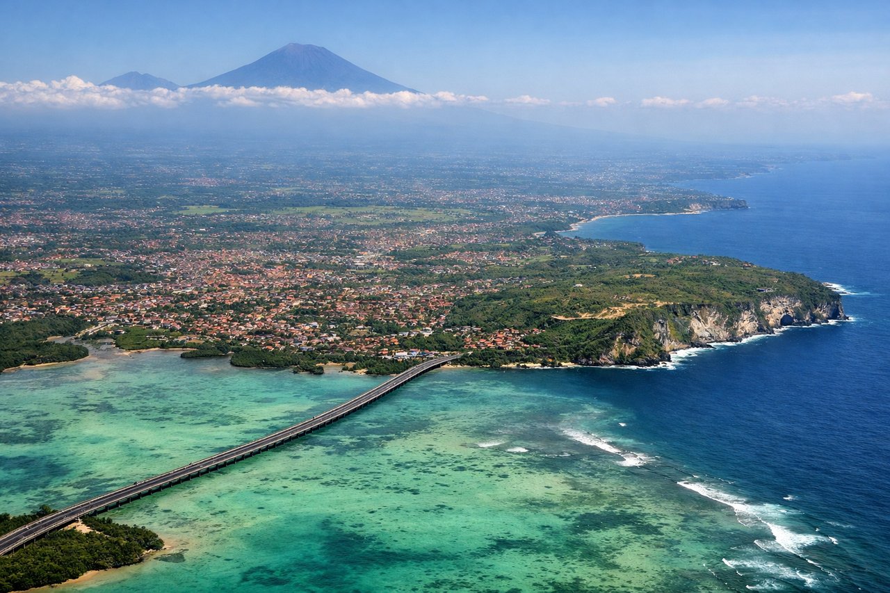
RIGHTRight-side seats capture the dramatic volcanic landscape immediately west and northwest of Denpasar. The aircraft climbs northwestward, offering direct views of Mount Agung and the surrounding ridge system that defines Bali's interior.
Landing at JOG
LEFTLeft-side seats provide excellent views during the descent into Yogyakarta. The approach path from the northeast brings the city and surrounding plains into clear view, with Mount Merapi visible to the north—a striking landmark during final descent.
Landmarks on this routeAll landmarks →
Will your flight be in sunlight?
Pick a date and time in the Sun Map to watch the sun move across your whole flight.
About This Route
Which side of the plane should I sit on flying from Denpasar I Gusti Ngurah Rai International Airport (DPS) to Adisutjipto International Airport (JOG)?
Sit on the Left side of the plane for the best views on flights from Denpasar to Yogyakarta. While takeoff on the right offers Bali's volcanic drama, the landing approach on the left provides the more visually striking finale with Mount Merapi's commanding presence and the contrast between agricultural plains and urban Yogyakarta. The left side captures the journey's geographic climax.
What can I see during takeoff from Denpasar I Gusti Ngurah Rai International Airport in Denpasar?
During takeoff from Denpasar I Gusti Ngurah Rai International Airport (DPS), sit on the Right side for the best views. Right-side seats capture the dramatic volcanic landscape immediately west and northwest of Denpasar. The aircraft climbs northwestward, offering direct views of Mount Agung and the surrounding ridge system that defines Bali's interior. Notable sights include: Mount Agung (3,142 m, Bali's highest volcano), Mount Batur (1,717 m), Bali Strait coastline to the north, rice terraces and valleys of central Bali.
What can I see when landing at Adisutjipto International Airport in Yogyakarta?
When landing at Adisutjipto International Airport (JOG), sit on the Left side for the best views. Left-side seats provide excellent views during the descent into Yogyakarta. The approach path from the northeast brings the city and surrounding plains into clear view, with Mount Merapi visible to the north—a striking landmark during final descent. Notable sights include: Mount Merapi (2,968 m, active volcano), Yogyakarta city grid and urban sprawl, Progo River valley, agricultural plains of central Java.
How long is the flight from Denpasar to Yogyakarta?
The flight from Denpasar I Gusti Ngurah Rai International Airport (DPS) to Adisutjipto International Airport (JOG) takes about 1 hour 10 minutes. The shortest flight path between them is 330 miles (532 km); winds and air traffic control usually add a few percent.
What does the Denpasar to Yogyakarta flight path pass over?
The flight path crosses the Bali Strait (visible as open water with occasional fishing boats), then tracks northwest across central Java. Notable midpoint features include the volcanic ridge system of eastern Java, the Brantas River valley, and the transition from Bali's mountainous terrain to Java's broader plains. Mount Raung and Mount Ijen may be visible to the east depending on exact routing. The landscape shifts from Bali's steep volcanic slopes to Java's more gradual terrain with extensive rice cultivation.