The left side combines a rare fleeting mountainous glimpse near Taiwan during cruise with the flight's best payoff: Mount Fuji and the Tokyo skyline together on the final approach into Haneda, while the right side is dominated by open Philippine Sea and a less distinctive Tokyo Bay industrial shoreline on landing.
Flown KUL to HND? Did we get it right?
Flight Path
Kuala Lumpur to Tokyo is 3,325 miles (5,351 km), a flight of about 6 hours 55 minutes.
Philippine Sea crossed near the Bashi Channel between Taiwan and northern Luzon, with the Ryukyu Islands (Okinawa chain) passing below before the route continues north toward Kyushu and Honshu.
Great circle distance and headings ›

Phase by phase
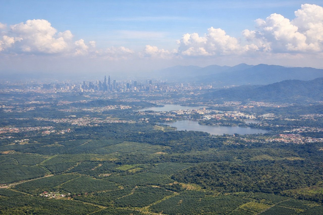
Takeoff from KUL
RIGHTDeparting KUL on the northwest-facing runways during southwest monsoon season, the aircraft typically banks right to establish its northeast heading toward Japan, swinging the Kuala Lumpur skyline and the Klang Valley into view on the right side. The left side mostly shows flat oil-palm plantations and the featureless Selangor coastal plain.
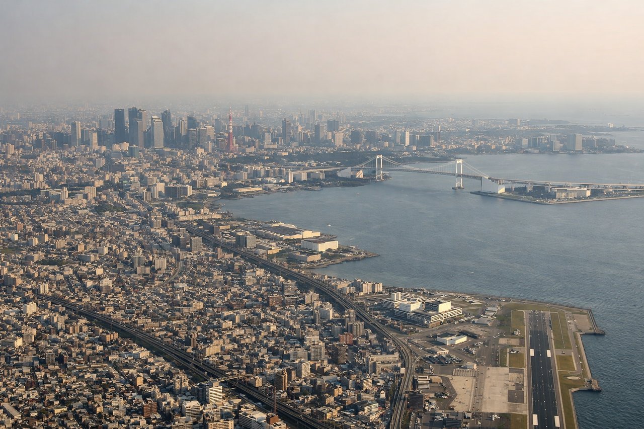
Landing at HND
LEFTOn the common south-wind arrival into HND, aircraft track north through Sagami Bay before landing on 34L/34R, putting Mount Fuji's snow-capped cone on the left horizon during the approach. As the plane continues north into Tokyo Bay, the Tokyo skyline, Rainbow Bridge, and Odaiba waterfront also appear on the left just before touchdown.
Will your flight be in sunlight?
Pick a date and time in the Sun Map to watch the sun move across your whole flight.
About This Route
Which side of the plane should I sit on flying from Kuala Lumpur International (KUL) to Tokyo International (HND)?
Sit on the Left side of the plane for the best views on flights from Kuala Lumpur to Tokyo. The left side combines a rare fleeting mountainous glimpse near Taiwan during cruise with the flight's best payoff: Mount Fuji and the Tokyo skyline together on the final approach into Haneda, while the right side is dominated by open Philippine Sea and a less distinctive Tokyo Bay industrial shoreline on landing.
What can I see during takeoff from Kuala Lumpur International in Kuala Lumpur?
During takeoff from Kuala Lumpur International (KUL), sit on the Right side for the best views. Departing KUL on the northwest-facing runways during southwest monsoon season, the aircraft typically banks right to establish its northeast heading toward Japan, swinging the Kuala Lumpur skyline and the Klang Valley into view on the right side. The left side mostly shows flat oil-palm plantations and the featureless Selangor coastal plain. Notable sights include: Kuala Lumpur skyline (Petronas Towers, KL Tower), Klang Valley urban sprawl, distant Titiwangsa Range foothills.
What can I see when landing at Tokyo International in Tokyo?
When landing at Tokyo International (HND), sit on the Left side for the best views. On the common south-wind arrival into HND, aircraft track north through Sagami Bay before landing on 34L/34R, putting Mount Fuji's snow-capped cone on the left horizon during the approach. As the plane continues north into Tokyo Bay, the Tokyo skyline, Rainbow Bridge, and Odaiba waterfront also appear on the left just before touchdown. Notable sights include: Mount Fuji, Tokyo Bay, Rainbow Bridge and Odaiba waterfront, Tokyo skyline (Tokyo Tower, Minato skyscrapers).
How long is the flight from Kuala Lumpur to Tokyo?
The flight from Kuala Lumpur International (KUL) to Tokyo International (HND) takes about 6 hours 55 minutes. The shortest flight path between them is 3,325 miles (5,351 km); winds and air traffic control usually add a few percent.
What does the Kuala Lumpur to Tokyo flight path pass over?
Philippine Sea crossed near the Bashi Channel between Taiwan and northern Luzon, with the Ryukyu Islands (Okinawa chain) passing below before the route continues north toward Kyushu and Honshu.