Kuala Lumpur to Labuhan Bajo is 1,473 miles (2,371 km), a flight of about 3 hours.
Right-side seats offer superior views on both legs: departure over the Strait of Malacca and Klang Valley, and arrival over Flores's volcanic terrain and the Flores Sea. The route crosses the Sunda Strait and Java Sea, but right-side positioning captures the most distinctive geography at both ends.
Flight Path
The flight path crosses the Java Sea southeastward, passing over or near the Sunda Strait (between Sumatra and Java) during climb-out, then continues over open water. The Karimata Strait (between Borneo and Sumatra) may be visible to the left during cruise. Komodo National Park waters appear in the descent phase. No major landmasses are directly beneath the cruise altitude for most of the flight—it is predominantly open ocean with scattered small islands in the Java Sea and approaches to the Lesser Sunda Islands.
Great circle distance and headings ›

Phase by phase
Takeoff from KUL
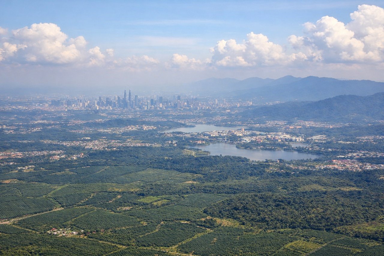
RIGHTKUL typically departs on runway 32L or 32R (northwesterly heading). Right-side seats face toward the Klang Valley and Strait of Malacca during initial climb, offering views of the coastal plain and water body. Left seats turn inland toward the Titiwangsa Range but at steeper angles that compress the view.
Landing at LBJ
RIGHTLabuhan Bajo airport (LBJ) sits on Flores Island with runway 09/27. Approach typically comes from the east over the Flores Sea. Right-side seats face south toward the volcanic peaks of Flores and the island's interior terrain. Left seats face north over open water with limited distinctive features.
Landmarks on this routeAll landmarks →
Will your flight be in sunlight?
Pick a date and time in the Sun Map to watch the sun move across your whole flight.
About This Route
Which side of the plane should I sit on flying from Kuala Lumpur International (KUL) to Komodo Airport (LBJ)?
Sit on the Right side of the plane for the best views on flights from Kuala Lumpur to Labuhan Bajo. Right-side seats offer superior views on both legs: departure over the Strait of Malacca and Klang Valley, and arrival over Flores's volcanic terrain and the Flores Sea. The route crosses the Sunda Strait and Java Sea, but right-side positioning captures the most distinctive geography at both ends.
What can I see during takeoff from Kuala Lumpur International in Kuala Lumpur?
During takeoff from Kuala Lumpur International (KUL), sit on the Right side for the best views. KUL typically departs on runway 32L or 32R (northwesterly heading). Right-side seats face toward the Klang Valley and Strait of Malacca during initial climb, offering views of the coastal plain and water body. Left seats turn inland toward the Titiwangsa Range but at steeper angles that compress the view. Notable sights include: Strait of Malacca (southwest), Klang Valley urban sprawl (north), Titiwangsa Mountain Range foothills (northeast), Port Klang industrial zone (northwest).
What can I see when landing at Komodo Airport in Labuhan Bajo?
When landing at Komodo Airport (LBJ), sit on the Right side for the best views. Labuhan Bajo airport (LBJ) sits on Flores Island with runway 09/27. Approach typically comes from the east over the Flores Sea. Right-side seats face south toward the volcanic peaks of Flores and the island's interior terrain. Left seats face north over open water with limited distinctive features. Notable sights include: Flores volcanic peaks (Mount Inerie, Mount Ranaka to the south), Flores Sea (north), Labuhan Bajo harbor and town (immediate vicinity), Komodo National Park waters (east).
How long is the flight from Kuala Lumpur to Labuhan Bajo?
The flight from Kuala Lumpur International (KUL) to Komodo Airport (LBJ) takes about 3 hours. The shortest flight path between them is 1,473 miles (2,371 km); winds and air traffic control usually add a few percent.
What does the Kuala Lumpur to Labuhan Bajo flight path pass over?
The flight path crosses the Java Sea southeastward, passing over or near the Sunda Strait (between Sumatra and Java) during climb-out, then continues over open water. The Karimata Strait (between Borneo and Sumatra) may be visible to the left during cruise. Komodo National Park waters appear in the descent phase. No major landmasses are directly beneath the cruise altitude for most of the flight—it is predominantly open ocean with scattered small islands in the Java Sea and approaches to the Lesser Sunda Islands.