The left side wins on both ends and during cruise: Kuala Lumpur's skyline and mountain backdrop at departure, Taiwan's Central Mountain Range as the flight threads the Bashi Channel, and Mount Fuji with the Tokyo skyline on arrival outclass the mostly open-ocean views on the right.
Flown KUL to NRT? Did we get it right?
Flight Path
Kuala Lumpur to Tokyo is 3,361 miles (5,409 km), a flight of about 6 hours 40 minutes.
Bashi Channel between Taiwan and the Philippines' Luzon Island, South China Sea and Philippine Sea, Ryukyu Island chain (Okinawa) further north along the track
Great circle distance and headings ›

Phase by phase
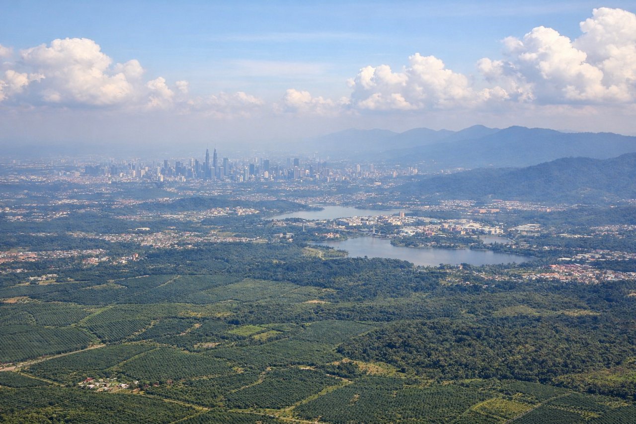
Takeoff from KUL
LEFTDeparting KUL toward the northeast, the climb-out swings the aircraft past the Kuala Lumpur skyline, with the Petronas Towers and KL Tower visible against the Titiwangsa mountain backdrop. The right side mostly shows flat oil-palm plantations and the low coastal plain toward the Strait of Malacca.
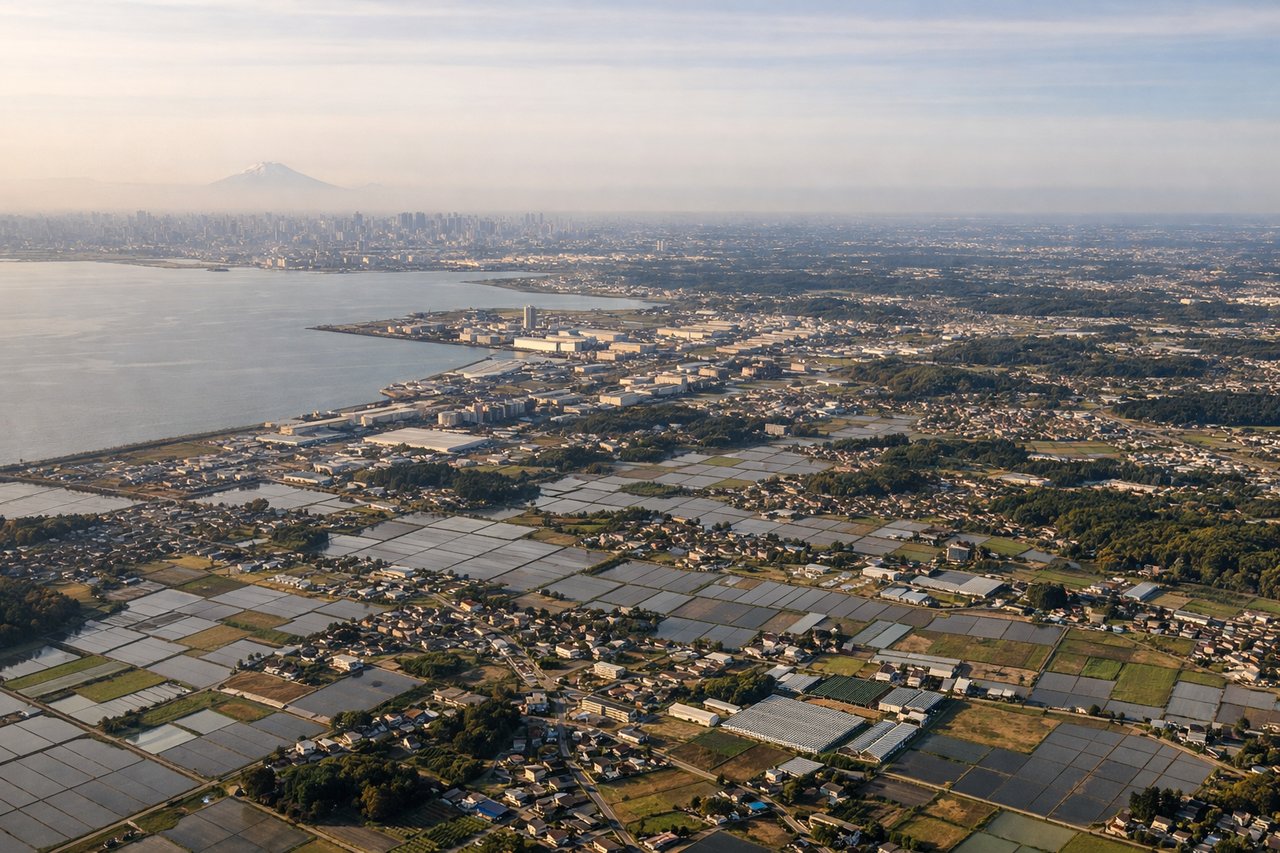
Landing at NRT
LEFTOn the descent into Narita from the south, the approach path tracks along the Boso Peninsula and Tokyo Bay area, giving a clear view toward Mount Fuji's snow-capped cone and the sprawling Tokyo skyline on the west side. The right side faces the open Pacific and the flatter Kujukuri coastline, which is scenic but far less dramatic.
Will your flight be in sunlight?
Pick a date and time in the Sun Map to watch the sun move across your whole flight.
About This Route
Which side of the plane should I sit on flying from Kuala Lumpur International (KUL) to New Tokyo International (NRT)?
Sit on the Left side of the plane for the best views on flights from Kuala Lumpur to Tokyo. The left side wins on both ends and during cruise: Kuala Lumpur's skyline and mountain backdrop at departure, Taiwan's Central Mountain Range as the flight threads the Bashi Channel, and Mount Fuji with the Tokyo skyline on arrival outclass the mostly open-ocean views on the right.
What can I see during takeoff from Kuala Lumpur International in Kuala Lumpur?
During takeoff from Kuala Lumpur International (KUL), sit on the Left side for the best views. Departing KUL toward the northeast, the climb-out swings the aircraft past the Kuala Lumpur skyline, with the Petronas Towers and KL Tower visible against the Titiwangsa mountain backdrop. The right side mostly shows flat oil-palm plantations and the low coastal plain toward the Strait of Malacca. Notable sights include: Kuala Lumpur skyline (Petronas Towers, KL Tower), Titiwangsa Mountain Range, Klang Valley urban sprawl.
What can I see when landing at New Tokyo International in Tokyo?
When landing at New Tokyo International (NRT), sit on the Left side for the best views. On the descent into Narita from the south, the approach path tracks along the Boso Peninsula and Tokyo Bay area, giving a clear view toward Mount Fuji's snow-capped cone and the sprawling Tokyo skyline on the west side. The right side faces the open Pacific and the flatter Kujukuri coastline, which is scenic but far less dramatic. Notable sights include: Mount Fuji, Tokyo Bay and skyline, Boso Peninsula coastline, Sagami Bay.
How long is the flight from Kuala Lumpur to Tokyo?
The flight from Kuala Lumpur International (KUL) to New Tokyo International (NRT) takes about 6 hours 40 minutes. The shortest flight path between them is 3,361 miles (5,409 km); winds and air traffic control usually add a few percent.
What does the Kuala Lumpur to Tokyo flight path pass over?
Bashi Channel between Taiwan and the Philippines' Luzon Island, South China Sea and Philippine Sea, Ryukyu Island chain (Okinawa) further north along the track