The right side wins because it captures the most dramatic and varied scenery of the flight — the Los Angeles mountain-and-coast departure — and retains a chance at distant glimpses of the Alaska Peninsula, Aleutian Islands, or Kamchatka's volcanic coastline during the northern arc of the great-circle cruise, whereas the left side is mostly open, featureless Pacific for the bulk of the 11-hour crossing.
Flight Path
The great-circle route arcs up toward roughly 50°N before descending to Japan, passing south of the Alaska Peninsula and Aleutian Islands and, on very clear days, within distant view of Kamchatka's volcanic coastline before the long final descent into Chiba; for most of the crossing, though, both sides show only open North Pacific water.
Great circle distance and headings ›.jpg?width=600)

Phase by phase
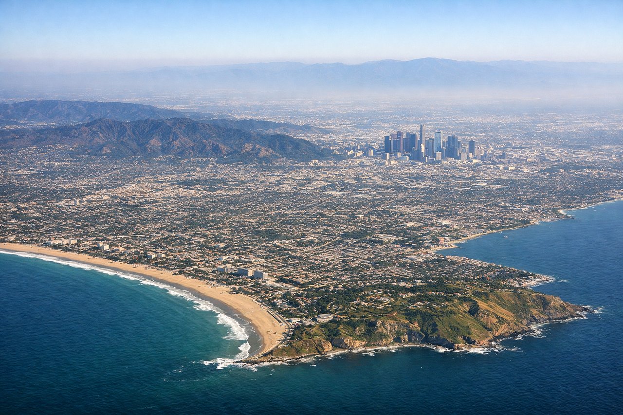
Takeoff from LAX
RIGHTDeparting LAX in the standard west-flow pattern, the jet climbs out over Santa Monica Bay and then banks right (north) to join the great-circle track toward Japan, putting the San Gabriel and Santa Monica Mountains plus the Malibu coastline on the right side. The left side only shows the flatter South Bay and Palos Verdes Peninsula before the turn carries the view away.
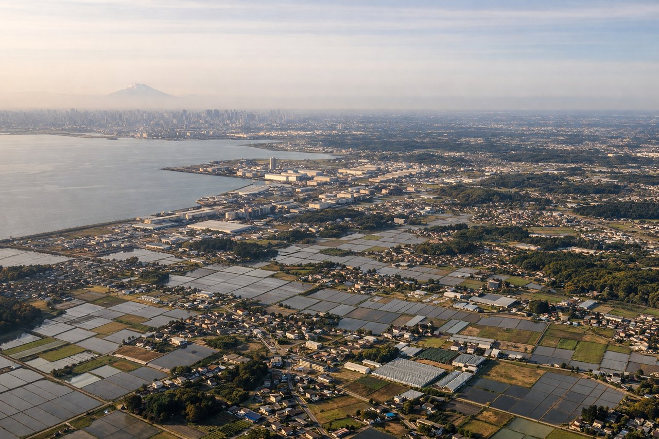
Landing at NRT
LEFTOn the more common northerly-wind approach into Narita (landing on runway 34), the aircraft flies north over Chiba, putting Tokyo Bay, the Tokyo skyline, and on clear days the distant cone of Mount Fuji on the left side of the cabin. The right side mostly overlooks the flatter Boso Peninsula farmland with fewer distinctive features.
Landmarks on this routeAll landmarks →
Will your flight be in sunlight?
See exactly which side of the plane gets sun and shade at your departure time.
About This Route
Which side of the plane should I sit on flying from Los Angeles International (LAX) to New Tokyo International (NRT)?
Sit on the Right side of the plane for the best views on flights from Los Angeles to Tokyo. The right side wins because it captures the most dramatic and varied scenery of the flight — the Los Angeles mountain-and-coast departure — and retains a chance at distant glimpses of the Alaska Peninsula, Aleutian Islands, or Kamchatka's volcanic coastline during the northern arc of the great-circle cruise, whereas the left side is mostly open, featureless Pacific for the bulk of the 11-hour crossing.
What can I see during takeoff from Los Angeles International in Los Angeles?
During takeoff from Los Angeles International (LAX), sit on the Right side for the best views. Departing LAX in the standard west-flow pattern, the jet climbs out over Santa Monica Bay and then banks right (north) to join the great-circle track toward Japan, putting the San Gabriel and Santa Monica Mountains plus the Malibu coastline on the right side. The left side only shows the flatter South Bay and Palos Verdes Peninsula before the turn carries the view away. Notable sights include: Santa Monica Mountains, Malibu coastline, San Gabriel Mountains, Channel Islands in the distance.
What can I see when landing at New Tokyo International in Tokyo?
When landing at New Tokyo International (NRT), sit on the Left side for the best views. On the more common northerly-wind approach into Narita (landing on runway 34), the aircraft flies north over Chiba, putting Tokyo Bay, the Tokyo skyline, and on clear days the distant cone of Mount Fuji on the left side of the cabin. The right side mostly overlooks the flatter Boso Peninsula farmland with fewer distinctive features. Notable sights include: Tokyo Bay, Tokyo skyline, Mount Fuji (weather permitting), Chiba rice paddies and rivers.
How long is the flight from Los Angeles to Tokyo?
The flight from Los Angeles International (LAX) to New Tokyo International (NRT) takes 11h 35m.
What does the Los Angeles to Tokyo flight path pass over?
The great-circle route arcs up toward roughly 50°N before descending to Japan, passing south of the Alaska Peninsula and Aleutian Islands and, on very clear days, within distant view of Kamchatka's volcanic coastline before the long final descent into Chiba; for most of the crossing, though, both sides show only open North Pacific water.