While takeoff offers excellent Lisbon estuary views on the left, the landing approach on the right provides more sustained scenic interest over the English countryside and North Downs. Right side also captures more of the flight path's midpoint features.
Flown LIS to LGW? Did we get it right?
Flight Path
Lisbon to London is 958 miles (1,542 km), a flight of about 2 hours 15 minutes.
The flight path crosses the Bay of Biscay and English Channel. Notable features include the Brittany coastline (visible if flying slightly south of direct routing), the Channel Islands as small specks, and the Dorset and Hampshire coastlines before turning inland toward Gatwick. The English Channel crossing typically occurs at 25,000-30,000 feet where water detail diminishes, but the French and English coasts remain visible on clear days.
Great circle distance and headings ›


Phase by phase
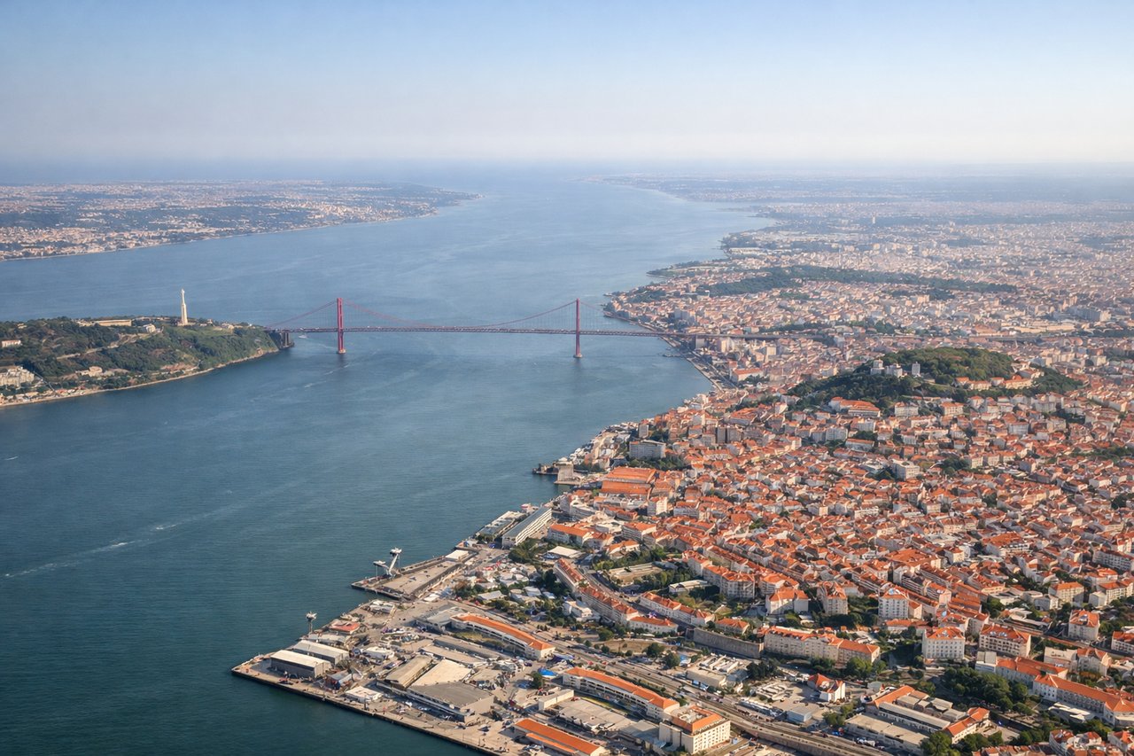
Takeoff from LIS
LEFTLeft side captures the Tagus River estuary and Lisbon's waterfront as you climb northward. You'll see the 25 de Abril Bridge and Cristo Rei monument clearly, plus the Atlantic coastline curving west toward Cascais.
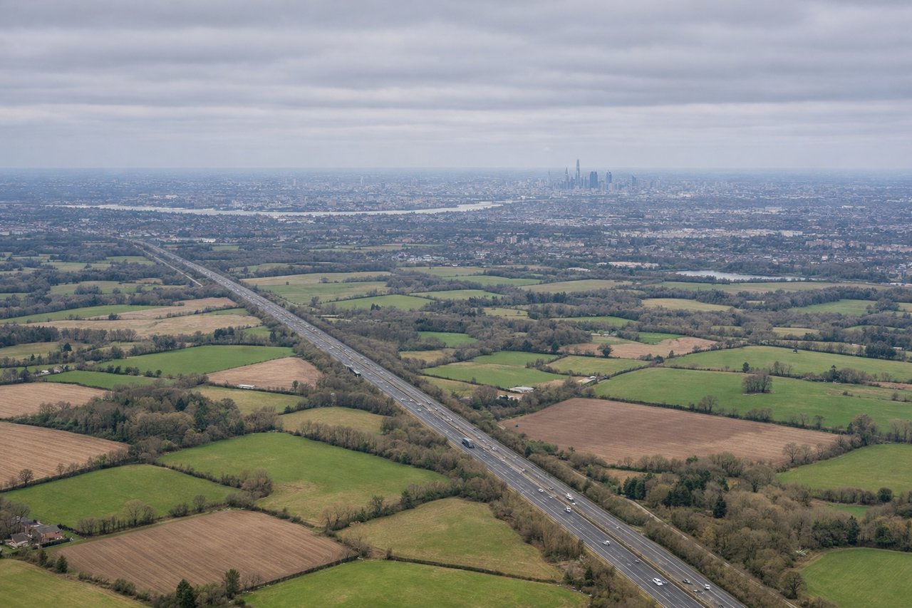
Landing at LGW
RIGHTRight side gives you the best view during descent into Gatwick. You'll see the North Downs ridge and the patchwork of Surrey farmland, plus the Thames valley spreading out as you approach from the south.
Will your flight be in sunlight?
Pick a date and time in the Sun Map to watch the sun move across your whole flight.
About This Route
Which side of the plane should I sit on flying from Lisboa (LIS) to Gatwick (LGW)?
Sit on the Right side of the plane for the best views on flights from Lisbon to London. While takeoff offers excellent Lisbon estuary views on the left, the landing approach on the right provides more sustained scenic interest over the English countryside and North Downs. Right side also captures more of the flight path's midpoint features.
What can I see during takeoff from Lisboa in Lisbon?
During takeoff from Lisboa (LIS), sit on the Left side for the best views. Left side captures the Tagus River estuary and Lisbon's waterfront as you climb northward. You'll see the 25 de Abril Bridge and Cristo Rei monument clearly, plus the Atlantic coastline curving west toward Cascais. Notable sights include: Tagus River estuary, 25 de Abril Bridge, Cristo Rei monument, Cascais coastline.
What can I see when landing at Gatwick in London?
When landing at Gatwick (LGW), sit on the Right side for the best views. Right side gives you the best view during descent into Gatwick. You'll see the North Downs ridge and the patchwork of Surrey farmland, plus the Thames valley spreading out as you approach from the south. Notable sights include: North Downs ridge, Thames valley, Surrey agricultural landscape, Gatwick approach corridor.
How long is the flight from Lisbon to London?
The flight from Lisboa (LIS) to Gatwick (LGW) takes about 2 hours 15 minutes. The shortest flight path between them is 958 miles (1,542 km); winds and air traffic control usually add a few percent.
What does the Lisbon to London flight path pass over?
The flight path crosses the Bay of Biscay and English Channel. Notable features include the Brittany coastline (visible if flying slightly south of direct routing), the Channel Islands as small specks, and the Dorset and Hampshire coastlines before turning inland toward Gatwick. The English Channel crossing typically occurs at 25,000-30,000 feet where water detail diminishes, but the French and English coasts remain visible on clear days.