Banak to London is 1,520 miles (2,446 km), a flight of about 3 hours 30 minutes.
The left side captures the Norwegian coast and fjords during the early part of the flight as the route tracks southwest, then delivers the iconic London approach with the Thames and city skyline on descent. The right side has the better takeoff view but the left wins across the full journey.
Flight Path
The route crosses the Norwegian Sea and then tracks over southern Norway or the North Sea depending on routing. Expect views of the Norwegian coastline and possibly the Lofoten Islands area early on, then open North Sea, followed by the Scottish or English coastline near Aberdeen or Newcastle, and finally the English Midlands before descending into London.
Great circle distance and headings ›
.jpeg?width=600)
Phase by phase
Takeoff from LKL
RIGHTDeparting Banak, the runway typically aligns roughly east-west. Climbing out heading southwest, the right side faces northwest toward the Porsangerfjord and the broad tundra plateau of Finnmarksvidda. The fjord's long narrow inlet and snow-dusted plateau are clearly visible on the right during the initial climb.
Landing at LHR
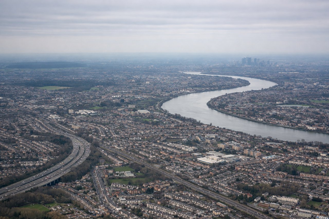
LEFTHeathrow's main approach is from the east on runway 27L/27R, meaning aircraft track westward over central London. The left side gives a clear view south over the Thames, the City of London, Canary Wharf, and the river's distinctive bends through southeast London during the descent.
Landmarks on this routeAll landmarks →
Will your flight be in sunlight?
Pick a date and time in the Sun Map to watch the sun move across your whole flight.
About This Route
Which side of the plane should I sit on flying from Banak (LKL) to Heathrow (LHR)?
Sit on the Left side of the plane for the best views on flights from Banak to London. The left side captures the Norwegian coast and fjords during the early part of the flight as the route tracks southwest, then delivers the iconic London approach with the Thames and city skyline on descent. The right side has the better takeoff view but the left wins across the full journey.
What can I see during takeoff from Banak in Banak?
During takeoff from Banak (LKL), sit on the Right side for the best views. Departing Banak, the runway typically aligns roughly east-west. Climbing out heading southwest, the right side faces northwest toward the Porsangerfjord and the broad tundra plateau of Finnmarksvidda. The fjord's long narrow inlet and snow-dusted plateau are clearly visible on the right during the initial climb. Notable sights include: Porsangerfjord, Finnmarksvidda plateau, Lakselv river delta, Sennalandet highland.
What can I see when landing at Heathrow in London?
When landing at Heathrow (LHR), sit on the Left side for the best views. Heathrow's main approach is from the east on runway 27L/27R, meaning aircraft track westward over central London. The left side gives a clear view south over the Thames, the City of London, Canary Wharf, and the river's distinctive bends through southeast London during the descent. Notable sights include: River Thames bends through London, Canary Wharf tower cluster, The Shard, Windsor Castle area to the west.
How long is the flight from Banak to London?
The flight from Banak (LKL) to Heathrow (LHR) takes about 3 hours 30 minutes. The shortest flight path between them is 1,520 miles (2,446 km); winds and air traffic control usually add a few percent.
What does the Banak to London flight path pass over?
The route crosses the Norwegian Sea and then tracks over southern Norway or the North Sea depending on routing. Expect views of the Norwegian coastline and possibly the Lofoten Islands area early on, then open North Sea, followed by the Scottish or English coastline near Aberdeen or Newcastle, and finally the English Midlands before descending into London.