The right side wins at both ends of the flight — Louisville's Ohio River and city at departure, and the Las Vegas Strip plus Spring Mountains on approach. Across the mid-flight, the right (north) side also tracks closer to the Colorado Rockies and canyon country of Utah, making it the stronger choice throughout.
Flown LOU to LAS? Did we get it right?
Flight Path
Louisville to Las Vegas is 1,624 miles (2,613 km), a flight of about 3 hours 30 minutes.
The route crosses the Ozark Plateau of Missouri and Arkansas, then the flat Oklahoma and Texas panhandle plains, before entering New Mexico where the Sangre de Cristo and Sacramento Mountains appear to the north. Over Arizona, the Colorado Plateau and its canyon systems including portions of the Grand Canyon region may be visible to the north. The Mojave Desert dominates the final hour before descending into the Las Vegas Valley.
Great circle distance and headings ›


Phase by phase
Takeoff from LOU
RIGHTBowman Field typically departs runway 33 (northwest) or runway 15 (southeast). On a westbound departure toward Las Vegas, the aircraft will bank left and head southwest, putting the right side facing south toward downtown Louisville, the Ohio River, and the broader Kentucky landscape. The right side gets the city grid and river bends clearly.
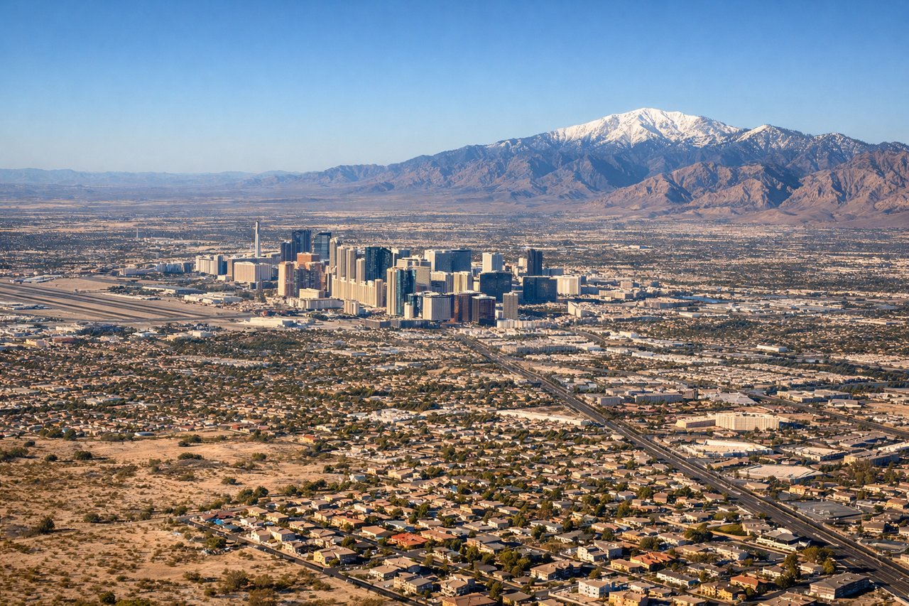
Landing at LAS
RIGHTMcCarran International (now Harry Reid) typically uses runways 26L/26R for westbound arrivals, meaning the aircraft approaches from the east over Henderson and the Las Vegas Valley. The right side faces north, giving a direct view over the Strip, downtown Las Vegas, and the Spring Mountains including Charleston Peak to the northwest. Left side faces south toward open desert.
Will your flight be in sunlight?
Pick a date and time in the Sun Map to watch the sun move across your whole flight.
About This Route
Which side of the plane should I sit on flying from Bowman Fld (LOU) to Mc Carran International (LAS)?
Sit on the Right side of the plane for the best views on flights from Louisville to Las Vegas. The right side wins at both ends of the flight — Louisville's Ohio River and city at departure, and the Las Vegas Strip plus Spring Mountains on approach. Across the mid-flight, the right (north) side also tracks closer to the Colorado Rockies and canyon country of Utah, making it the stronger choice throughout.
What can I see during takeoff from Bowman Fld in Louisville?
During takeoff from Bowman Fld (LOU), sit on the Right side for the best views. Bowman Field typically departs runway 33 (northwest) or runway 15 (southeast). On a westbound departure toward Las Vegas, the aircraft will bank left and head southwest, putting the right side facing south toward downtown Louisville, the Ohio River, and the broader Kentucky landscape. The right side gets the city grid and river bends clearly. Notable sights include: Ohio River bends south of Louisville, downtown Louisville skyline, Churchill Downs racetrack, Louisville waterfront district.
What can I see when landing at Mc Carran International in Las Vegas?
When landing at Mc Carran International (LAS), sit on the Right side for the best views. McCarran International (now Harry Reid) typically uses runways 26L/26R for westbound arrivals, meaning the aircraft approaches from the east over Henderson and the Las Vegas Valley. The right side faces north, giving a direct view over the Strip, downtown Las Vegas, and the Spring Mountains including Charleston Peak to the northwest. Left side faces south toward open desert. Notable sights include: Las Vegas Strip casino corridor, Spring Mountains and Charleston Peak (11,918 ft), Lake Mead to the east during approach, Hoover Dam visible on final approach from the east.
How long is the flight from Louisville to Las Vegas?
The flight from Bowman Fld (LOU) to Mc Carran International (LAS) takes about 3 hours 30 minutes. The shortest flight path between them is 1,624 miles (2,613 km); winds and air traffic control usually add a few percent.
What does the Louisville to Las Vegas flight path pass over?
The route crosses the Ozark Plateau of Missouri and Arkansas, then the flat Oklahoma and Texas panhandle plains, before entering New Mexico where the Sangre de Cristo and Sacramento Mountains appear to the north. Over Arizona, the Colorado Plateau and its canyon systems including portions of the Grand Canyon region may be visible to the north. The Mojave Desert dominates the final hour before descending into the Las Vegas Valley.