Launceston to Adelaide is 655 miles (1,054 km), a flight of about 2 hours.
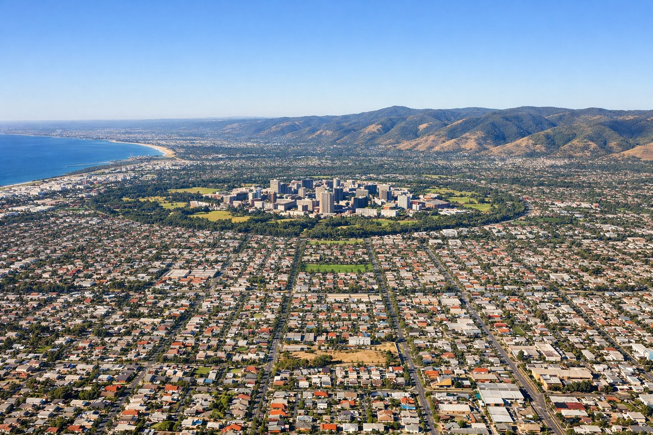
The landing approach offers more visually distinctive scenery with the Mount Lofty Ranges and Adelaide's urban geography, outweighing the takeoff views of the Tamar estuary.
Flight Path
Bass Strait crossing with occasional visibility of small islands (Flinders Island to the south), transition from Tasmania's forested terrain to South Australia's coastal plains, Murray River delta region approaching Adelaide, Gulf St Vincent coastline
Great circle distance and headings ›

Phase by phase
Takeoff from LST
LEFTLeft side captures the Tamar River estuary and the city of Launceston immediately after departure, with views extending across northern Tasmania's agricultural plains toward the Bass Strait coastline.
Landing at ADL
RIGHTRight side provides excellent views of Adelaide's Hills suburbs, the Mount Lofty Ranges, and the city's grid layout as the aircraft descends toward the airport on the western plains.
Landmarks on this routeAll landmarks →
Will your flight be in sunlight?
Pick a date and time in the Sun Map to watch the sun move across your whole flight.
About This Route
Which side of the plane should I sit on flying from Launceston (LST) to Adelaide International (ADL)?
Sit on the Right side of the plane for the best views on flights from Launceston to Adelaide. The landing approach offers more visually distinctive scenery with the Mount Lofty Ranges and Adelaide's urban geography, outweighing the takeoff views of the Tamar estuary.
What can I see during takeoff from Launceston in Launceston?
During takeoff from Launceston (LST), sit on the Left side for the best views. Left side captures the Tamar River estuary and the city of Launceston immediately after departure, with views extending across northern Tasmania's agricultural plains toward the Bass Strait coastline. Notable sights include: Tamar River estuary, Launceston city grid, Bass Strait coastline, northern Tasmania agricultural plains.
What can I see when landing at Adelaide International in Adelaide?
When landing at Adelaide International (ADL), sit on the Right side for the best views. Right side provides excellent views of Adelaide's Hills suburbs, the Mount Lofty Ranges, and the city's grid layout as the aircraft descends toward the airport on the western plains. Notable sights include: Mount Lofty Ranges, Adelaide city grid and parklands, Gulf St Vincent coastline, Adelaide Hills suburbs.
How long is the flight from Launceston to Adelaide?
The flight from Launceston (LST) to Adelaide International (ADL) takes about 2 hours. The shortest flight path between them is 655 miles (1,054 km); winds and air traffic control usually add a few percent.
What does the Launceston to Adelaide flight path pass over?
Bass Strait crossing with occasional visibility of small islands (Flinders Island to the south), transition from Tasmania's forested terrain to South Australia's coastal plains, Murray River delta region approaching Adelaide, Gulf St Vincent coastline