Launceston to Melbourne is 296 miles (476 km), a flight of about 50 minutes.
While takeoff favors the right side with Tasmania's highlands, the left side wins overall thanks to the strong visual payoff of Melbourne's skyline and Port Phillip Bay during the final approach, which outweighs the brief highland view at departure on this short flight.
Flight Path
Bass Strait open water, with Flinders Island sometimes visible in the distance on the right side depending on routing
Great circle distance and headings ›Phase by phase
Takeoff from LST
RIGHTDeparting Launceston, the climb typically banks toward the northwest, putting the Ben Lomond plateau and Tasmania's northern highlands on the right side of the aircraft. The left side mostly shows the flatter Tamar Valley and farmland, which is less dramatic.
Landing at MEL
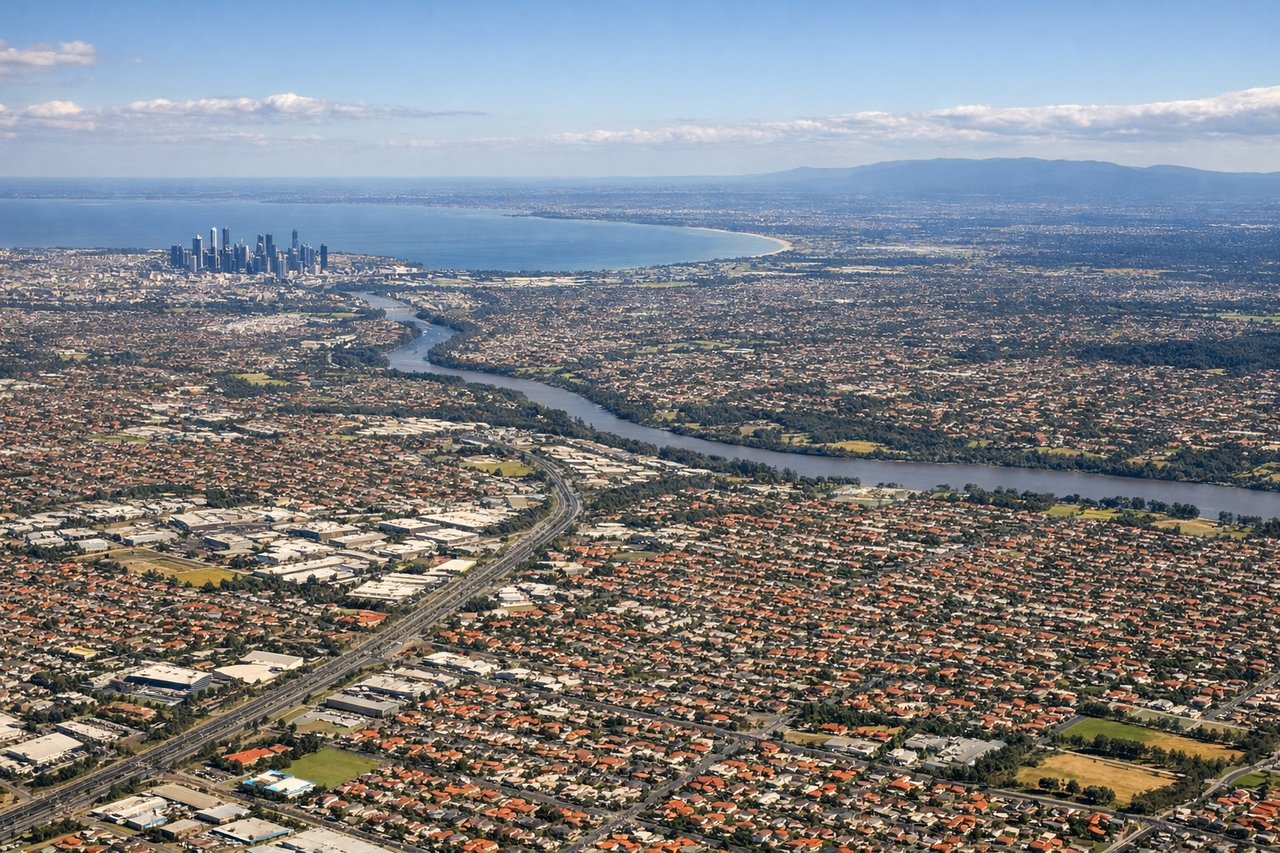
LEFTOn approach into Melbourne, arrivals from the south over Port Phillip Bay typically curve toward runway 34, placing the city's skyline and the Yarra River mouth on the left side of the aircraft. The right side mainly shows open bay water and the Mornington Peninsula in the distance, less visually rich than the urban approach.
Landmarks on this routeAll landmarks →
Will your flight be in sunlight?
Pick a date and time in the Sun Map to watch the sun move across your whole flight.
About This Route
Which side of the plane should I sit on flying from Launceston (LST) to Melbourne International (MEL)?
Sit on the Left side of the plane for the best views on flights from Launceston to Melbourne. While takeoff favors the right side with Tasmania's highlands, the left side wins overall thanks to the strong visual payoff of Melbourne's skyline and Port Phillip Bay during the final approach, which outweighs the brief highland view at departure on this short flight.
What can I see during takeoff from Launceston in Launceston?
During takeoff from Launceston (LST), sit on the Right side for the best views. Departing Launceston, the climb typically banks toward the northwest, putting the Ben Lomond plateau and Tasmania's northern highlands on the right side of the aircraft. The left side mostly shows the flatter Tamar Valley and farmland, which is less dramatic. Notable sights include: Ben Lomond plateau, Tasmanian northern highlands, Tamar River valley (distant, left).
What can I see when landing at Melbourne International in Melbourne?
When landing at Melbourne International (MEL), sit on the Left side for the best views. On approach into Melbourne, arrivals from the south over Port Phillip Bay typically curve toward runway 34, placing the city's skyline and the Yarra River mouth on the left side of the aircraft. The right side mainly shows open bay water and the Mornington Peninsula in the distance, less visually rich than the urban approach. Notable sights include: Melbourne CBD skyline, Yarra River mouth, Port Phillip Bay, Docklands towers.
How long is the flight from Launceston to Melbourne?
The flight from Launceston (LST) to Melbourne International (MEL) takes about 50 minutes. The shortest flight path between them is 296 miles (476 km); winds and air traffic control usually add a few percent.
What does the Launceston to Melbourne flight path pass over?
Bass Strait open water, with Flinders Island sometimes visible in the distance on the right side depending on routing