Right-side seats capture the most dramatic scenery: Port Phillip Bay and the Dandenong Ranges during takeoff are more visually striking than the approach into Launceston. The 200 km flight path crosses relatively flat terrain between the two cities, so the endpoints offer the best viewing opportunities.
Flown MEL to LST? Did we get it right?
Flight Path
Melbourne to Launceston is 296 miles (476 km), a flight of about 55 minutes.
The flight crosses the Western Port region and then moves over the Bass Strait approaches. Between Melbourne and Launceston, passengers will see the transition from Victoria's coastal plains to Tasmania's volcanic plateau landscape. The Strzelecki Ranges (low, forested hills) may be visible to the right during the flight's midpoint if the aircraft tracks far enough east. Most of the route crosses relatively featureless agricultural and forested terrain with few distinctive landmarks from cruising altitude.
Great circle distance and headings ›Phase by phase
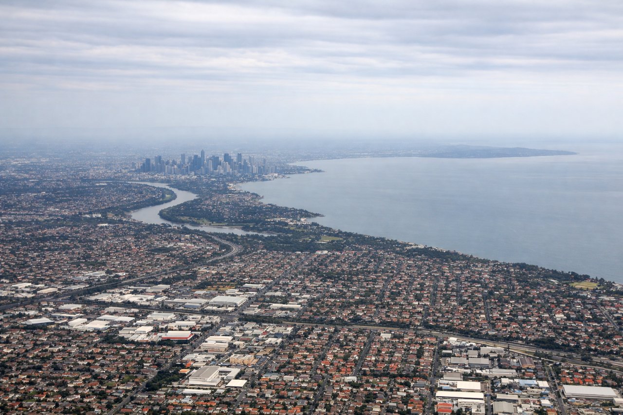
Takeoff from MEL
RIGHTRight-side seats capture the initial climb over Port Phillip Bay and the Dandenong Ranges to the east. Melbourne's runways typically depart eastward or northeastward, positioning right-side passengers for immediate views of the bay's western shoreline and the ranges' forested ridges.
Landing at LST
LEFTLeft-side seats offer the best views during descent into Launceston. The approach typically comes from the south or southwest, and left-side passengers will see the South Esk River valley, the city itself nestled in the river confluence, and the surrounding volcanic plains and low hills that characterize the region.
Will your flight be in sunlight?
Pick a date and time in the Sun Map to watch the sun move across your whole flight.
About This Route
Which side of the plane should I sit on flying from Melbourne International (MEL) to Launceston (LST)?
Sit on the Right side of the plane for the best views on flights from Melbourne to Launceston. Right-side seats capture the most dramatic scenery: Port Phillip Bay and the Dandenong Ranges during takeoff are more visually striking than the approach into Launceston. The 200 km flight path crosses relatively flat terrain between the two cities, so the endpoints offer the best viewing opportunities.
What can I see during takeoff from Melbourne International in Melbourne?
During takeoff from Melbourne International (MEL), sit on the Right side for the best views. Right-side seats capture the initial climb over Port Phillip Bay and the Dandenong Ranges to the east. Melbourne's runways typically depart eastward or northeastward, positioning right-side passengers for immediate views of the bay's western shoreline and the ranges' forested ridges. Notable sights include: Port Phillip Bay (immediate view below during climb), Dandenong Ranges (eastern horizon, heavily forested), Yarra River valley (visible snaking through suburbs), Western suburbs sprawl (Footscray, Williamstown area to the left/north).
What can I see when landing at Launceston in Launceston?
When landing at Launceston (LST), sit on the Left side for the best views. Left-side seats offer the best views during descent into Launceston. The approach typically comes from the south or southwest, and left-side passengers will see the South Esk River valley, the city itself nestled in the river confluence, and the surrounding volcanic plains and low hills that characterize the region. Notable sights include: South Esk River (meandering through green valley, clearly visible from altitude), Launceston city center (compact urban area in river bend), Cataract Gorge (dramatic gorge cutting through landscape south of city), Tasmanian volcanic plains (rolling terrain with patchwork agriculture).
How long is the flight from Melbourne to Launceston?
The flight from Melbourne International (MEL) to Launceston (LST) takes about 55 minutes. The shortest flight path between them is 296 miles (476 km); winds and air traffic control usually add a few percent.
What does the Melbourne to Launceston flight path pass over?
The flight crosses the Western Port region and then moves over the Bass Strait approaches. Between Melbourne and Launceston, passengers will see the transition from Victoria's coastal plains to Tasmania's volcanic plateau landscape. The Strzelecki Ranges (low, forested hills) may be visible to the right during the flight's midpoint if the aircraft tracks far enough east. Most of the route crosses relatively featureless agricultural and forested terrain with few distinctive landmarks from cruising altitude.