The right side wins on both ends: Melbourne's skyline and bay appear during the climb-out turn, and the California coastline and LA basin dominate the descent into LAX, while the long mid-Pacific cruise offers identical open ocean on either side.
Flight Path
Vast open Pacific Ocean for most of the crossing, with the route passing well north of New Zealand and south of the Hawaiian Islands; no significant land is visible for the majority of the flight.
Great circle distance and headings ›
.jpg?width=600)
Phase by phase
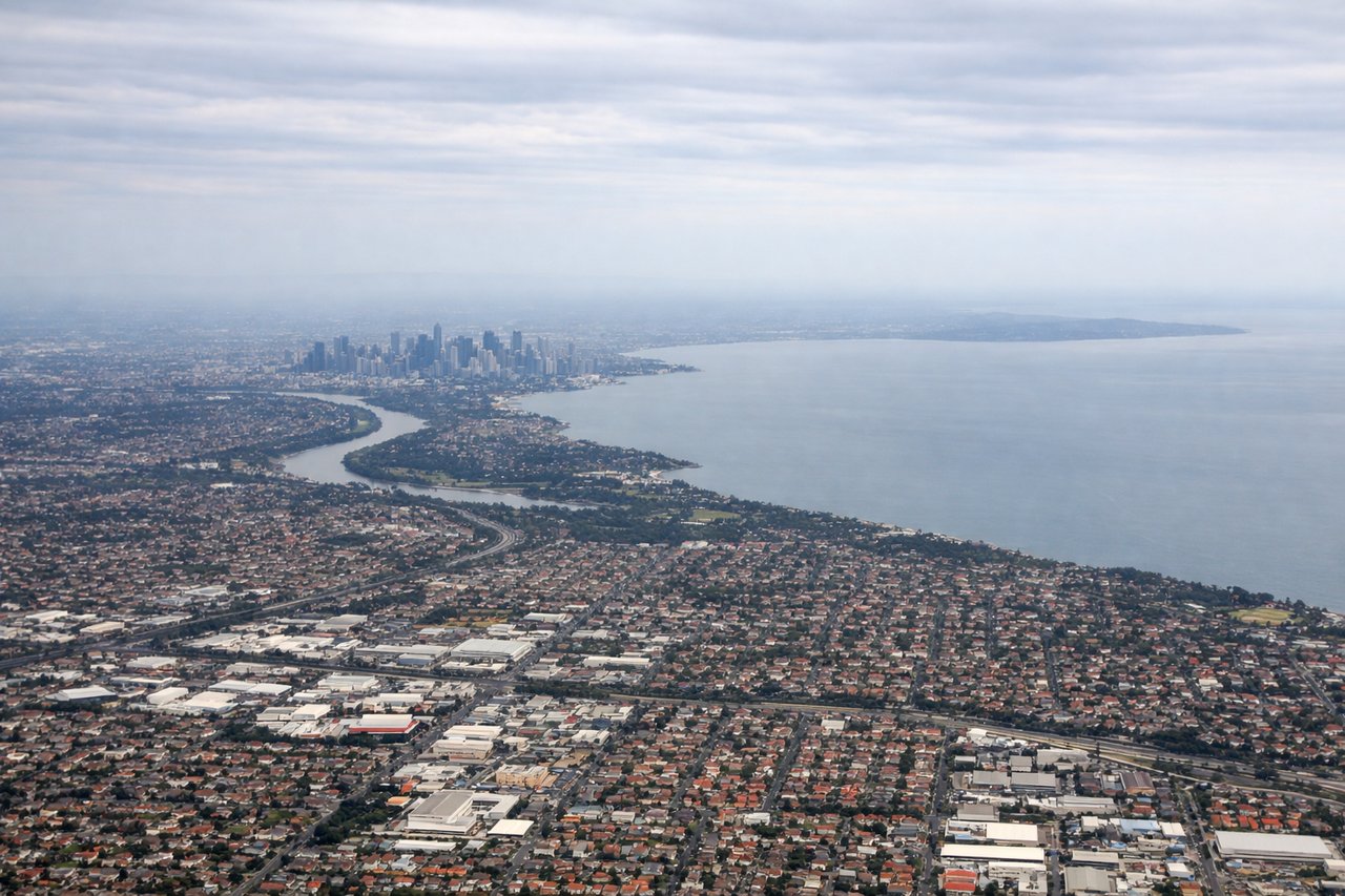
Takeoff from MEL
RIGHTEastbound departures from Melbourne use runway 34, climbing north before banking right to head out over the Tasman/Pacific. That right-hand turn swings the wing toward the city, giving right-side passengers a clear view of the CBD skyline and Port Phillip Bay before the coastline falls away.

Landing at LAX
RIGHTArriving from the Pacific, flights are typically vectored down the coast past Malibu before turning to land west at LAX, putting the Santa Monica Mountains, Malibu coastline, and the LA basin's skyline on the right side of the cabin during the final descent.
Landmarks on this routeAll landmarks →
Will your flight be in sunlight?
See exactly which side of the plane gets sun and shade at your departure time.
About This Route
Which side of the plane should I sit on flying from Melbourne International (MEL) to Los Angeles International (LAX)?
Sit on the Right side of the plane for the best views on flights from Melbourne to Los Angeles. The right side wins on both ends: Melbourne's skyline and bay appear during the climb-out turn, and the California coastline and LA basin dominate the descent into LAX, while the long mid-Pacific cruise offers identical open ocean on either side.
What can I see during takeoff from Melbourne International in Melbourne?
During takeoff from Melbourne International (MEL), sit on the Right side for the best views. Eastbound departures from Melbourne use runway 34, climbing north before banking right to head out over the Tasman/Pacific. That right-hand turn swings the wing toward the city, giving right-side passengers a clear view of the CBD skyline and Port Phillip Bay before the coastline falls away. Notable sights include: Melbourne CBD skyline, Port Phillip Bay, Yarra River mouth, West Gate Bridge.
What can I see when landing at Los Angeles International in Los Angeles?
When landing at Los Angeles International (LAX), sit on the Right side for the best views. Arriving from the Pacific, flights are typically vectored down the coast past Malibu before turning to land west at LAX, putting the Santa Monica Mountains, Malibu coastline, and the LA basin's skyline on the right side of the cabin during the final descent. Notable sights include: Malibu coastline and Santa Monica Bay, Santa Monica Mountains, Downtown LA skyline in the distance, Palos Verdes Peninsula.
How long is the flight from Melbourne to Los Angeles?
The flight from Melbourne International (MEL) to Los Angeles International (LAX) takes 15h 35m.
What does the Melbourne to Los Angeles flight path pass over?
Vast open Pacific Ocean for most of the crossing, with the route passing well north of New Zealand and south of the Hawaiian Islands; no significant land is visible for the majority of the flight.