Both sides get one strong scenic phase, but the left side's landing sequence over the Golden Gate Bridge, San Francisco skyline and bay is more visually dramatic than the right side's plain coastal approach, and the left also carries a chance of a distant Hawaiian Islands sighting during the long ocean crossing.
Flight Path
The route is dominated by open Pacific Ocean for roughly 12-13 hours with no land visible. The great-circle path passes south of Fiji early on and later skirts south of the main Hawaiian Islands, occasionally offering a distant left-side glimpse of Mauna Kea and Mauna Loa on the Big Island on especially clear days before the descent toward the California coast.
Great circle distance and headings ›.jpg?width=600)

Phase by phase
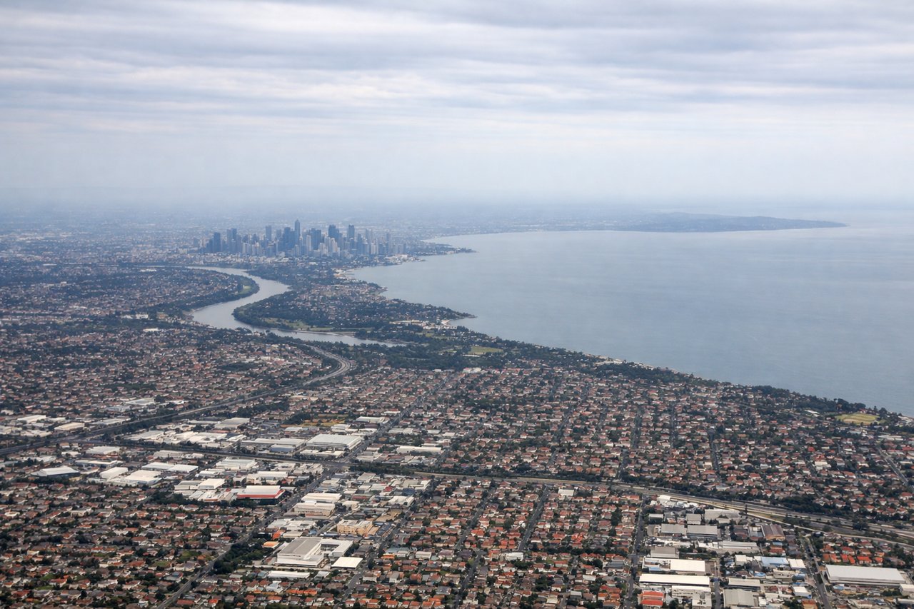
Takeoff from MEL
RIGHTDeparting MEL on runway 34, the aircraft climbs north before banking right onto the northeast transpacific track. That right turn swings the CBD skyline, the Yarra River and Port Phillip Bay into view on the right side before the coast slips away behind.
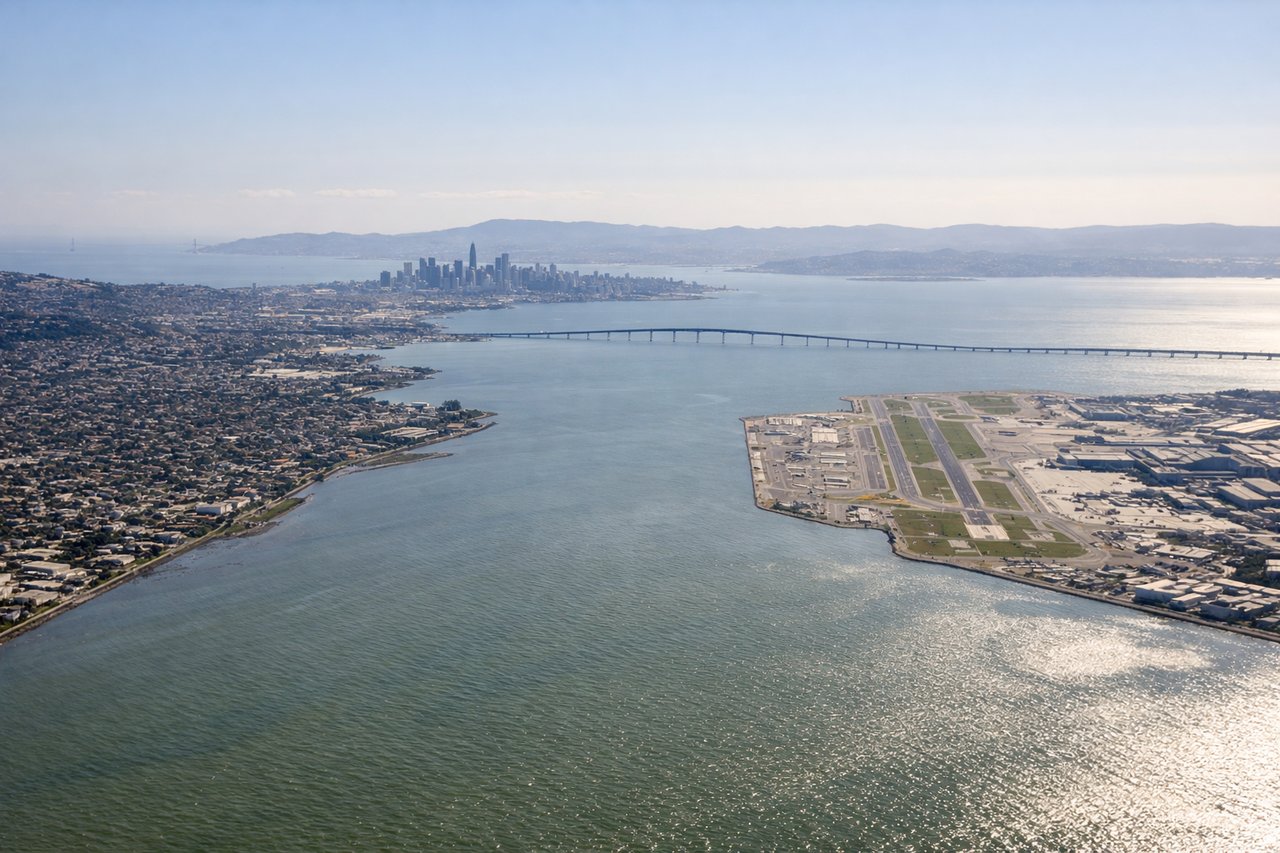
Landing at SFO
LEFTOn the descent into SFO the aircraft tracks south down the Marin coastline before lining up with the runway, keeping the Golden Gate Bridge, San Francisco's skyline and the bay on the left side. The right side only shows open Pacific coastline by comparison.
Landmarks on this routeAll landmarks →
Will your flight be in sunlight?
See exactly which side of the plane gets sun and shade at your departure time.
About This Route
Which side of the plane should I sit on flying from Melbourne International (MEL) to San Francisco International (SFO)?
Sit on the Left side of the plane for the best views on flights from Melbourne to San Francisco. Both sides get one strong scenic phase, but the left side's landing sequence over the Golden Gate Bridge, San Francisco skyline and bay is more visually dramatic than the right side's plain coastal approach, and the left also carries a chance of a distant Hawaiian Islands sighting during the long ocean crossing.
What can I see during takeoff from Melbourne International in Melbourne?
During takeoff from Melbourne International (MEL), sit on the Right side for the best views. Departing MEL on runway 34, the aircraft climbs north before banking right onto the northeast transpacific track. That right turn swings the CBD skyline, the Yarra River and Port Phillip Bay into view on the right side before the coast slips away behind. Notable sights include: Melbourne CBD skyline, Docklands and Yarra River mouth, Port Phillip Bay, distant Mornington Peninsula.
What can I see when landing at San Francisco International in San Francisco?
When landing at San Francisco International (SFO), sit on the Left side for the best views. On the descent into SFO the aircraft tracks south down the Marin coastline before lining up with the runway, keeping the Golden Gate Bridge, San Francisco's skyline and the bay on the left side. The right side only shows open Pacific coastline by comparison. Notable sights include: Golden Gate Bridge, San Francisco skyline and Alcatraz Island, San Francisco Bay, Marin Headlands.
How long is the flight from Melbourne to San Francisco?
The flight from Melbourne International (MEL) to San Francisco International (SFO) takes 14h 35m.
What does the Melbourne to San Francisco flight path pass over?
The route is dominated by open Pacific Ocean for roughly 12-13 hours with no land visible. The great-circle path passes south of Fiji early on and later skirts south of the main Hawaiian Islands, occasionally offering a distant left-side glimpse of Mauna Kea and Mauna Loa on the Big Island on especially clear days before the descent toward the California coast.