While takeoff offers decent desert scenery on the right, the landing approach on the left provides the dramatic visual payoff—the Canadian Rockies' eastern escarpment is one of North America's most striking aerial views and dominates the final descent phase.
Flown LUF to YYC? Did we get it right?
Flight Path
Phoenix to Calgary is 1,218 miles (1,960 km), a flight of about 3 hours 15 minutes.
You'll cross the Colorado Plateau and high desert of northern Arizona and southern Utah, then transition into the Great Plains of eastern Wyoming and Colorado. The flight path roughly follows the transition zone between the Rocky Mountain system and the Colorado Plateau. Notable geographic features along the route include the Kaibab Plateau region (though typically south of direct routing), the high desert basins of Utah, and the Front Range approach to the Rockies near the Colorado-Wyoming border. The landscape transitions from low-desert scrub to high-altitude grassland and coniferous forest as you move north and east.
Great circle distance and headings ›


Phase by phase
Takeoff from LUF
RIGHTLuke AFB typically departs to the west or northwest. Right-side seats offer views of the Phoenix metropolitan area sprawl and the transition from urban development into the Sonoran Desert. You'll see the grid of suburbs giving way to open desert terrain as you climb.
Landing at YYC
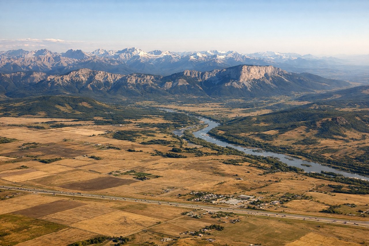
LEFTApproaching Calgary from the south typically uses runways 16 or 17. Left-side seats provide excellent views of the Canadian Rockies' eastern front as you descend through southern Alberta. The mountains grow progressively larger and more detailed as you approach, and you'll see the transition from prairie to foothills.
Will your flight be in sunlight?
Pick a date and time in the Sun Map to watch the sun move across your whole flight.
About This Route
Which side of the plane should I sit on flying from Luke Afb (LUF) to Calgary International (YYC)?
Sit on the Left side of the plane for the best views on flights from Phoenix to Calgary. While takeoff offers decent desert scenery on the right, the landing approach on the left provides the dramatic visual payoff—the Canadian Rockies' eastern escarpment is one of North America's most striking aerial views and dominates the final descent phase.
What can I see during takeoff from Luke Afb in Phoenix?
During takeoff from Luke Afb (LUF), sit on the Right side for the best views. Luke AFB typically departs to the west or northwest. Right-side seats offer views of the Phoenix metropolitan area sprawl and the transition from urban development into the Sonoran Desert. You'll see the grid of suburbs giving way to open desert terrain as you climb. Notable sights include: Phoenix urban grid and suburbs, Sonoran Desert scrubland, Lake Pleasant to the north (visible as a blue water body), White Tank Mountains to the west.
What can I see when landing at Calgary International in Calgary?
When landing at Calgary International (YYC), sit on the Left side for the best views. Approaching Calgary from the south typically uses runways 16 or 17. Left-side seats provide excellent views of the Canadian Rockies' eastern front as you descend through southern Alberta. The mountains grow progressively larger and more detailed as you approach, and you'll see the transition from prairie to foothills. Notable sights include: Canadian Rocky Mountains (eastern front), Bow River valley and Calgary city center, Foothills west of Calgary, Prairie grasslands to the east and south.
How long is the flight from Phoenix to Calgary?
The flight from Luke Afb (LUF) to Calgary International (YYC) takes about 3 hours 15 minutes. The shortest flight path between them is 1,218 miles (1,960 km); winds and air traffic control usually add a few percent.
What does the Phoenix to Calgary flight path pass over?
You'll cross the Colorado Plateau and high desert of northern Arizona and southern Utah, then transition into the Great Plains of eastern Wyoming and Colorado. The flight path roughly follows the transition zone between the Rocky Mountain system and the Colorado Plateau. Notable geographic features along the route include the Kaibab Plateau region (though typically south of direct routing), the high desert basins of Utah, and the Front Range approach to the Rockies near the Colorado-Wyoming border. The landscape transitions from low-desert scrub to high-altitude grassland and coniferous forest as you move north and east.