The left side wins overall because it captures the dramatic transition from the Rocky Mountain ranges of Wyoming and Montana during cruise to the volcanic grandeur of Mount Rainier and Puget Sound on final approach, while the right side stays largely over flat plains and less distinctive terrain for most of the flight.
Flight Path
Great Plains of Nebraska and South Dakota, the Black Hills near Rapid City, the Bighorn Mountains of Wyoming, and the northern Rocky Mountains along the Montana-Idaho border before descending toward the Columbia Plateau and Cascade Range
Great circle distance and headings ›.jpg?width=600)
.jpg?width=600)

Phase by phase
Takeoff from MCI
RIGHTClimbing out of MCI, the right side offers a brief look at the Missouri River winding through the farmland north of Kansas City before the plains take over. The left side only shows featureless agricultural fields stretching to the horizon.
Landing at SEA
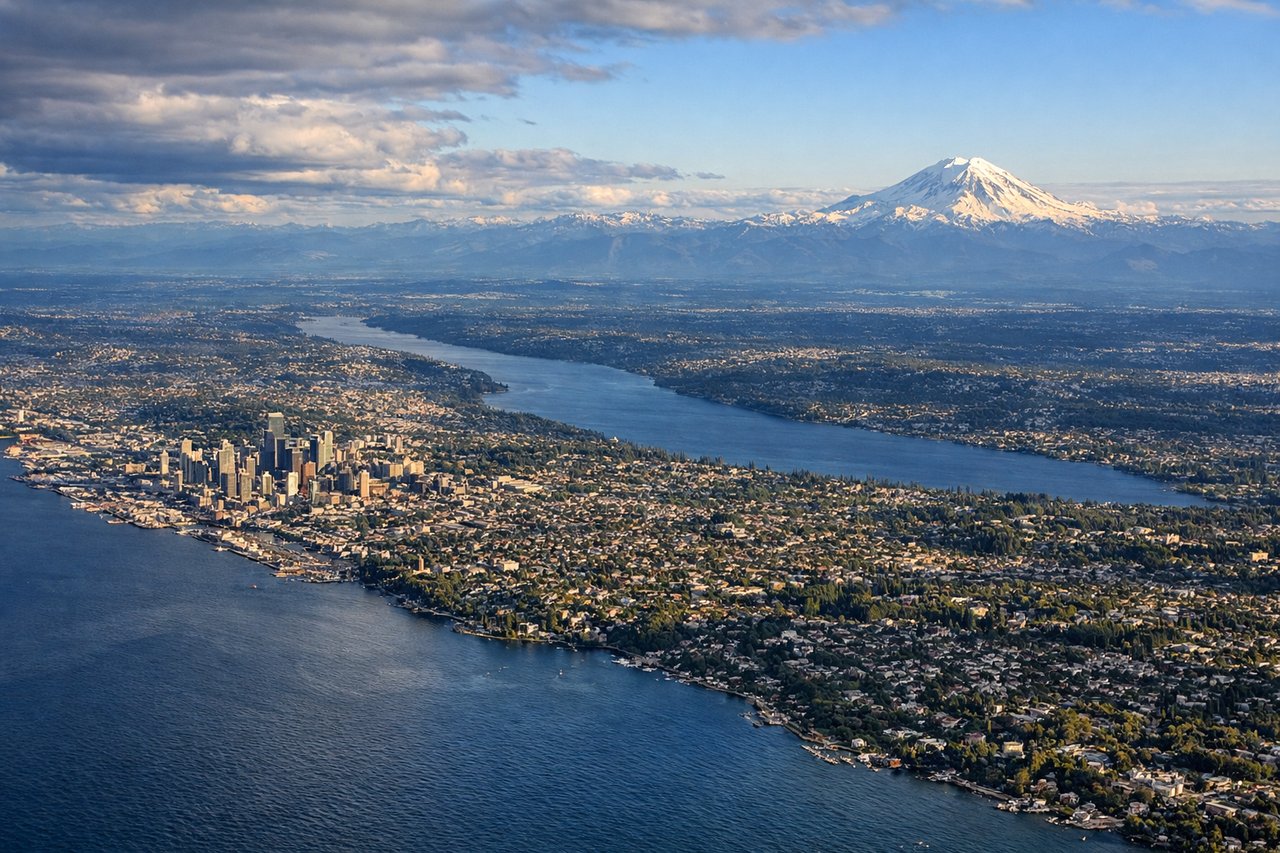
LEFTOn approach into SEA the left side reveals the snow-capped cone of Mount Rainier rising above the Cascade foothills, followed by the islands and inlets of Puget Sound as the plane descends toward Sea-Tac. The right side during this phase mostly shows the flatter Sammamish plateau and Lake Washington suburbs, less dramatic by comparison.
Landmarks on this routeAll landmarks →
Will your flight be in sunlight?
See exactly which side of the plane gets sun and shade at your departure time.
About This Route
Which side of the plane should I sit on flying from Kansas City International (MCI) to Seattle Tacoma International (SEA)?
Sit on the Left side of the plane for the best views on flights from Kansas City to Seattle. The left side wins overall because it captures the dramatic transition from the Rocky Mountain ranges of Wyoming and Montana during cruise to the volcanic grandeur of Mount Rainier and Puget Sound on final approach, while the right side stays largely over flat plains and less distinctive terrain for most of the flight.
What can I see during takeoff from Kansas City International in Kansas City?
During takeoff from Kansas City International (MCI), sit on the Right side for the best views. Climbing out of MCI, the right side offers a brief look at the Missouri River winding through the farmland north of Kansas City before the plains take over. The left side only shows featureless agricultural fields stretching to the horizon. Notable sights include: Missouri River, Kansas City northern suburbs, patchwork farmland.
What can I see when landing at Seattle Tacoma International in Seattle?
When landing at Seattle Tacoma International (SEA), sit on the Left side for the best views. On approach into SEA the left side reveals the snow-capped cone of Mount Rainier rising above the Cascade foothills, followed by the islands and inlets of Puget Sound as the plane descends toward Sea-Tac. The right side during this phase mostly shows the flatter Sammamish plateau and Lake Washington suburbs, less dramatic by comparison. Notable sights include: Mount Rainier, Cascade Range foothills, Puget Sound islands, Seattle skyline.
How long is the flight from Kansas City to Seattle?
The flight from Kansas City International (MCI) to Seattle Tacoma International (SEA) takes 3h 15m.
What does the Kansas City to Seattle flight path pass over?
Great Plains of Nebraska and South Dakota, the Black Hills near Rapid City, the Bighorn Mountains of Wyoming, and the northern Rocky Mountains along the Montana-Idaho border before descending toward the Columbia Plateau and Cascade Range