Harrisburg to Chicago is 593 miles (954 km), a flight of about 1 hour 20 minutes.
The left side wins both departure and arrival. It captures the Susquehanna River and Appalachian ridgeline on climb-out, then the Lake Michigan shoreline and Chicago skyline on descent. The right side offers flat Indiana farmland for most of the cruise, which is significantly less interesting.
Flight Path
The flight crosses central Pennsylvania farmland, then the flat agricultural plains of Ohio and Indiana. The Ohio-Indiana state line area is almost entirely level glaciated farmland with a strong rectangular field grid. No significant terrain features mid-flight — this is one of the flattest flight paths in the eastern US. The Maumee River valley near Fort Wayne, Indiana is faintly visible as a slight drainage corridor.
Great circle distance and headings ›.jpeg?width=600)


Phase by phase
Takeoff from MDT
LEFTMDT typically departs runway 13 heading southeast or runway 31 heading northwest. On a westbound flight to ORD, aircraft usually depart runway 31 (northwest), then turn west. The left side picks up the Susquehanna River below and the Cumberland Valley stretching southwest, with the Blue Mountain ridge of the Appalachians visible to the north.
Landing at ORD
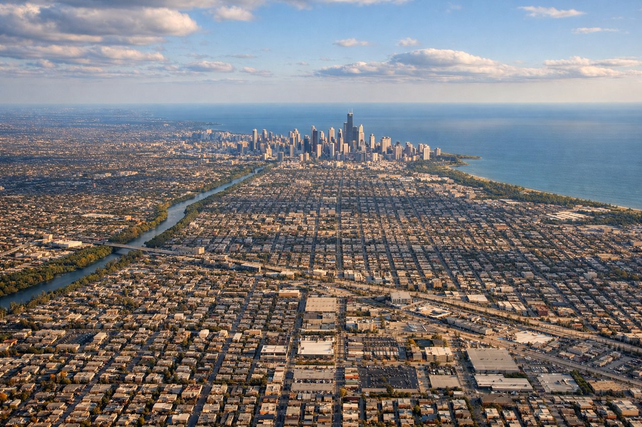
LEFTORD predominantly uses runways oriented east-west and northwest-southeast. Arrivals from the east typically come in on runway 10L/10R heading east, meaning the aircraft approaches from the west side of the city. The left side gives a clear view of Lake Michigan's shoreline, the Chicago downtown skyline, and the lakefront grid as the plane descends over the western suburbs.
Landmarks on this routeAll landmarks →
Will your flight be in sunlight?
Pick a date and time in the Sun Map to watch the sun move across your whole flight.
About This Route
Which side of the plane should I sit on flying from Harrisburg International (MDT) to Chicago Ohare International (ORD)?
Sit on the Left side of the plane for the best views on flights from Harrisburg to Chicago. The left side wins both departure and arrival. It captures the Susquehanna River and Appalachian ridgeline on climb-out, then the Lake Michigan shoreline and Chicago skyline on descent. The right side offers flat Indiana farmland for most of the cruise, which is significantly less interesting.
What can I see during takeoff from Harrisburg International in Harrisburg?
During takeoff from Harrisburg International (MDT), sit on the Left side for the best views. MDT typically departs runway 13 heading southeast or runway 31 heading northwest. On a westbound flight to ORD, aircraft usually depart runway 31 (northwest), then turn west. The left side picks up the Susquehanna River below and the Cumberland Valley stretching southwest, with the Blue Mountain ridge of the Appalachians visible to the north. Notable sights include: Susquehanna River, Cumberland Valley, Blue Mountain (Appalachian front ridge), Harrisburg city grid.
What can I see when landing at Chicago Ohare International in Chicago?
When landing at Chicago Ohare International (ORD), sit on the Left side for the best views. ORD predominantly uses runways oriented east-west and northwest-southeast. Arrivals from the east typically come in on runway 10L/10R heading east, meaning the aircraft approaches from the west side of the city. The left side gives a clear view of Lake Michigan's shoreline, the Chicago downtown skyline, and the lakefront grid as the plane descends over the western suburbs. Notable sights include: Lake Michigan shoreline, Chicago downtown skyline (Loop), O'Hare suburban grid, Des Plaines River corridor.
How long is the flight from Harrisburg to Chicago?
The flight from Harrisburg International (MDT) to Chicago Ohare International (ORD) takes about 1 hour 20 minutes. The shortest flight path between them is 593 miles (954 km); winds and air traffic control usually add a few percent.
What does the Harrisburg to Chicago flight path pass over?
The flight crosses central Pennsylvania farmland, then the flat agricultural plains of Ohio and Indiana. The Ohio-Indiana state line area is almost entirely level glaciated farmland with a strong rectangular field grid. No significant terrain features mid-flight — this is one of the flattest flight paths in the eastern US. The Maumee River valley near Fort Wayne, Indiana is faintly visible as a slight drainage corridor.