Harrisburg to Seattle is 2,291 miles (3,687 km), a flight of about 5 hours 45 minutes.
Left side wins at both ends of the flight. During the cruise over the northern Rockies and Cascades, the left side also tends to offer better angles on the Columbia River basin and the volcanic peaks of the Cascades including Mount Rainier as you descend into Seattle from the north.
Flight Path
The flight tracks northwest over Pennsylvania's Ridge and Valley Appalachians, then across Ohio and Indiana flatlands, before crossing the Mississippi River near the Quad Cities area. Over South Dakota and Wyoming the terrain rises into the northern Great Plains and then the Bighorn Mountains. The flight crosses the northern Rockies over Montana or Wyoming depending on routing, then descends over the Columbia Plateau and the Cascade Range, with Mount Rainier often visible to the south on the Seattle approach.
Great circle distance and headings ›.jpeg?width=600)


.jpg?width=600)

Phase by phase
Takeoff from MDT
LEFTMDT's primary departure runway 13 sends aircraft southeast before turning northwest, and a left-side seat gives you a clear look back at the Susquehanna River valley and the ridgelines of the Ridge and Valley Appalachians as you climb out. The parallel folded ridges of Blue Mountain and Second Mountain are unmistakable from the left window.
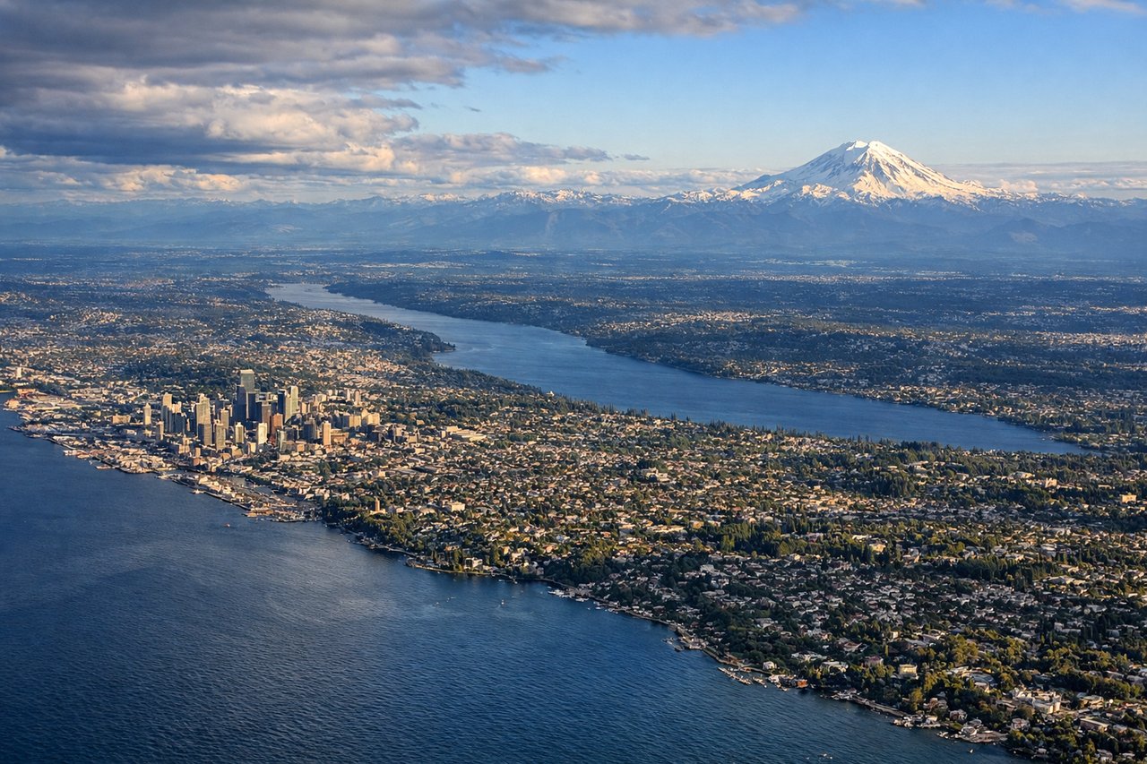
Landing at SEA
LEFTSeaTac primarily uses runways 16L/16R for southerly arrivals, meaning the approach comes from the north over Puget Sound. A left-side seat on final approach gives you a direct view across Puget Sound toward the Olympic Mountains and downtown Seattle's skyline to the north. Right side faces east toward the Cascades, which is also good, but the left side captures the water, the city, and the Olympics simultaneously.
Landmarks on this routeAll landmarks →
Will your flight be in sunlight?
Pick a date and time in the Sun Map to watch the sun move across your whole flight.
About This Route
Which side of the plane should I sit on flying from Harrisburg International (MDT) to Seattle Tacoma International (SEA)?
Sit on the Left side of the plane for the best views on flights from Harrisburg to Seattle. Left side wins at both ends of the flight. During the cruise over the northern Rockies and Cascades, the left side also tends to offer better angles on the Columbia River basin and the volcanic peaks of the Cascades including Mount Rainier as you descend into Seattle from the north.
What can I see during takeoff from Harrisburg International in Harrisburg?
During takeoff from Harrisburg International (MDT), sit on the Left side for the best views. MDT's primary departure runway 13 sends aircraft southeast before turning northwest, and a left-side seat gives you a clear look back at the Susquehanna River valley and the ridgelines of the Ridge and Valley Appalachians as you climb out. The parallel folded ridges of Blue Mountain and Second Mountain are unmistakable from the left window. Notable sights include: Susquehanna River, Blue Mountain ridge, Second Mountain ridge, Harrisburg city grid along the river.
What can I see when landing at Seattle Tacoma International in Seattle?
When landing at Seattle Tacoma International (SEA), sit on the Left side for the best views. SeaTac primarily uses runways 16L/16R for southerly arrivals, meaning the approach comes from the north over Puget Sound. A left-side seat on final approach gives you a direct view across Puget Sound toward the Olympic Mountains and downtown Seattle's skyline to the north. Right side faces east toward the Cascades, which is also good, but the left side captures the water, the city, and the Olympics simultaneously. Notable sights include: Puget Sound, Seattle downtown skyline, Olympic Mountains, Vashon Island.
How long is the flight from Harrisburg to Seattle?
The flight from Harrisburg International (MDT) to Seattle Tacoma International (SEA) takes about 5 hours 45 minutes. The shortest flight path between them is 2,291 miles (3,687 km); winds and air traffic control usually add a few percent.
What does the Harrisburg to Seattle flight path pass over?
The flight tracks northwest over Pennsylvania's Ridge and Valley Appalachians, then across Ohio and Indiana flatlands, before crossing the Mississippi River near the Quad Cities area. Over South Dakota and Wyoming the terrain rises into the northern Great Plains and then the Bighorn Mountains. The flight crosses the northern Rockies over Montana or Wyoming depending on routing, then descends over the Columbia Plateau and the Cascade Range, with Mount Rainier often visible to the south on the Seattle approach.