While takeoff offers brief river views on the right, the landing approach on the left provides sustained, dramatic views of the Wasatch Range—one of the most visually striking mountain ranges in North America. The approach geometry typically favors left-side visibility of the range.
Flown MEM to SLC? Did we get it right?
Flight Path
Memphis to Salt Lake City is 1,259 miles (2,027 km), a flight of about 3 hours 15 minutes.
The flight path crosses central Arkansas, then the Ozark Plateau (visible as rolling terrain with forest cover), continues over Oklahoma panhandle and the Texas Panhandle (flat grasslands and sparse development), then enters New Mexico and Colorado where the Rocky Mountain foothills begin to rise. The Colorado Plateau becomes visible with its distinctive layered geology and canyon systems. By descent into Salt Lake City, the Wasatch Range dominates the eastern horizon.
Great circle distance and headings ›


Phase by phase
Takeoff from MEM
RIGHTRight side captures the Mississippi River immediately after departure, which is the dominant geographic feature near Memphis. Depending on runway (typically 09/27), northwestbound climbs offer the best view of the river's meanders and the city grid below.
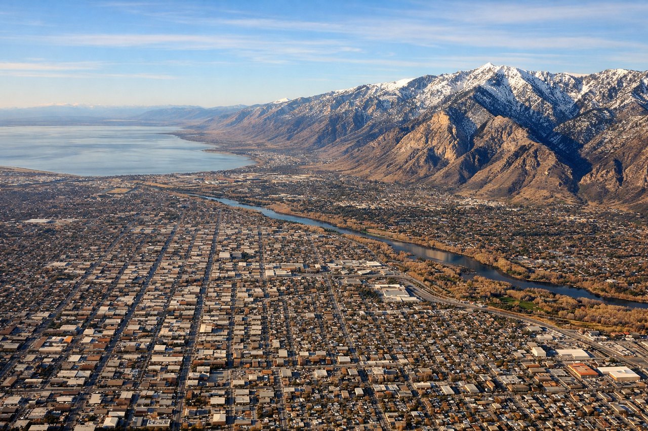
Landing at SLC
LEFTLeft side provides the best approach view of the Wasatch Range and Salt Lake Valley. Most arrivals use runways 16L/16R or 34L/34R; southeastbound approaches align the Wasatch Mountains prominently on the left, with the Great Salt Lake visible to the northwest.
Will your flight be in sunlight?
Pick a date and time in the Sun Map to watch the sun move across your whole flight.
About This Route
Which side of the plane should I sit on flying from Memphis International (MEM) to Salt Lake City International (SLC)?
Sit on the Left side of the plane for the best views on flights from Memphis to Salt Lake City. While takeoff offers brief river views on the right, the landing approach on the left provides sustained, dramatic views of the Wasatch Range—one of the most visually striking mountain ranges in North America. The approach geometry typically favors left-side visibility of the range.
What can I see during takeoff from Memphis International in Memphis?
During takeoff from Memphis International (MEM), sit on the Right side for the best views. Right side captures the Mississippi River immediately after departure, which is the dominant geographic feature near Memphis. Depending on runway (typically 09/27), northwestbound climbs offer the best view of the river's meanders and the city grid below. Notable sights include: Mississippi River (main channel and oxbow lakes), Memphis city center and Shelby County urban sprawl, Wolf River confluence, Arkansas farmland to the west.
What can I see when landing at Salt Lake City International in Salt Lake City?
When landing at Salt Lake City International (SLC), sit on the Left side for the best views. Left side provides the best approach view of the Wasatch Range and Salt Lake Valley. Most arrivals use runways 16L/16R or 34L/34R; southeastbound approaches align the Wasatch Mountains prominently on the left, with the Great Salt Lake visible to the northwest. Notable sights include: Wasatch Range (Lone Peak, Twin Peaks, American Fork Canyon), Great Salt Lake (northern arm), Salt Lake Valley urban grid, Utah Lake to the south.
How long is the flight from Memphis to Salt Lake City?
The flight from Memphis International (MEM) to Salt Lake City International (SLC) takes about 3 hours 15 minutes. The shortest flight path between them is 1,259 miles (2,027 km); winds and air traffic control usually add a few percent.
What does the Memphis to Salt Lake City flight path pass over?
The flight path crosses central Arkansas, then the Ozark Plateau (visible as rolling terrain with forest cover), continues over Oklahoma panhandle and the Texas Panhandle (flat grasslands and sparse development), then enters New Mexico and Colorado where the Rocky Mountain foothills begin to rise. The Colorado Plateau becomes visible with its distinctive layered geology and canyon systems. By descent into Salt Lake City, the Wasatch Range dominates the eastern horizon.