Right-side seats capture the dramatic Sierra Madre Oriental departure from Mexico City and maintain better views during the long southern flight path over Central America and into South America. While left offers the Río de la Plata approach, the takeoff experience from the right is more visually distinctive.
Flown MEX to EZE? Did we get it right?
Flight Path
Mexico City to Buenos Aires is 4,596 miles (7,397 km), a flight of about 9 hours 15 minutes.
The flight path crosses the Isthmus of Tehuantepec (narrowest point of Mexico), then continues over the Yucatan Peninsula, crosses the Caribbean, passes over Central America (Guatemala highlands visible on clear days), then over the northern coast of South America, eventually reaching the Andes foothills in Colombia/Venezuela before descending into the Argentine Pampas. The Caribbean crossing offers occasional views of island chains and deep blue water. The approach to Buenos Aires crosses the flat, featureless Pampas for the final 200+ miles.
Great circle distance and headings ›


Phase by phase
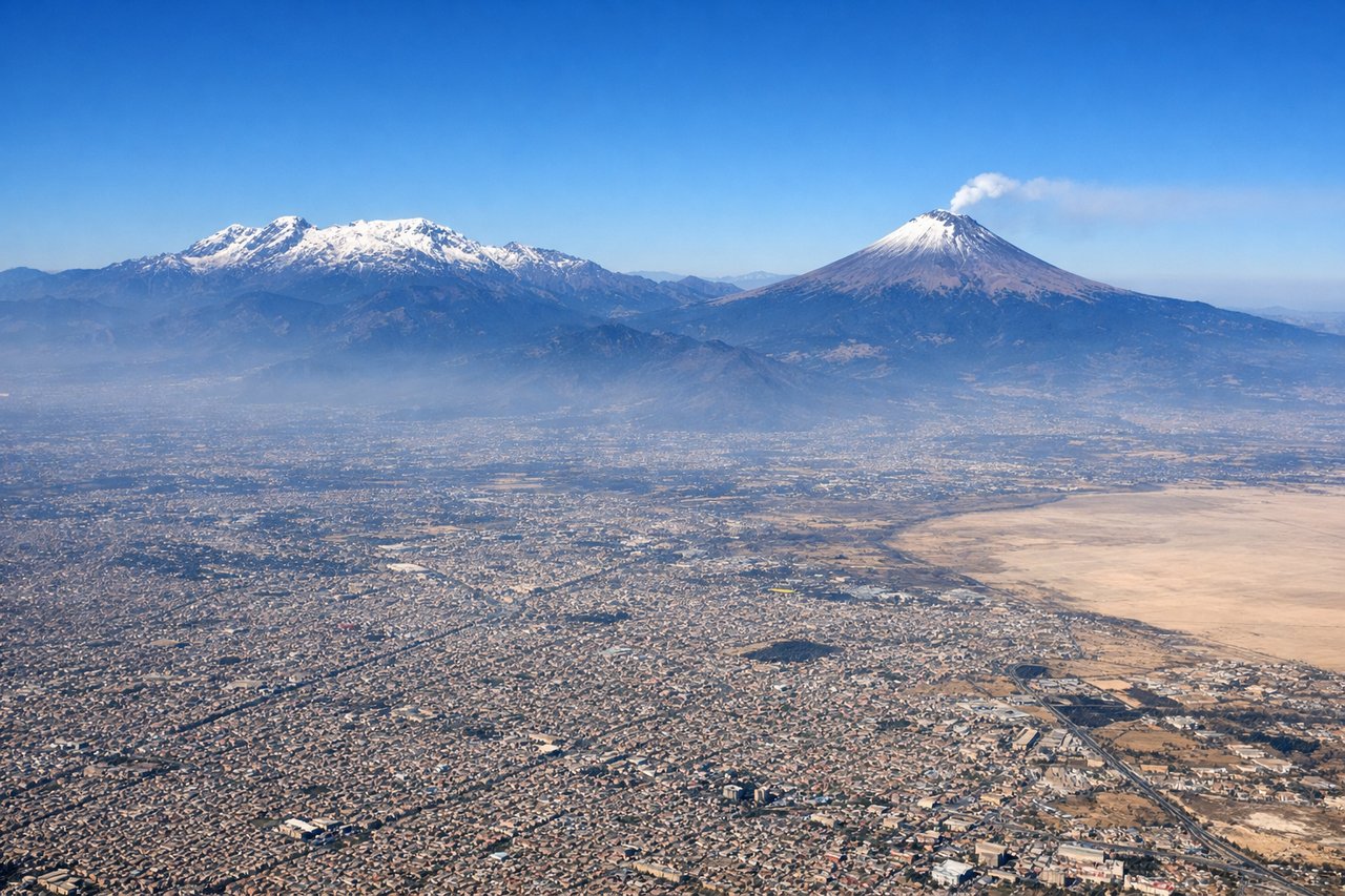
Takeoff from MEX
RIGHTMEX typically departs eastbound (runways 05L/05R or 23L/23R depending on wind). Right-side seats face toward the Sierra Madre Oriental and the Valley of Mexico's eastern rim during initial climb, offering clear views of the high terrain surrounding the city.

Landing at EZE
LEFTEZE approaches from the northeast (typically runway 09 or 27 depending on wind). Left-side seats during descent offer views of the Río de la Plata estuary, the Buenos Aires waterfront, and the approach path over the flat Pampas. The river and coastal features are the most distinctive visual elements on final approach.
Will your flight be in sunlight?
Pick a date and time in the Sun Map to watch the sun move across your whole flight.
About This Route
Which side of the plane should I sit on flying from Licenciado Benito Juarez International (MEX) to Ezeiza Ministro Pistarini (EZE)?
Sit on the Right side of the plane for the best views on flights from Mexico City to Buenos Aires. Right-side seats capture the dramatic Sierra Madre Oriental departure from Mexico City and maintain better views during the long southern flight path over Central America and into South America. While left offers the Río de la Plata approach, the takeoff experience from the right is more visually distinctive.
What can I see during takeoff from Licenciado Benito Juarez International in Mexico City?
During takeoff from Licenciado Benito Juarez International (MEX), sit on the Right side for the best views. MEX typically departs eastbound (runways 05L/05R or 23L/23R depending on wind). Right-side seats face toward the Sierra Madre Oriental and the Valley of Mexico's eastern rim during initial climb, offering clear views of the high terrain surrounding the city. Notable sights include: Sierra Madre Oriental (eastern escarpment), Lake Texcoco remnants (visible as water bodies and wetland areas in the valley floor), Mexico City's northern urban sprawl extending toward Ecatepec, Popocatépetl volcano (visible on clear days as a distant peak to the southeast on the horizon).
What can I see when landing at Ezeiza Ministro Pistarini in Buenos Aires?
When landing at Ezeiza Ministro Pistarini (EZE), sit on the Left side for the best views. EZE approaches from the northeast (typically runway 09 or 27 depending on wind). Left-side seats during descent offer views of the Río de la Plata estuary, the Buenos Aires waterfront, and the approach path over the flat Pampas. The river and coastal features are the most distinctive visual elements on final approach. Notable sights include: Río de la Plata estuary (wide muddy-brown waterway), Buenos Aires waterfront and Puerto Madero district (modern high-rises along the river), the flat Pampas grasslands extending to the horizon, Ezeiza airport's runway infrastructure and surrounding agricultural land.
How long is the flight from Mexico City to Buenos Aires?
The flight from Licenciado Benito Juarez International (MEX) to Ezeiza Ministro Pistarini (EZE) takes about 9 hours 15 minutes. The shortest flight path between them is 4,596 miles (7,397 km); winds and air traffic control usually add a few percent.
What does the Mexico City to Buenos Aires flight path pass over?
The flight path crosses the Isthmus of Tehuantepec (narrowest point of Mexico), then continues over the Yucatan Peninsula, crosses the Caribbean, passes over Central America (Guatemala highlands visible on clear days), then over the northern coast of South America, eventually reaching the Andes foothills in Colombia/Venezuela before descending into the Argentine Pampas. The Caribbean crossing offers occasional views of island chains and deep blue water. The approach to Buenos Aires crosses the flat, featureless Pampas for the final 200+ miles.