Right side wins at both ends of the flight. During the cruise over northern Mexico and the Sonoran Desert, the right side also faces east toward the Sierra Madre Occidental ranges, which are more visually interesting than the flat Pacific coastal plain on the left. Consistent advantage throughout.
Flight Path
The route crosses the Trans-Mexican Volcanic Belt shortly after departure, then tracks northwest over the high desert plateau of Zacatecas and Durango states, crossing the Sierra Madre Occidental mountain range visible as a rugged north-south spine. The flight then crosses the Sonoran Desert of Sonora and Arizona, with the Gulf of California visible to the left (west) side in the distance. Over the US border the route passes near Tucson and then across the Mojave Desert before descending into the LA Basin.
Great circle distance and headings ›_(cropped).jpg?width=600)

.jpg?width=600)
Phase by phase
Takeoff from MEX
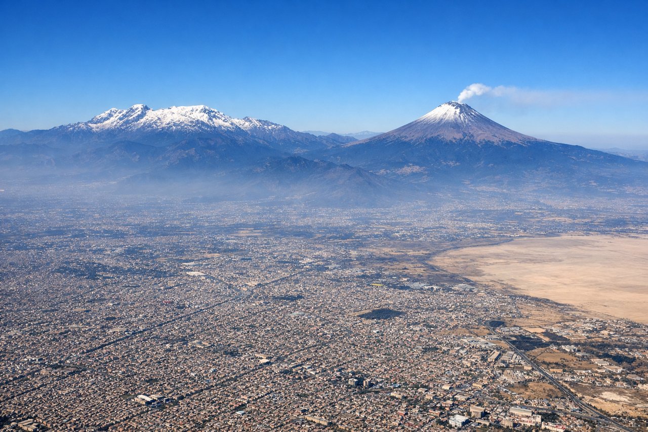
RIGHTMEX typically departs on runway 05R heading northeast, then turns northwest toward LAX. The right side faces south and east during climb-out, giving a clear view of the Valley of Mexico and the twin volcanic peaks of Popocatépetl and Iztaccíhuatl rising above the basin rim. These are among the most dramatic volcanoes in North America and are unmistakable from the air.

Landing at LAX
RIGHTLAX primarily lands on the north complex runways (24L/24R) approaching from the east, meaning the aircraft tracks westward over the LA Basin before touching down. The right side faces north, giving views over the Santa Monica Mountains, the San Fernando Valley, and the Hollywood Hills. The left side faces south over the South Bay and ocean, which is less distinctive.
Landmarks on this routeAll landmarks →
Will your flight be in sunlight?
See exactly which side of the plane gets sun and shade at your departure time.
About This Route
Which side of the plane should I sit on flying from Licenciado Benito Juarez International (MEX) to Los Angeles International (LAX)?
Sit on the Right side of the plane for the best views on flights from Mexico City to Los Angeles. Right side wins at both ends of the flight. During the cruise over northern Mexico and the Sonoran Desert, the right side also faces east toward the Sierra Madre Occidental ranges, which are more visually interesting than the flat Pacific coastal plain on the left. Consistent advantage throughout.
What can I see during takeoff from Licenciado Benito Juarez International in Mexico City?
During takeoff from Licenciado Benito Juarez International (MEX), sit on the Right side for the best views. MEX typically departs on runway 05R heading northeast, then turns northwest toward LAX. The right side faces south and east during climb-out, giving a clear view of the Valley of Mexico and the twin volcanic peaks of Popocatépetl and Iztaccíhuatl rising above the basin rim. These are among the most dramatic volcanoes in North America and are unmistakable from the air. Notable sights include: Popocatépetl (active volcano, 17,802 ft), Iztaccíhuatl (dormant volcano, 17,159 ft), the urban sprawl of greater Mexico City filling the basin, Lake Texcoco remnant and the new airport construction zone to the northeast.
What can I see when landing at Los Angeles International in Los Angeles?
When landing at Los Angeles International (LAX), sit on the Right side for the best views. LAX primarily lands on the north complex runways (24L/24R) approaching from the east, meaning the aircraft tracks westward over the LA Basin before touching down. The right side faces north, giving views over the Santa Monica Mountains, the San Fernando Valley, and the Hollywood Hills. The left side faces south over the South Bay and ocean, which is less distinctive. Notable sights include: Santa Monica Mountains and Malibu coastline, San Fernando Valley urban grid, Griffith Observatory area and Hollywood Hills, Santa Monica Bay as the aircraft descends over the coast.
How long is the flight from Mexico City to Los Angeles?
The flight from Licenciado Benito Juarez International (MEX) to Los Angeles International (LAX) takes Approximately 3 hours 30 minutes to 4 hours.
What does the Mexico City to Los Angeles flight path pass over?
The route crosses the Trans-Mexican Volcanic Belt shortly after departure, then tracks northwest over the high desert plateau of Zacatecas and Durango states, crossing the Sierra Madre Occidental mountain range visible as a rugged north-south spine. The flight then crosses the Sonoran Desert of Sonora and Arizona, with the Gulf of California visible to the left (west) side in the distance. Over the US border the route passes near Tucson and then across the Mojave Desert before descending into the LA Basin.