While the left side wins the departure with LA's coastline, the right side delivers a rare, unmistakable landmark at the end of the flight: the twin volcanoes overlooking Mexico City, an approach view with no equivalent on the left.
Flight Path
Gulf of California (Sea of Cortez), Baja California peninsula, Sierra Madre Occidental foothills
Great circle distance and headings ›.jpg?width=600)

_(cropped).jpg?width=600)

Phase by phase

Takeoff from LAX
LEFTIn LAX's typical west-flow departure, the aircraft climbs out over Santa Monica Bay and then banks left toward the southeast heading for Mexico. That left turn puts the Los Angeles coastline, Palos Verdes Peninsula, and Long Beach Harbor directly below on the left side, with Catalina Island visible offshore.
Landing at MEX
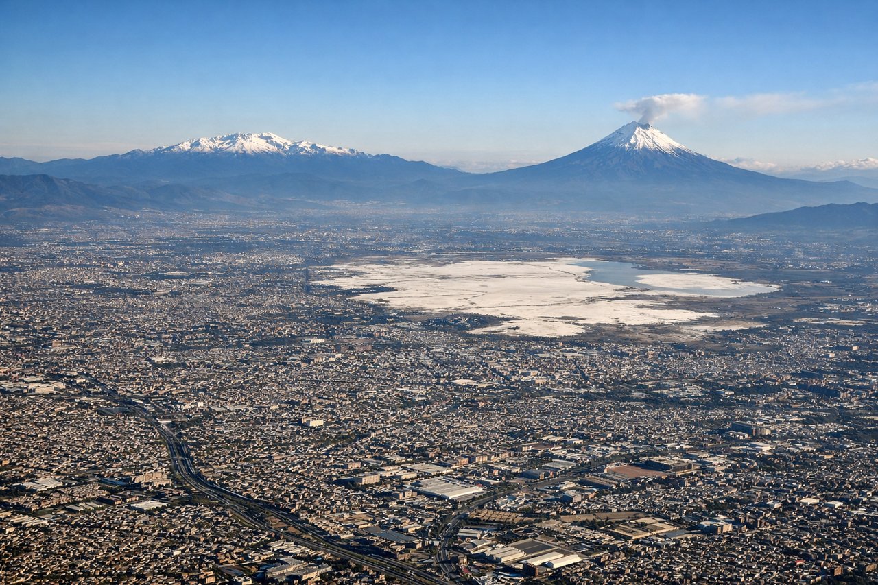
RIGHTOn approach into Mexico City's high-altitude valley, arrivals swinging in from the southwest toward runway 05R put the towering volcanoes Popocatepetl and Iztaccihuatl on the right side of the aircraft, framing the sprawling Valley of Mexico below. This is one of the most dramatic scheduled airport approaches in the Americas.
Landmarks on this routeAll landmarks →
Will your flight be in sunlight?
See exactly which side of the plane gets sun and shade at your departure time.
About This Route
Which side of the plane should I sit on flying from Los Angeles International (LAX) to Licenciado Benito Juarez International (MEX)?
Sit on the Right side of the plane for the best views on flights from Los Angeles to Mexico City. While the left side wins the departure with LA's coastline, the right side delivers a rare, unmistakable landmark at the end of the flight: the twin volcanoes overlooking Mexico City, an approach view with no equivalent on the left.
What can I see during takeoff from Los Angeles International in Los Angeles?
During takeoff from Los Angeles International (LAX), sit on the Left side for the best views. In LAX's typical west-flow departure, the aircraft climbs out over Santa Monica Bay and then banks left toward the southeast heading for Mexico. That left turn puts the Los Angeles coastline, Palos Verdes Peninsula, and Long Beach Harbor directly below on the left side, with Catalina Island visible offshore. Notable sights include: Palos Verdes Peninsula, Santa Monica Bay, Long Beach/San Pedro Harbor, Catalina Island (distant).
What can I see when landing at Licenciado Benito Juarez International in Mexico City?
When landing at Licenciado Benito Juarez International (MEX), sit on the Right side for the best views. On approach into Mexico City's high-altitude valley, arrivals swinging in from the southwest toward runway 05R put the towering volcanoes Popocatepetl and Iztaccihuatl on the right side of the aircraft, framing the sprawling Valley of Mexico below. This is one of the most dramatic scheduled airport approaches in the Americas. Notable sights include: Popocatepetl volcano, Iztaccihuatl volcano, Ajusco mountain range, Mexico City urban sprawl.
How long is the flight from Los Angeles to Mexico City?
The flight from Los Angeles International (LAX) to Licenciado Benito Juarez International (MEX) takes 3h 35m.
What does the Los Angeles to Mexico City flight path pass over?
Gulf of California (Sea of Cortez), Baja California peninsula, Sierra Madre Occidental foothills