Mexico City to Mexicali is 1,353 miles (2,177 km), a flight of about 3 hours 15 minutes.
Right side provides superior views on departure (volcanic peaks and Mexico City) and competitive views on arrival (border landscape). The northwestbound routing favors right-side geography for most of the flight.
Flight Path
The flight tracks northwest across the Mexican plateau, passing east of the Sierra Madre Occidental. Notable midpoint features include the high desert terrain of Zacatecas and Durango states, with sparse vegetation and occasional mountain ridges. The landscape transitions from Mexico City's volcanic zone through the central Mexican plateau's arid, elevated terrain (around 6,000–8,000 feet elevation) toward the lower Sonoran Desert as you approach Mexicali. No major water bodies or cities are directly on the route, but the Sierra Madre Occidental's eastern escarpment remains visible to the west for much of the flight.
Great circle distance and headings ›_(cropped).jpg?width=600)


Phase by phase
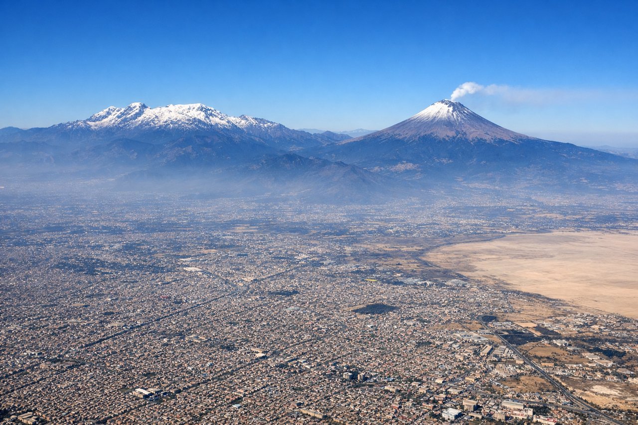
Takeoff from MEX
RIGHTRight side seats capture the climb-out northwestward over Mexico City's urban sprawl and the surrounding volcanic peaks. You'll see the city grid receding below and the Trans-Mexican Volcanic Belt rising ahead.
Landing at MXL
LEFTLeft side seats offer the best view during descent into Mexicali. You'll see the Colorado River valley, the U.S.–Mexico border, and the Imperial Valley's agricultural grid coming into focus as you approach from the southeast.
Landmarks on this routeAll landmarks →
Will your flight be in sunlight?
Pick a date and time in the Sun Map to watch the sun move across your whole flight.
About This Route
Which side of the plane should I sit on flying from Licenciado Benito Juarez International (MEX) to General Rodolfo Sanchez Taboada International (MXL)?
Sit on the Right side of the plane for the best views on flights from Mexico City to Mexicali. Right side provides superior views on departure (volcanic peaks and Mexico City) and competitive views on arrival (border landscape). The northwestbound routing favors right-side geography for most of the flight.
What can I see during takeoff from Licenciado Benito Juarez International in Mexico City?
During takeoff from Licenciado Benito Juarez International (MEX), sit on the Right side for the best views. Right side seats capture the climb-out northwestward over Mexico City's urban sprawl and the surrounding volcanic peaks. You'll see the city grid receding below and the Trans-Mexican Volcanic Belt rising ahead. Notable sights include: Mexico City urban area, Popocatépetl volcano (southeast, snow-capped peak), Iztaccihuatl volcano (east), Sierra de Guadalupe ridge.
What can I see when landing at General Rodolfo Sanchez Taboada International in Mexicali?
When landing at General Rodolfo Sanchez Taboada International (MXL), sit on the Left side for the best views. Left side seats offer the best view during descent into Mexicali. You'll see the Colorado River valley, the U.S.–Mexico border, and the Imperial Valley's agricultural grid coming into focus as you approach from the southeast. Notable sights include: Colorado River (border), Imperial Valley agricultural fields (U.S. side), Mexicali city grid, Sierra de los Cucapah mountains (east).
How long is the flight from Mexico City to Mexicali?
The flight from Licenciado Benito Juarez International (MEX) to General Rodolfo Sanchez Taboada International (MXL) takes about 3 hours 15 minutes. The shortest flight path between them is 1,353 miles (2,177 km); winds and air traffic control usually add a few percent.
What does the Mexico City to Mexicali flight path pass over?
The flight tracks northwest across the Mexican plateau, passing east of the Sierra Madre Occidental. Notable midpoint features include the high desert terrain of Zacatecas and Durango states, with sparse vegetation and occasional mountain ridges. The landscape transitions from Mexico City's volcanic zone through the central Mexican plateau's arid, elevated terrain (around 6,000–8,000 feet elevation) toward the lower Sonoran Desert as you approach Mexicali. No major water bodies or cities are directly on the route, but the Sierra Madre Occidental's eastern escarpment remains visible to the west for much of the flight.